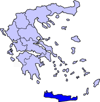
Crete, EL

ALMYRIDA

Panneau d'entrée dans Almyrida (La Canée, Crète).jpg

Crete, EL

Almyrida

A calm, shallow windsurf bay whose edge holds the open-air mosaic floor of a three-aisled 6th-century basilica, excavated 1974-1989.

Panneau d'entrée dans Almyrida (La Canée, Crète).jpg · <bdi><a href="https://www.wikidata.org/wiki/Q42790984" class="extiw" title="d:Q42790984"><span title="French computing engineer">Benoît Prieur</span></a></bdi> · CC0
Nearest airport
CHQ · 10 km
I’m here for
Story

Almyrida is a seaside village in the municipality of Apokoronas, in the Chania regional unit of Crete, about 22 kilometers east of Chania on the eastern side of Souda Bay. Its shoreline is two shallow sandy beaches separated by a short rocky spit topped with a small white chapel, opening onto the Cretan Sea. The water stays shallow and warm well offshore, which is why the village grew into a family resort and a beginner windsurfing spot rather than a surf beach.

At the eastern edge of the village, a few steps back from the sand, lies the reason the place is worth more than a swimming stop: the roofless mosaic floor of a three-aisled Christian basilica built in the second half of the 6th century AD. Greek archaeologists Manolis Borboudakis and Michalis Andrianakis excavated it between 1974 and 1989. The pavement is in situ and open to the sky, fenced but unroofed, with the base of an octagonal pulpit and the lower slab of the Holy Table still in place.

The basilica is the surviving trace of a coastal town whose foundations and cemetery lie around it and which appears to have been destroyed in seaborne raids of the 7th century. An ancient port named Amphimalla is attested on this coast, though it is generally placed to the east, near modern Georgioupoli, rather than at Almyrida; directly offshore, the small islet of Karga carries ancient wall ruins and German bunkers from the 1941 Battle of Crete. The village name comes from the Greek root for salt and saltiness, almyra, a record of the low, brackish, sheltered ground at this edge of the sea.

As a beach, Almyrida is honest about what it is. Open-Meteo's ERA5 marine reanalysis gives it an annual mean wave height of about 0.67 meters, biggest in February and calmest in June. When the summer Meltemi is absent, a thermal westerly builds across Souda Bay in the afternoon, twelve to twenty knots over flat water or light chop, enough for beginners and rentals but rarely for anything advanced. The bay is safe and swimmable most of the season and EU bathing-water monitoring rates it in the top, excellent category.

The uncomfortable part is proximity without attention. Almyrida was a fishing village that has become one of the developed holiday corners of Apokoronas, ringed by villas and rental apartments, and the 6th-century mosaic sits a hundred meters from hundreds of sunbeds, fenced, unroofed, largely unsignposted, and walked past by most of the people on the sand.

The spike

A calm, shallow windsurf bay whose edge holds the open-air mosaic floor of a three-aisled 6th-century basilica, excavated 1974-1989.

Almyrida's singular fact is not the shallow bay that fills with families and beginner windsurfers each summer. It is the roofless mosaic floor lying a few steps from the sand, at the eastern edge of the village: the surviving pavement of a three-aisled Christian basilica built in the second half of the 6th century AD, and the clearest trace of an early Byzantine town that raids and time erased.

What was found. Between 1974 and 1989 the Greek archaeologists Manolis Borboudakis and Michalis Andrianakis excavated the church at the entrance to Almyrida, under the Greek Ministry of Culture's Byzantine antiquities service. What they uncovered was a wooden-roofed basilica of the standard early-Christian plan: three aisles divided by colonnades, a transverse aisle, and a T-shaped narthex, with an atrium in front. The lower slab of the Holy Table still sits in the sanctuary, and the base of an octagonal pulpit stands in the central aisle. Corinthian column capitals were recovered from the debris. Beneath the floors of the side aisles were burials, the town's dead laid inside its own church.

The floor is the point. The sanctuary, central aisle, narthex, and atrium were paved with a mosaic of high quality, framed by geometric bands and filled with repeating motifs: crosses, intersecting circles and semicircles, peacocks, and fish. One cross is worked as a Christogram, its upper arm forming the rho, with the letters alpha and omega set on either side and ivy shoots rising from vessels. Peacocks and fish are standard early-Christian symbols of eternity and of Christ; the alpha and omega quote the Book of Revelation. This is not decoration lifted into a museum. It is in situ, open to the Cretan sky, fenced but unroofed, a short walk above the waterline of a working beach.

The town that vanished. The basilica did not stand alone. It served a coastal settlement whose foundations and cemetery lie around it, and which appears to have been destroyed in the raids of the 7th century, before the Arab conquest of Crete in the 820s. An ancient port named Amphimalla is attested on this stretch of the north Cretan coast, but its exact site is debated; it is more often placed to the east, toward modern Georgioupoli at the southwest corner of Almyros Bay, rather than at Almyrida itself. Directly offshore, the islet of Karga carries ancient wall ruins that older accounts call Phoenician and others read as Greek or Roman; the identification is not settled, and the islet has never been systematically excavated. What is certain is that people built, worshipped, and were buried on this bay for centuries, and the mosaic is the one piece of that record a visitor can still stand over.

Why it reads as a spike, not a footnote. Crete is dense with early-Christian basilicas, but most survive only as low wall lines. Almyrida's survives as a legible floor, with its liturgical furniture, its Christogram, and its peacocks and fish still in place. And it sits in deliberate contradiction to its setting. A few steps away the bay is shallow enough that the water stays warm and calm through most of the summer, which is exactly why the village became a family resort and a beginner windsurf spot. The same shallow, sheltered geometry that draws the umbrellas is what made this a safe harbour and settlement in antiquity. The beach and the basilica are two answers to the same question about this bay, separated by fifteen hundred years.

The name and the salt. Almyrida takes its name from the Greek root for salt and saltiness, almyra, whether from the salt-marsh ground, the tamarisks that tolerate brackish soil along the shore, or the nearby Almyros river. The name records what the bay is: a low, salty, sheltered edge of the Cretan Sea, the kind of place people keep returning to. Ottoman rule ended in a revolt across Apokoronas, and local histories record fighting at Almyrida in 1896, in the last Cretan rising against Turkish rule before the island's union with Greece in 1913. Forty years later the same coast was a German strongpoint: bunkers from the May 1941 Battle of Crete and the Souda Bay defenses still stand on the islet of Karga.

What it actually is. Almyrida is a shallow, family-scale Cretan beach with a working windsurf school and a row of fish tavernas, and it is also an open-air Byzantine floor that almost no one on the sand walks the extra hundred meters to see. The mosaic is not the beach's backdrop. It is the older, harder fact the beach happens to sit beside, exposed to the same sky and the same salt that named the place.

Waterfront of Almyrida on the Island of Crete, Greece 2009-04-12.jpg
Culture

Where it shows up

History
  • The Almyrida basilica mosaic · 550

    The 6th-century mosaic floor of the Almyrida basilica, with its geometric bands, Christogram cross, peacocks, and fish, is one of the more complete early-Christian pavements on the north Cretan coast and the village's principal monument.

  • Amphimalla

    An ancient port named Amphimalla is attested on the north coast of Crete. Its exact location is debated and is generally placed to the east, near modern Georgioupoli at the southwest corner of Almyros Bay, rather than at Almyrida.

  • The Battle of Crete · 1941

    The German airborne invasion of Crete in May 1941, Operation Mercury, made Souda Bay a strategic objective; German coastal-defense bunkers from the occupation survive on the islet of Karga off Almyrida.

Other
  • The name Almyrida (salt)

    The village name derives from the Greek root almyra, salt or saltiness, attributed variously to the salt-marsh ground, the salt-tolerant tamarisks along the shore, or the nearby Almyros river, a name that records the low, brackish edge of the sea.

B.Prieur à Kalyvès (Crète) en juillet 2021.jpg
History

What happened here

  1. 550founding

    The three-aisled basilica is built

    A three-aisled, wooden-roofed Christian basilica with a transverse aisle, a T-shaped narthex, and a high-quality mosaic floor is built at Almyrida in the second half of the 6th century AD, serving an early Byzantine coastal town on the bay.

  2. 650natural

    The coastal town is destroyed in raids

    The settlement the basilica served appears to have been destroyed in the seaborne raids of the 7th century, part of the wave of coastal attacks on Crete in the generations before the Arab conquest of the island in the 820s. Its foundations and cemetery lie around the ruined church.

  3. 1896historic

    Fighting at Almyrida in the Cretan revolt (local tradition)

    Local histories record that fighting against Ottoman forces took place at Almyrida in 1896, during the Apokoronas revolt, which they describe as among the last armed risings against Turkish rule on Crete. The specific claim is repeated in regional guides rather than confirmed in the academic record.

  4. 1913policy

    Crete united with Greece

    Crete formally becomes part of the Kingdom of Greece in December 1913, ending centuries of Ottoman and then autonomous rule. Apokoronas, including Almyrida, passes with the island into the Greek state.

    Wikipedia →
  5. 1941historic

    The Battle of Crete and the Souda Bay defenses

    German forces launch the airborne invasion of Crete, Operation Mercury, on 20 May 1941, with Souda Bay one of the key strategic objectives. Concrete bunkers from the German coastal defenses of this period survive on the islet of Karga off Almyrida.

    Wikipedia →
  6. 1974cultural

    Excavation of the basilica begins

    Archaeologists Manolis Borboudakis and Michalis Andrianakis begin excavating the Early Christian basilica at the entrance to Almyrida, uncovering the mosaic floor, the octagonal pulpit base, the Holy Table slab, Corinthian capitals, and burials beneath the side aisles.

  7. 1989cultural

    The excavation concludes

    The fifteen-year excavation of the basilica concludes in 1989, leaving the mosaic pavement exposed in situ within a fenced, unroofed enclosure at the eastern edge of the village, a few steps from the beach.

The honest part
“The mosaic is not the beach's backdrop; it is the older, harder fact the beach happens to sit beside.”

The honest problem at Almyrida is proximity without protection or attention. The 6th-century basilica is one of the more complete early-Christian mosaic floors on this coast, excavated over fifteen years and documented by the Greek Ministry of Culture, and it lies a hundred meters from hundreds of summer sunbeds. It is fenced but unroofed, open to weather and sun, and largely unsignposted; most people on the beach never learn it is there, and many who find it see a rectangle of gravel and low walls rather than a Christian pavement with a Christogram and peacocks in it. A fishing village has become a developed Apokoronas holiday settlement of villas and rental apartments, and the ancient town under and beside it has no comparable footprint in the way the place presents itself.

None of that is scandal; it is ordinary. But it means the beach and the monument coexist rather than connect. The islet of Karga, with its unexcavated ancient walls and its 1941 German bunkers, sits offshore unmanaged. The windsurfing the village markets is genuinely beginner-only, thermal-dependent, and calm most days, which the promotion tends to soften. Almyrida is a good, safe, shallow family beach that happens to be built beside a serious archaeological site, and the two facts are kept a walk apart.

Almyrida - Kréta - panoramio.jpg
Anatomy

The shape of the place

The main sandy beach

40%

The larger of the two sandy beaches, shallow and warm well offshore, organized with rented umbrellas and beds and the village's windsurf and watersports rentals. The family and beginner-windsurf core of Almyrida.

Best for Family swimming, beginner windsurfing, afternoon thermal wind

Shallow far out and calm most days; the afternoon westerly, when it blows, is a beginner wind.

Karga islet

50%

The small islet offshore from the beach, a habitat for seabirds and a target for small-boat excursions and fishing. It carries ancient wall ruins of disputed date and concrete bunkers from the German coastal defenses of 1941.

Best for Birdlife, a short boat excursion, the WWII and ancient ruins

Coordinates approximate; the islet is unexcavated and unmanaged, reachable only by boat.

The rocky spit and white chapel

55%

The short rocky peninsula that divides Almyrida's two sandy beaches, topped by a small whitewashed chapel. A low natural break between the west and east strands rather than a swimming zone in itself.

Best for The walk between the two beaches; the chapel view over the bay

Rock underfoot; the two sandy beaches lie on either side of it.

The Early Christian basilica

85%

The fenced, roofless enclosure at the eastern entrance to the village holding the in-situ mosaic floor of the 6th-century basilica, with the octagonal pulpit base and Holy Table slab still in place. Open to the sky and largely unsignposted.

Best for Reading the mosaic in low morning light; the reason the beach is more than a swim

A few steps back from the sand; unroofed and exposed to weather, so early or late light is best.

Landmarks

Early Christian Basilica of Almyrida · 550

archaeological site

A three-aisled, wooden-roofed Christian basilica of the second half of the 6th century AD, excavated 1974-1989 by M. Borboudakis and M. Andrianakis. Its high-quality mosaic floor, with crosses, a Christogram, peacocks, and fish, survives in situ under the open sky at the village's eastern edge.

Karga islet

island

The small islet directly offshore from Almyrida beach, a seabird habitat with ancient wall ruins of disputed date and German bunkers from the 1941 Battle of Crete and the Souda Bay defenses.

Lefka Ori (White Mountains)

mountain range

The White Mountains of western Crete, rising to about 2,453 meters at Pachnes, visible to the south from Almyrida beach and snow-capped from late autumn into spring.

Wikipedia →
A day here

From first light to dark

Dawn

At first light the bay is at its flattest, before any thermal wind, and the water reads clear over pale sand. The White Mountains stand out to the south, snow-capped from late autumn into spring. The basilica enclosure at the village edge is empty and the low morning sun rakes across the exposed mosaic, the one hour it is easy to read the crosses and fish in the floor.

Midday

By late morning the family beach is busy and shaded under rented umbrellas; the water stays shallow and warm far out, which is the whole draw. The sun is hard and the fenced mosaic, open to the sky, bakes with no shade of its own. Swimmers keep to the two sandy beaches on either side of the rocky spit and its small white chapel.

Golden hour

Late afternoon is when the sea earns its windsurf reputation, if it earns it at all that day. With no Meltemi, a westerly thermal builds across Souda Bay and the rental boards go out over flat water. The light warms the limestone and the pale tesserae; the islet of Karga sits dark offshore against the lowering sun.

Night

After dark the beach empties and the waterfront tavernas take over, lit along the front for fresh fish and Cretan plates. The mosaic enclosure closes into the dark unlit, and the bay goes quiet; on Karga, the concrete of the 1941 bunkers is invisible until morning.

Café grec à Almyrida (2).jpg
Sea & surf

What the water does

JFMAMJJASONDmetres (significant wave height)

Solid = typical monthly wave height; pale = the bigger days (90th pct). Offshore/regional swell from Open-Meteo Marine (ERA5 Ocean reanalysis, 2023–2024); a sheltered cove may sit calmer than this.

Mixed — usually swimmable, with a livelier season
Typical wave height
0.67 m
Biggest swell
Feb · 0.96 m
Calmest
Jun · 0.48 m
Typical period
5.1 s (wind chop)
Before you go

Things to know

Find the basilica

The 6th-century mosaic floor is in a fenced, unroofed enclosure at the eastern entrance to the village, a short walk from the beach and largely unsignposted. Low morning or late-afternoon light makes the crosses, peacocks, and fish in the floor legible; midday glare flattens them.

The windsurfing is for beginners

Souda Bay is calm most days. When the Meltemi is not blowing, an afternoon thermal westerly reaches twelve to twenty knots over flat water; advanced sailors go to other Cretan spots. This is a learn-and-rent bay, not a performance one.

Shallow and family-safe, but exposed in winter

The bay stays shallow and warm well offshore and is EU-rated excellent for bathing water, which is the family draw. It faces roughly north, so the biggest seas come in winter, peaking around February; June is the calmest month.

You need a car

Almyrida is about 22 km east of Chania and 10 km from Chania International Airport (CHQ), reached via Kalyves. Public buses from Chania are limited and seasonal; a rental car is the practical way in and out.

Sharks

No incidents on record in the global shark-attack file.

Plan

If you go

Getting there
Nearest airport
Chania International Airport (CHQ) · 10 km
Nearest town
Kalivai · 2 km

Almyrida sits on the coast of Apokoronas, about 22 km east of Chania and roughly 10 km from Chania International Airport (CHQ) by road via Kalyves. KTEL public buses from Chania run to the area but are limited and seasonal, so most visitors drive; free and paid parking is available around the village, filling on summer weekends.

When to go
  • The afternoon thermal westerly · Summer afternoons when the Meltemi is not blowing

    The village's reliable recurring draw for wind is not a festival but the afternoon thermal westerly that builds across Souda Bay on calm days, twelve to twenty knots over flat water, the window when the beginner windsurf and rental scene actually works.

What to eat & drink
Fresh Cretan seafood

Almyrida's waterfront tavernas are known regionally for fresh fish and seafood off the local boats, grilled whole or served as small fried fish and prawns. This is the village's genuine specialty and the reason many Chania residents drive out to eat here.

Tavernas along the Almyrida seafront

Dakos

The Cretan barley rusk topped with grated tomato, crumbled mizithra or feta, olive oil, and oregano, the island's signature cold plate. It appears on essentially every taverna menu in Apokoronas and travels well to a beach table.

Any Cretan taverna in Almyrida and the surrounding villages

Chochlioi boubouristi (fried snails)

Land snails fried in olive oil with rosemary and vinegar, a traditional Cretan dish more common in the inland Apokoronas and Chania villages than on the tourist beachfront, worth seeking out at a village taverna away from the sand.

Traditional tavernas in the Apokoronas villages inland

Apokoronas olive oil

Apokoronas is olive-growing country, and the local extra-virgin olive oil is the base of nearly everything served here. It is sold at village shops and dressed over the dakos, the fish, and the salads rather than being a dish in itself.

Village shops and tavernas across Apokoronas

Sources & references
  1. cretanbeaches.com; orthodoxcrete.com · cited 3×
  2. Greek Ministry of Culture (odysseus.culture.gr); cretanbeaches.com · cited 2×
  3. cretanbeaches.com; explorecrete.com · cited 2×
  4. explorecrete.com; cretanbeaches.com (local histories)
  5. Wikipedia: Cretan State
  6. Wikipedia: Battle of Crete; cretanbeaches.com
  7. Wikipedia: Almyrida; explorecrete.com
  8. World Beach Tour dataset
  9. Open-Meteo Marine (ERA5 reanalysis, 2023-2024)
  10. surf-magazin.de; cretanbeaches.com
  11. European Environment Agency bathing-water dataset
Colophon · Provenance

Where this page comes from

Geography, facilities
OpenStreetMap (ODbL) for geometry and facility tags within 500 m of the beach centroid. GeoNames for city/airport distances.
Climate & ocean
Open-Meteo ERA5 + Marine archive, 2014–2023 monthly normals.
Photography
Archival, original tone (Tier B — Wikimedia Commons). Each image licensed per its own terms; attribution visible inline.
History & culture
Every factual claim is linked to its source in the prose above. Wikipedia citations inline. Non-wiki sources named where relevant.
Editorial voice
Register: reverent. Written to pass a local's nod test; corrections welcome.
Written by Erin Rose
Last reviewed 2026-04-19
v0.9 — in editorial development toward v1.0