AW

Baby beach

Baby beach Aruba - 2.jpg

AW

Baby Beach

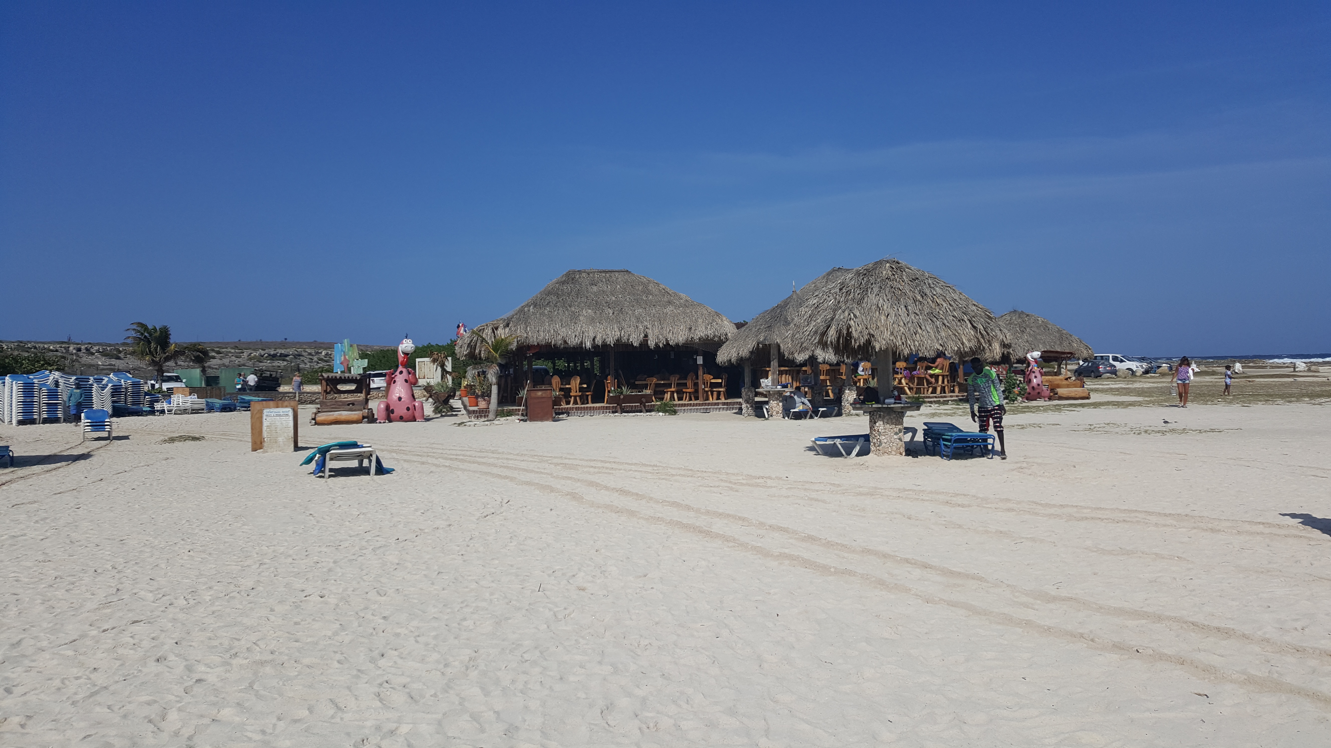
A rock breakwater closes a shallow horseshoe lagoon into water that barely moves, the calm exception to Aruba's rough, current-driven windward coast.

Baby beach Aruba - 2.jpg · DanielleJWiki · CC BY-SA 4.0
Nearest airport
AUA · 18 km
Tier
Featured
I’m here for
Story

Baby Beach is a shallow, man-altered lagoon at the southeastern tip of Aruba, in the Mangle Cora locality near the village of Seroe Colorado. Its official name is Klein Lagoen. The popular name comes from the water itself: the lagoon is calm enough to be safe for very small children, which is the entire reason it draws families and first-time snorkelers. The centroid sits at roughly 12.41 degrees north, 69.88 degrees west, about 17.6 kilometers southeast of Queen Beatrix International Airport and 13.8 kilometers from the nearest settlement.

The calm is engineered, not incidental. A curving rock breakwater closes the lagoon into a horseshoe, blocking the swell that the open Caribbean sends against this coast. Inside the barrier the water stays generally waist-high and the bottom is visible throughout; toward the inlet at the mouth of the horseshoe it deepens, and the current strengthens. That contrast is the defining fact of the place. Aruba's windward stretches run rough, with measured offshore wave heights averaging near 1.4 meters across the year and rip current to respect. Baby Beach is the sheltered exception carved out of that coast by the breakwater.

The lagoon supports more marine life than its size suggests. Parrotfish, angelfish, blowfish, squid, eels, and barracuda all occur here, though most of the larger animals keep to the deeper inlet rather than the shallows where waders stand. Snorkeling in two to three feet of water is a real activity here precisely because the breakwater keeps the surface flat and the visibility high.

The setting is industrial, and the page does not hide it. The Refineria di Aruba oil refinery stands in plain sight from the sand. The refinery and the beach share one history: the Lago Oil and Transport Company established a trans-shipping facility here in 1924 and began processing Venezuelan crude on the island by 1928, growing into one of the world's largest refineries. A self-contained company town, Lago Colony, was built alongside it, with hundreds of homes, a hospital, a church, and an American school for an expatriate workforce drawn from the United States, the United Kingdom, and Europe. In the 1950s the Aruba Esso Club operated at Baby Beach with a restaurant, a dance floor, and a baseball stadium. The refinery's closure in 1985 ended the colony's purpose and, with Aruba's status aparte in 1986 and the island's pivot to tourism, opened the beach to the public it had largely been closed to before.

The honest hazard is the inlet. The shallows are as safe as the name promises, but the breakwater has a gap, and beyond it the protected water gives way to open-sea current. Swimmers who drift toward the mouth of the horseshoe leave the calm the lagoon is famous for.
The spike

A rock breakwater closes a shallow horseshoe lagoon into water that barely moves, the calm exception to Aruba's rough, current-driven windward coast.

Baby Beach is calm on purpose. The single fact that defines it is that the lagoon is man-altered: a curving rock breakwater closes the inlet into a horseshoe and holds off the swell of the open Caribbean. Everything the beach is famous for follows from that one piece of engineering.

The contrast that makes it remarkable. Aruba's windward coast is not a gentle place. Offshore wave heights along the island average near 1.4 meters across the year, with a character described in the local marine record as exposed — real surf, and rip current to respect. Baby Beach is the deliberate exception. Inside the breakwater the water stays generally waist-high over a sandy bottom you can see throughout, flat enough that a small child can wade and a person who has never snorkeled can lie in two to three feet of water and watch parrotfish. The lagoon's official name, Klein Lagoen, is plainer than the popular one; the popular name, Baby Beach, records exactly why people come — the water is calm enough to be safe for the very young.

Where the promise stops. The honest qualification is the inlet. The horseshoe is not sealed. The breakwater has a gap, and toward that mouth the bottom drops away and the current strengthens, reconnecting the protected lagoon to the open sea the barrier was built to exclude. The marine life follows the same gradient: parrotfish, angelfish, and blowfish hold in the shallows, while barracuda and the larger animals tend to range in the deeper inlet. There are no posted lifeguards. The shallows are as safe as advertised; the gap is not. A swimmer who drifts toward the opening leaves the exact condition the beach is named for.

The industrial history in plain sight. Baby Beach is not a wild cove, and the page does not pretend otherwise. The Refineria di Aruba refinery stands visible from the sand, and the beach and the refinery share one origin. The Lago Oil and Transport Company set up a trans-shipping facility at this tip of the island in 1924 and was processing Venezuelan crude by 1928, building it into one of the world's largest refineries. A company town, Lago Colony, grew alongside it — hundreds of houses, a hospital, a church, an American school, an expatriate workforce from the U.S., U.K., and Europe. In the 1950s the Aruba Esso Club operated right here at Baby Beach, with a restaurant, a dance floor, and a baseball stadium. For decades this stretch of coast was effectively the refinery's, accessible mainly to its employees and their families. The refinery closed in 1985; with Aruba's status aparte in 1986 and the turn to tourism, the lagoon opened to the public. One abandoned colony building still stands, and a dive shop still works the site.

The water stays clean despite the neighbor. It would be reasonable to assume a refinery within sight would foul the water. It does not, and the reason is local current direction, which carries the lagoon clear of the industrial coast. That is the small, specific fact that lets the contrast hold: an engineered calm-water lagoon, clean and shallow, sitting in plain view of one of the Caribbean's old industrial giants, on the rough windward tip of an arid island.

Baby beach Aruba - 3.jpg
Culture

Where it shows up

History
  • Lago Colony, the company town

    The self-contained residential colony built alongside the Lago refinery, with hundreds of homes, a hospital, a church, and an American school for an expatriate workforce from the U.S., U.K., and Europe. Its existence is why this coast was effectively closed to the public until the refinery shut.

Other
  • Klein Lagoen / the 'Baby Beach' name

    The lagoon's official name is Klein Lagoen; the popular name 'Baby Beach' refers to water calm enough to be safe for very small children. The name encodes the place's single selling point and its single blind spot — the inlet, where the calm ends.

Baby Beach.jpg
History

What happened here

  1. 1924founding

    Lago established as a trans-shipping facility

    The Lago Oil and Transport Company establishes a facility at the southeastern tip of Aruba to trans-ship Venezuelan crude oil, the beginning of the industrial complex beside the future Baby Beach.

    Wikipedia →
  2. 1928founding

    Crude processing begins on Aruba

    The Lago refinery begins processing crude oil on the island, growing over the following decades into one of the world's largest refineries.

  3. 1950cultural

    Aruba Esso Club operates at Baby Beach

    In the 1950s the Aruba Esso Club is built at Baby Beach as part of the Lago Colony, with a restaurant, a dance floor, and a baseball stadium serving the refinery's expatriate workforce.

    Wikipedia →
  4. 1985policy

    The Lago refinery closes

    The Lago oil refinery closes, ending the purpose of the company town that had limited access to the area largely to refinery employees and their families.

  5. 1986policy

    Status aparte and the turn to tourism

    Aruba attains status aparte within the Kingdom of the Netherlands and pivots toward tourism as its primary economy; with the refinery shut, Baby Beach opens to the general public.

The honest part
The beach earns its name in the shallows and forfeits it at the gap.

The name sells a promise the whole lagoon does not keep. Inside the breakwater the water is genuinely waist-high, flat, and clear enough that a toddler can wade and a first-time snorkeler can look down at parrotfish in two or three feet of water. That is real, and it is why Aruban families bring small children here. But the horseshoe is not a closed pool. The breakwater has an opening, and toward the inlet at the mouth of the lagoon the bottom drops away and the current picks up, feeding back into the open Caribbean that the barrier was built to hold off. The water that makes Baby Beach safe is the water the breakwater traps; the water just past it is the same rough, rip-prone sea that runs along the rest of Aruba's windward coast. There are no posted lifeguards. The conditions inside the lagoon are inherently gentle, but the gentleness ends at the rocks, and the deeper inlet is where the larger animals — barracuda among them — tend to range. The beach earns its name in the shallows and forfeits it at the gap.

Mangrove Tree (Conocarpus erectus) Aruba Baby Beach (2908229093).jpg
Anatomy

The shape of the place

The inlet at the mouth

20%

The deeper opening in the breakwater where the bottom drops away, the current strengthens, and the larger animals — barracuda among them — tend to range.

The hazard zone; protected water gives way to open-sea current beyond the gap.

The rock breakwater

30%

The curving barrier of rock that closes the lagoon into its horseshoe and blocks the open-Caribbean swell, the structure responsible for the calm the beach is named for.

Man-altered barrier; the lagoon is described as a man-altered feature.

The wading shallows

50%

The inner horseshoe where the water stays generally waist-high over a visible sandy bottom, calm enough for very small children and first-time snorkelers in two to three feet of water.

Best for Families and beginner snorkeling

The safe core of the lagoon, sheltered behind the breakwater.

The refinery skyline

50%

The Refineria di Aruba oil refinery, visible from the sand, the surviving industrial frame of the Lago complex that built and once controlled this stretch of coast.

Within sight of the beach; local current direction keeps the lagoon water clear despite the proximity.

Landmarks

The rock breakwater

natural

The curving rock barrier that closes Baby Beach into a sheltered horseshoe lagoon and absorbs the Caribbean swell. The lagoon is described as a man-altered feature, and this barrier is what makes the inner water calm.

Wikipedia →

Refineria di Aruba (the Lago refinery) · 1924

industrial

The oil refinery at the island's southeastern tip, founded in 1924 as the Lago Oil and Transport Company trans-shipping facility and processing crude by 1928. Closed in 1985; still visible from Baby Beach.

Wikipedia →

Aruba Esso Club (former) · 1950

building

A 1950s social club at Baby Beach built for the Lago Colony, with a restaurant, dance floor, and baseball stadium. One abandoned building remains, and a dive shop still operates at the site.

Wikipedia →
A day here

From first light to dark

Dawn

At first light the lagoon is flat and empty, the refinery a dark silhouette on the horizon before the sun clears the low arid headland of Seroe Colorado. The snack stand has not opened, and the chair-and-umbrella rental rigs sit stacked. The water is at its clearest before the day's waders stir the sand.

Midday

By late morning the sun is overhead and the shallows light to pale turquoise over the visible bottom. This is the crowded window: family groups, beginner snorkelers in two to three feet of water, and the snack stand and dive shop both working. The breakwater keeps the surface flat even as the open coast beyond it runs choppy.

Golden hour

Late afternoon throws warm light across the pale sand and the lagoon, and the contrast between the calm horseshoe and the industrial line of the refinery sharpens. Day-trippers driving back toward Oranjestad or San Nicolas begin to thin the crowd before dusk.

Night

After dark the beach is unlit and unattended, with no lifeguard and the rental operations packed away. The refinery's lights mark the horizon. The lagoon empties; the nearest people are in Seroe Colorado and San Nicolas, kilometers up the coast.

Baby beach Aruba - 4.jpg
Sea & surf

What the water does

JFMAMJJASONDmetres (significant wave height)

Solid = typical monthly wave height; pale = the bigger days (90th pct). Offshore/regional swell from Open-Meteo Marine (ERA5 Ocean reanalysis, 2023–2024); a sheltered cove may sit calmer than this.

Exposed — real surf, and rip current to respect
Typical wave height
1.43 m
Biggest swell
Jul · 1.65 m
Calmest
Oct · 1.12 m
Typical period
6.2 s (wind chop)
Before you go

Things to know

The calm is engineered

The flat, shallow water exists because a rock breakwater closes the lagoon; the inner horseshoe is generally waist-high over a visible bottom.

The inlet is the hazard

Toward the breakwater's opening the water deepens and the current strengthens into the open Caribbean. There are no posted lifeguards.

Snorkeling in inches

Parrotfish, angelfish, and other species are visible in two to three feet of water; larger animals keep to the deeper inlet.

Industrial backdrop

The Refineria di Aruba refinery is visible from the sand. Local current direction keeps the lagoon water clean despite the proximity.

Facilities are minimal

A snack stand, restrooms, and chair/umbrella/4x4 rentals operate on the beach; the nearest towns are Seroe Colorado and San Nicolas.

Surf & rip

Powerful water — strongest around Jul, gentlest in Oct. Mind rip currents; this isn't a wade-in-anywhere beach.

Sharks

No incidents on record in the global shark-attack file.

Plan

If you go

Getting there
Nearest airport
Queen Beatrix International Airport (AUA) · 18 km
Nearest town
Angochi · 14 km

Baby Beach sits at Aruba's southeastern tip near Seroe Colorado, about 17.6 km from Queen Beatrix International Airport. Access is by road via San Nicolas; there is no ferry. Entry and parking are free.

What to eat & drink
The beach snack stand

A small snack stand operates on the beach itself, alongside chair, umbrella, and four-wheel-drive rentals. It is the only food service on the sand; there is no restaurant at the lagoon.

On Baby Beach, near the rental rigs

Fresh fish in Seroe Colorado

Seroe Colorado, the village nearest the beach, retains a fishing-community character and serves catch-of-the-day fish; it is the closest settlement for a real meal off the sand.

Seroe Colorado village, southeast Aruba

San Nicolas dining

San Nicolas, Aruba's second-largest town and the historic refinery port, offers the broadest food selection within reach of Baby Beach, a short drive northwest of the lagoon.

San Nicolas, southern Aruba

Sources & references
  1. Wikipedia: Baby Beach, Aruba · cited 5×
  2. Wikipedia: Baby Beach, Aruba; Arubapapers · cited 2×
  3. Wikipedia: Baby Beach, Aruba; community history · cited 2×
  4. Arubapapers
  5. Community history; Aruba government
  6. World Beach Tour data (OSM/Wikidata)
  7. Open-Meteo Marine (ERA5, 2023-2024)
Colophon · Provenance

Where this page comes from

Geography, facilities
OpenStreetMap (ODbL) for geometry and facility tags within 500 m of the beach centroid. GeoNames for city/airport distances.
Climate & ocean
Open-Meteo ERA5 + Marine archive, 2014–2023 monthly normals.
Photography
Archival, original tone (Tier B — Wikimedia Commons). Each image licensed per its own terms; attribution visible inline.
History & culture
Every factual claim is linked to its source in the prose above. Wikipedia citations inline. Non-wiki sources named where relevant.
Editorial voice
Register: clinical. Written to pass a local's nod test; corrections welcome.
Written by Erin Rose
Last reviewed 2026-04-19
v0.9in editorial development toward v1.0