Chittagong, BD

Cox's Bazar Beach

Beauty of inani-beach at Cox's bazar.jpg

Chittagong, BD

Cox's Bazar Beach

A single unbroken run of sand from the Bakkhali River to Teknaf, claimed as the world's longest natural sea beach, with no lifeguard funding and the Rohingya camps next door.

Beauty of inani-beach at Cox's bazar.jpg · <a href="//commons.wikimedia.org/wiki/User:Syed07" title="User:Syed07">Syed sajidul islam</a> · CC BY-SA 4.0
Length
120.0 km
Spring tide
2.94 m
Nearest airport
CXB · 3 km
Tier
Featured
I’m here for
Story

Cox's Bazar Beach runs down the southeast coast of Bangladesh on the Bay of Bengal, one near-continuous strip of grey-brown sand from the mouth of the Bakkhali River south toward Teknaf. Bangladesh calls it the world's longest natural sea beach. The sand is wide and flat — about 200 meters across at high tide and 400 at low, with no rock to break the line of it for miles.

The name is colonial. Cox's Bazar honors Captain Hiram Cox (1760–1799), an East India Company officer sent to resettle Arakanese (Rakhine) refugees who had crossed from Burma. Cox died in 1799 before the work was finished; a market — a bazar — took his name afterward. The beach is divided into named points: Laboni at the town end, Sugandha and Kolatoli just south, the rocky Inani stretch about 18 kilometers down, and the long Teknaf section beyond. Himchari, roughly 8 kilometers south, is where forested hills meet the sand, with a waterfall that runs in the monsoon and dwindles by winter.

The water is the part the brochures skip. The Bay of Bengal here carries strong rip currents and shifting sand channels, and the three busiest points — Kolatoli, Sugandha, and Laboni — are where people drown. One private outfit, Sea-Safe, patrols about five kilometers of frontage with 27 guards; in 2025 it was repeatedly weeks from closing for lack of funding. At least 62 people drowned across Cox's Bazar in the first six months of 2025, and no public lifeguards cover the other hundred-plus kilometers.

The wider district is defined by something the beach pages rarely mention. Inland, around Ukhiya and Teknaf, sit the Kutupalong and Nayapara camps — the largest refugee settlement on Earth, close to a million Rohingya who fled Myanmar's Rakhine State after August 2017. Clearing land for the camps and for cooking fuel stripped thousands of hectares of forest off the hills behind the coast. A national-pride holiday strip and the world's biggest refugee crisis occupy the same district administration, a few dozen kilometers apart.

Offshore lie two islands: Sonadia, a mangrove-and-dune island about 15 kilometers northwest, and Saint Martin's, around 100 to 120 kilometers south past Teknaf — the only coral island in Bangladesh and the country's southernmost point. The monsoon runs the seasons: rain stacks up June through September, when the surf is biggest and the swimming most dangerous, and the dry window from November to March is when the beach fills.

The spike

A single unbroken run of sand from the Bakkhali River to Teknaf, claimed as the world's longest natural sea beach, with no lifeguard funding and the Rohingya camps next door.

Cox's Bazar's claim is a measurement, and the measurement is contested. The sentence you will hear everywhere in Bangladesh is that this is "the world's longest natural sea beach." It is worth taking that claim apart, because the truth is more specific and more interesting than the slogan, and because the gap between the two is where you learn what kind of place this actually is.

Start with the number. Wikipedia and most encyclopedic sources put the beach at 120 kilometers (75 miles) and describe it as the longest natural sea beach in Asia, ranking it fifth in the world by length behind Praia do Cassino in Brazil, Padre Island on the US Gulf coast, Eighty Mile Beach in Western Australia, and Ninety Mile Beach in Victoria, Australia. Bangladeshi tourism and national-pride sources frequently go further, citing an unbroken length of up to 155 kilometers and calling it the longest natural *unbroken* sea beach in the world. Those two framings are not the same claim. The honest reading is this: there are several longer beaches on Earth, so Cox's Bazar is not the longest beach by raw distance. The argument for its title rests on the word unbroken — the idea that it is a single continuous run of sand uninterrupted by rock, headland, or river mouth in a way the longer beaches are not. Whether that is literally true depends on where you start and stop the tape and how you treat the Bakkhali River estuary at the northern end and the rocky outcrops around Inani. The defensible statement, and the one this page makes, is that Cox's Bazar is the longest natural sea beach in Asia at about 120 kilometers, and that the stronger "world's longest unbroken" wording is a national claim that sources do not uniformly support. Where sources disagree, that disagreement is the fact.

Now the physical beach itself, because the length is the whole character. This is not a cove or a bay; it is a coast. The sand is quartz-dominant — roughly 77 percent quartz by the predictive sediment model — which is why it reads as a pale grey-brown rather than the white of a coral beach or the black of a mineral one. It is very flat: the slope is gentle enough that the waterline moves a long way between tides, so the beach measures about 200 meters wide at high tide and 400 meters wide at low tide, and during ebb tide there are stretches where the wet sand turns to quicksand. Because there is no rock for miles, the beach has no natural shelter; the wind and swell that come off the open Bay of Bengal hit the sand directly. The named points are not separate beaches but stations along the one strip: Laboni is the town beach, the most built-up and the closest to the hotels; Sugandha and Kolatoli are immediately south and just as busy; Darianagar and then Inani, about 18 kilometers down, where coral and laterite rock finally break the sand; and the long, emptier Teknaf section running toward the peninsula's tip. Himchari, around 8 kilometers south, is where the Himchari National Park hills come down to meet the beach, with a monsoon-fed waterfall behind that is full in the wet season and nearly dry by winter.

The sea is the reason the length matters in a darker way. A 120-kilometer beach with three million annual visitors and powerful Bay of Bengal rip currents is a drowning problem at scale. The dangerous zones are the busy ones — Kolatoli, Sugandha, and Laboni — where shifting sand channels and rip currents pull bathers out fast. The only organized rescue is Sea-Safe, a private lifeguard service that has run for over a decade with 27 lifeguards working two shifts across roughly five kilometers of the most crowded frontage, carrying buoys and surfboards. Over its run it has pulled more than 800 people out alive and recovered dozens of bodies. In 2025 that service was repeatedly on the edge of closing for lack of money, surviving on short funding extensions; at least 62 people drowned across Cox's Bazar in the first half of that year. The math is stark: a private crew of 27 covers five kilometers of a beach the country sells as 120, and the rest has no cover at all.

Then there is the thing that actually defines the district, which is not the beach. Cox's Bazar District holds the Kutupalong and Nayapara camps, the largest refugee settlement in the world. After the Myanmar military's operations in Rakhine State beginning 25 August 2017, more than 700,000 Rohingya crossed into Bangladesh in weeks, joining earlier arrivals to bring the total to close to a million people concentrated in the hills around Ukhiya and Teknaf, inland and south of the tourist beach. The environmental cost was immediate and measurable: clearing land for shelters and cutting trees for cooking fuel destroyed on the order of 2,000 to 3,300 hectares of forest off the hills behind the coast, which then slid in the monsoon. A 2018 World Bank assessment projected Cox's Bazar to be among the hardest-hit districts in South Asia from climate change by mid-century. So the singular fact of Cox's Bazar is not really the record-length beach at all. It is that the same district line encloses two things that almost never share a map: a beach Bangladesh holds up as a point of national pride, and the largest concentration of stateless refugees on the planet, a half-day's drive apart.

Finally, the new arteries, because they are changing the place fast. For most of its history Cox's Bazar was hard to reach — a long road from Chattogram, or a flight into a small airport. Two state projects changed that almost at once. In November 2023, Bangladesh opened the 102-kilometer Dohazari–Cox's Bazar railway line and an oyster-shaped terminal building, putting the beach on the rail network and the planned Trans-Asian Railway corridor for the first time; the Cox's Bazar Express began running from Dhaka that December. And the airport runway is being extended into the sea — a roughly $185 million project to reclaim land from the Bay of Bengal and stretch the runway to about 10,700 feet, with a section of it built out over the water, intended to be the country's longest and to take wide-body aircraft. The slogan is "the world's longest natural sea beach"; the reality being built around it is mass tourism infrastructure pointed at a coast that already cannot keep its swimmers alive.

Cox's Bazaar in daylight Sep2019.jpg
Culture

Where it shows up

History
  • Captain Hiram Cox · 1799

    East India Company officer (1760–1799) sent to resettle Arakanese refugees who had crossed from Burma. He died before the work was finished; the market named in his honor gave the town and beach their name.

  • Rohingya refugee crisis · 2017

    From August 2017, more than 700,000 Rohingya fled Myanmar's Rakhine State into Cox's Bazar District, building the Kutupalong/Nayapara camps into the largest refugee settlement on Earth — the defining contemporary fact of the district.

Other
  • Saint Martin's Island (coral island)

    Bangladesh's only coral island, the southernmost point of the country, marketed as the marquee day trip from Cox's Bazar and itself a focus of conservation concern over tourism and coral damage.

  • Dried fish (shutki) trade

    Cox's Bazar is one of Bangladesh's principal centers for sun-dried fish, with open drying racks along the coast (notably at Nazirartek) — a coastal economy and cuisine distinct from the tourist beach.

Cox's Bazaar Sunset Sep2019.jpg
History

What happened here

  1. 1799historical

    Captain Hiram Cox dies; market takes his name

    Hiram Cox (1760–1799), an East India Company officer sent to the Palongkee outpost to resettle Arakanese refugees from Burma, dies before the work is complete. A market (bazar) established afterward is named in his honor, and the town of Cox's Bazar grows out from it.

    Wikipedia →
  2. 1854political

    Cox's Bazar made a sub-divisional headquarters

    Under the Bengal Presidency of British India, Cox's Bazar is made a sub-divisional headquarters within Chittagong district, formalizing the settlement as an administrative center.

    Wikipedia →
  3. 1869political

    Cox's Bazar municipality established

    Cox's Bazar becomes a municipality, marking its growth from a colonial market post toward the fishing port and town that anchor the beach today.

    Wikipedia →
  4. 2017historical

    Rohingya exodus into Cox's Bazar District

    From 25 August 2017, Myanmar military operations in Rakhine State drive more than 700,000 Rohingya across the border into Bangladesh within weeks, swelling the Kutupalong and Nayapara camps in the hills inland of the beach to close to a million people — the largest refugee settlement on Earth.

    Wikipedia →
  5. 2018environmental

    Forest loss and climate-risk warning

    Clearing land for the camps and cutting trees for cooking fuel strips an estimated 2,000–3,300 hectares of forest off the hills behind the coast, triggering monsoon landslides. A 2018 World Bank assessment projects Cox's Bazar among the hardest-hit districts in South Asia from climate change by mid-century.

  6. 2021development

    Airport runway-into-the-sea project launched

    Bangladesh inaugurates a ~$185 million project to extend the Cox's Bazar airport runway by reclaiming land from the Bay of Bengal, stretching it to roughly 10,700 feet with a section built out over the water — intended as the country's longest runway, able to take wide-body aircraft.

    Wikipedia →
  7. 2023development

    Dohazari–Cox's Bazar railway and oyster station open

    On 11 November 2023, the 102-km Dohazari–Cox's Bazar dual-gauge railway line and an oyster-shaped terminal building are opened, connecting the beach to Bangladesh's rail network and the planned Trans-Asian Railway corridor for the first time.

    Wikipedia →
  8. 2023development

    Cox's Bazar Express begins running

    From 1 December 2023, the Cox's Bazar Express, the first commercial intercity train to serve the city, begins running between Dhaka and Cox's Bazar, sharply cutting travel time from the capital.

    Wikipedia →
  9. 2025safety

    Lifeguard service near collapse amid drownings

    At least 62 people drown across Cox's Bazar in the first six months of 2025. Sea-Safe, the private service of 27 lifeguards covering about five kilometers from Kolatoli to Laboni, is repeatedly within weeks of shutting down for lack of funding and survives on short extensions.

The honest part
One private crew of 27 lifeguards covers five kilometers of a beach the country sells as the longest in the world; the other hundred-plus have none.

The uncomfortable facts here are not hidden; they are just left out of the brochure. The first is the water. Cox's Bazar sells itself on its length and its sunsets, but the Bay of Bengal off Kolatoli, Sugandha, and Laboni carries rip currents and shifting sand channels that drown people regularly — at least 62 across the district in the first six months of 2025. The entire organized response is one private outfit, Sea-Safe, with 27 lifeguards covering about five kilometers of a 120-kilometer beach, and in 2025 that service was repeatedly weeks away from shutting down for lack of funding. The development is the second problem: largely unplanned hotel construction has crowded the town end, and the coast is under erosion pressure that the building does nothing to help. There is also a real and quiet tension between a conservative local society and a mass-tourism economy that runs on holiday crowds.

And then there is the fact that dwarfs all of it. Cox's Bazar District holds the Kutupalong and Nayapara camps — the largest refugee settlement on Earth, close to a million Rohingya who fled Myanmar after August 2017, concentrated in the hills inland from the beach. Clearing land for the camps and for cooking fuel stripped thousands of hectares of forest off those hills, which then slid in the monsoon. The holiday strip and the world's biggest refugee crisis share one district administration, a few dozen kilometers apart. To write about the beach without that fact is to describe a country by its postcard.

Cox's Bazaar Sea Beach.jpg
Anatomy

The shape of the place

Laboni Point

5%

The town beach — closest to the hotels and most built-up, the default arrival point for most visitors. Widest crowds at sunset; vendors, horse rides, and beach photographers work the waterline.

Best for First arrival, sunset crowds, easy access from the hotel zone

One of the three drowning hotspots; busiest stretch and within the Sea-Safe flagged zone.

Kolatoli & Sugandha Points

12%

Immediately south of Laboni, the heart of the modern hotel-and-seafood strip and the busiest bathing area. Sea-Safe concentrates its 27 guards across this ~5 km frontage.

Best for Seafood stalls, swimming where flagged, the main tourist scene

The most dangerous water on the beach — rip currents and shifting sand channels; most drownings occur here.

Himchari

30%

About 8 km south, where the forested hills of Himchari National Park come down to the sand, with a monsoon-fed waterfall behind. Full in the wet season, nearly dry by winter.

Best for The waterfall (in monsoon), hill-meets-sea views, the marine-drive trip

Waterfall is seasonal; the scenic value is the drive and the forest backdrop, not a swimming spot.

Inani

60%

Roughly 18 km south, where coral and laterite rock finally break the long sand line — quieter, with rock pools and a different texture from the town beach. Bordered by hills and forest.

Best for A calmer, less-crowded stretch; rocks and tide pools at low water

Rocky and slippery in places; still open Bay of Bengal water with currents — not a guaranteed-safe swim.

Landmarks

Himchari National Park & waterfall

natural

A tropical hill-forest park about 8 km south of Cox's Bazar town where forested hills meet the beach, with a seasonal waterfall that runs full in the monsoon and dwindles by winter. Reached along the coastal marine drive.

Wikipedia →

Cox's Bazar railway station (oyster terminal) · 2023

infrastructure

The oyster-shaped terminal building opened on 11 November 2023 as the end of the 102-km Dohazari–Cox's Bazar line — described as the country's first iconic railway station and part of the planned Trans-Asian Railway corridor.

Wikipedia →

Saint Martin's Island

natural

Bangladesh's only coral island and southernmost point, about 100–120 km south past Teknaf in the Bay of Bengal. A fragile, separate island reached by ferry from the Cox's Bazar trade; under pressure from day-trip tourism.

Wikipedia →
A day here

From first light to dark

Dawn

Before the heat, the wide flat sand at Laboni is at its emptiest and the tide is usually well out, exposing the full 400-meter run of beach. Fishing boats that worked the night come in, and the catch moves toward the town markets. The light is grey-gold through the Bay of Bengal haze; this is the calmest the water will be all day.

Midday

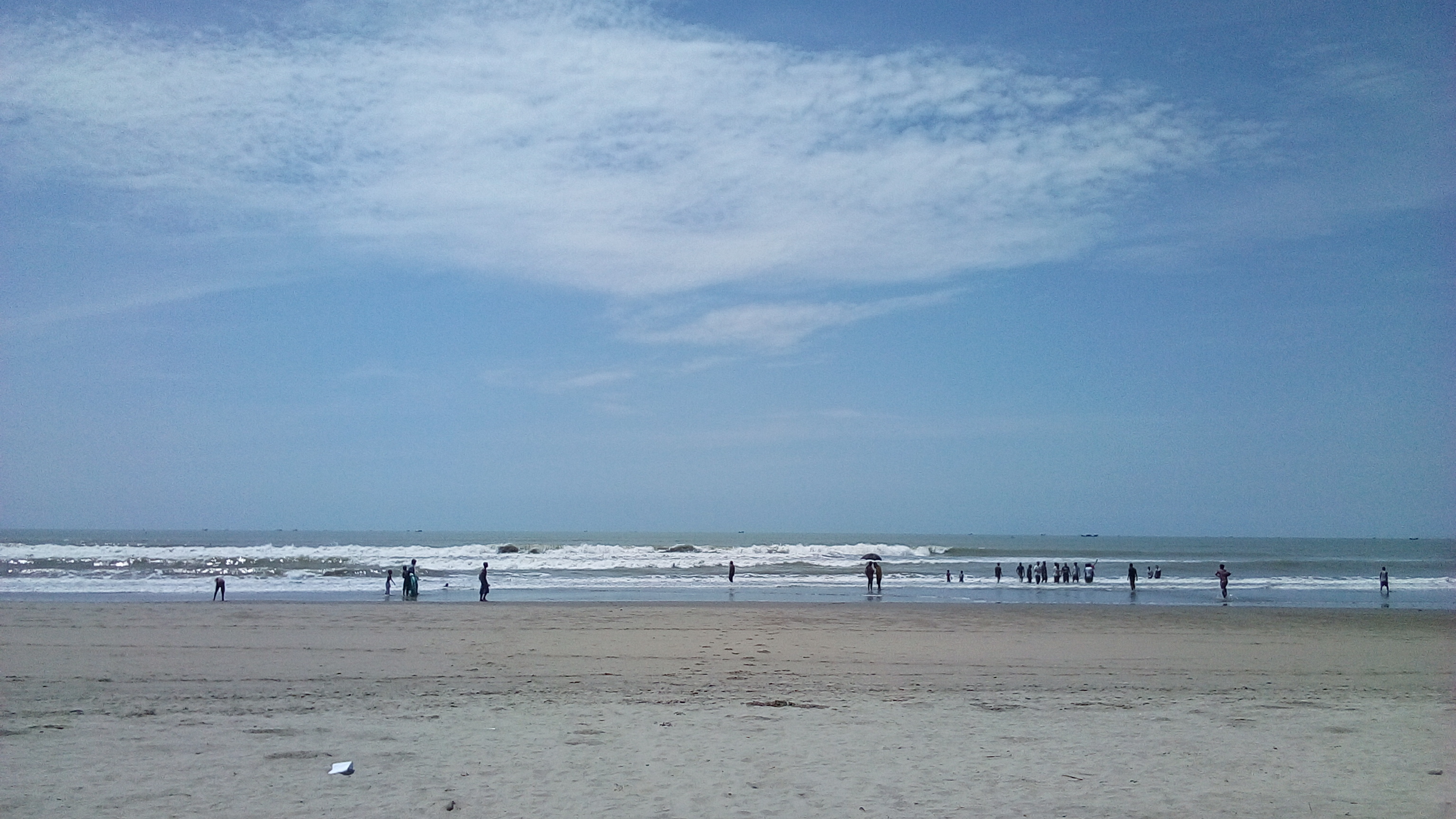
The sun is hard and the sand bakes. Day crowds fill Kolatoli and Sugandha, and this is when the drownings happen — bathers wade out over a flat bottom that suddenly drops into a rip channel. Sea-Safe guards work the flagged five-kilometer stretch with buoys and surfboards; beyond it, no one is watching. Tea and fried-snack vendors line the access points.

Golden hour

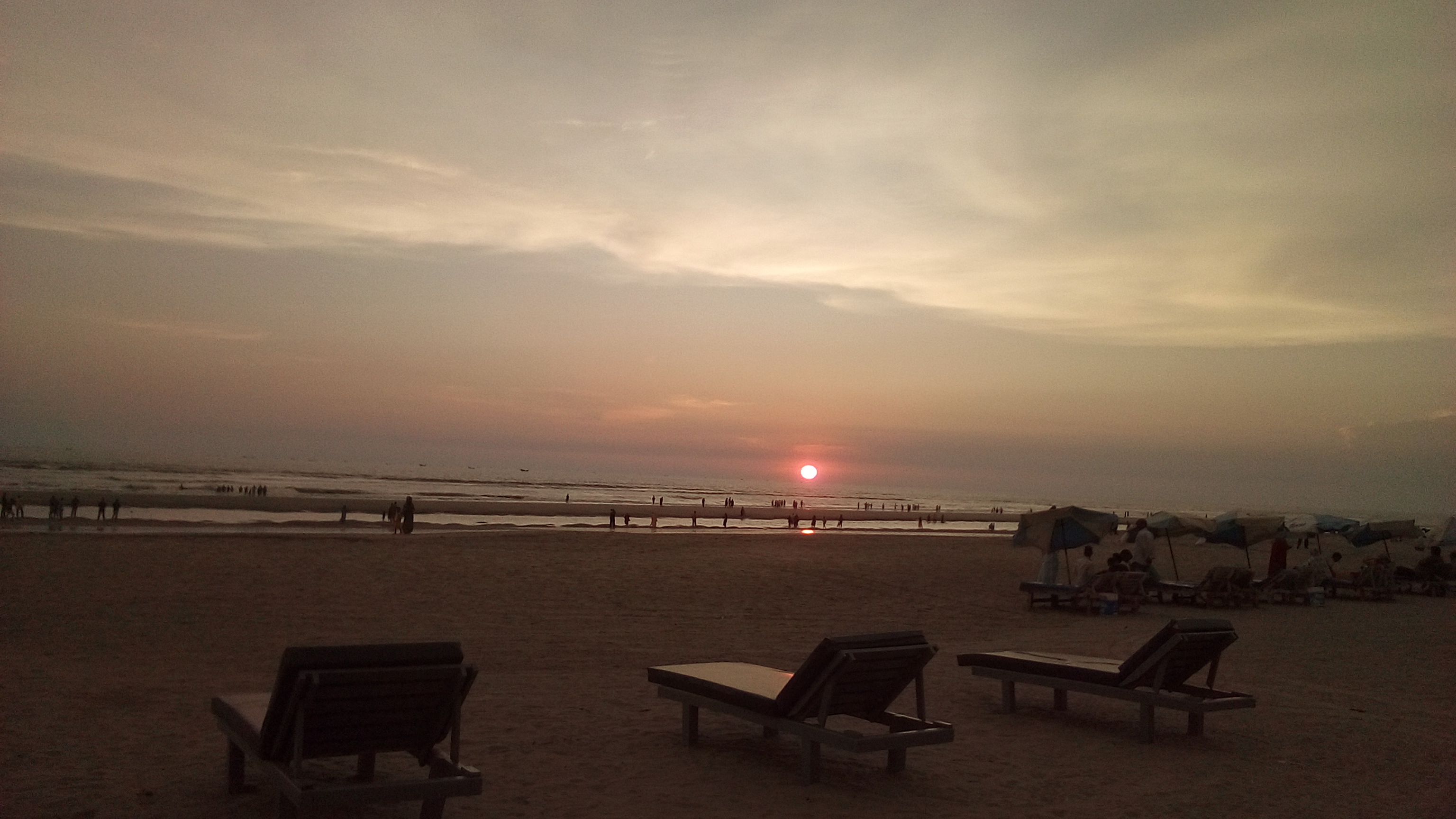
Sunset over the Bay of Bengal is the moment the whole strip turns out for, and at Laboni and Kolatoli the beach is at its most crowded. The flat, mirror-wet low-tide sand doubles the sky. Horse rides and beach-photo touts work the waterline. The conservative local register and the holiday crowd are most visibly side by side here.

Night

The water empties and the town takes over — the Kolatoli hotel zone, seafood places, and lit-up frontage. The beach itself goes dark and largely unwatched; there is no night lifeguard cover and the rip currents do not stop at sunset. Inland and to the south, the camps run on generator and solar light, a different country entirely a short drive away.

Compare

How it ranks

Peak warmth
Cooler than 78% of beaches in its country
Peak-month high ≈ 32°C
Worldwide
Among the warmest 8% of beaches on Earth

Ranked against every beach in our database — 228,000+ worldwide.

Air to cox bazer.jpg
Sea & surf

What the water does

JFMAMJJASONDmetres (significant wave height)

Solid = typical monthly wave height; pale = the bigger days (90th pct). Offshore/regional swell from Open-Meteo Marine (ERA5 Ocean reanalysis, 2023–2024); a sheltered cove may sit calmer than this.

Mixed — usually swimmable, with a livelier season
Typical wave height
0.76 m
Biggest swell
Jul · 1.34 m
Calmest
Feb · 0.39 m
Typical period
10.1 s (groundswell)
Before you go

Things to know

The water kills — swim only where flagged

Rip currents and shifting sand channels at Kolatoli, Sugandha, and Laboni drown people regularly (≥62 district-wide in the first half of 2025). The only rescue cover is Sea-Safe's 27 guards over ~5 km. Swim between their flags, in their hours, and not at night or in the monsoon swell.

Conservative town, no open alcohol

Cox's Bazar is socially conservative. Alcohol is not openly sold, dress is modest off the sand, and the holiday-crowd register and the local register sit uneasily together. Dress and behave accordingly, especially away from the hotel strip.

The camps are a district reality, not a sight

The Kutupalong/Nayapara Rohingya camps are inland around Ukhiya and Teknaf. They are not a tourist attraction; access is controlled and 'camp tourism' is intrusive and discouraged. Be aware of the context, but do not treat the world's largest refugee settlement as a stop.

Ebb-tide quicksand and a long walk to the water

The beach is very flat, so the waterline moves far between tides and patches of the wet ebb-tide sand behave like quicksand. Watch where you walk on the exposed low-tide flats.

Sharks

No incidents on record in the global shark-attack file.

Plan

If you go

Getting there
Nearest airport
Cox's Bazar Airport (CXB) · 3 km
Nearest town
Cox's Bazar · 3 km

Cox's Bazar is on Bangladesh's southeast coast, about 150 km south of Chattogram (Chittagong). Since December 2023 it is reachable by rail: the Cox's Bazar Express runs from Dhaka to the new oyster-shaped terminal, the end of the 102-km Dohazari–Cox's Bazar line, a few kilometers from the beach. Cox's Bazar Airport (CXB) sits about 3 km from the water, with flights from Dhaka and Chattogram; its runway is being extended into the Bay of Bengal to take larger aircraft. By road, it is a long drive south from Chattogram down the coast. From the town, Laboni Point is the closest beach access; Kolatoli, Himchari (~8 km), and Inani (~18 km) lie progressively south along the coastal marine drive. Saint Martin's Island day trips run by ferry from the Teknaf/Cox's Bazar area, ~100–120 km south, when seasonal services operate.

When to go
  • Winter peak holiday season · November–March (dry season)

    The dry, calmer window when the surf is smallest and the swimming least dangerous draws the heaviest domestic-tourist crowds. Hotels fill around national holidays and the winter break; the monsoon (June–September) is the off-season.

  • Beach Carnival · Around year-end / December (in some years)

    A tourism-board-organized year-end carnival on the Cox's Bazar beach front, with cultural performances, concerts, and events, run in some years to mark the high season. Programming and dates vary year to year.

What to eat & drink
Grilled and fried Bay of Bengal fish

The day's catch — rupchanda (pomfret), coral fish, and large prawns — laid out on ice at the Kolatoli and Sugandha beach-front stalls and grilled or fried to order with chili and spice. Quality and price vary sharply stall to stall; the catch is genuinely local, landed by the fleet that works the same water.

Kolatoli and Sugandha Point beach-front stalls and seafood restaurants

Dried fish (shutki)

Cox's Bazar is a major center of Bangladesh's shutki (sun-dried fish) trade — fish split and dried on open racks along the coast, then cooked into pungent, intensely savory curries. The dried-fish markets in and around the town are a regional specialty more than a beach snack, and an acquired taste.

Cox's Bazar town dried-fish (shutki) markets, e.g. Nazirartek

Coastal Bangladeshi rice-and-curry

The everyday meal: rice with fish or beef curry, dal, and vegetables, eaten at the town's rice hotels rather than on the sand. Hotter and oilier than inland Bengali cooking, often built around the local catch.

Rice hotels and restaurants in Cox's Bazar town, off the beach

Daab (tender coconut)

Green tender-coconut water sold from carts along the beach access roads is the standard answer to the midday heat — cut open and drunk straight. The reliable non-alcoholic option in a conservative town where alcohol is not openly sold.

Carts along the Laboni and Kolatoli beach approaches

Sources & references
  1. Wikipedia (Hiram Cox / Cox's Bazar) · cited 2×
  2. UNHCR / UNICEF Bangladesh · cited 2×
  3. The Daily Star / Prothom Alo · cited 2×
  4. International Railway Journal / The Daily Star · cited 2×
  5. The Daily Star / Business Standard (2025) · cited 2×
  6. Wikipedia (Cox's Bazar Beach) · cited 2×
  7. Wikipedia (Cox's Bazar District)
  8. Wikipedia (Cox's Bazar)
  9. World Bank / The Daily Star
  10. Wikipedia (Cox's Bazar Express)
  11. Wikipedia / Bangladesh tourism sources
Colophon · Provenance

Where this page comes from

Geography, facilities
OpenStreetMap (ODbL) for geometry and facility tags within 500 m of the beach centroid. GeoNames for city/airport distances.
Climate & ocean
worldclim_v2.1_2.5m
Tides
eot20
Photography
Archival, original tone (Tier B — Wikimedia Commons). Each image licensed per its own terms; attribution visible inline.
History & culture
Every factual claim is linked to its source in the prose above. Wikipedia citations inline. Non-wiki sources named where relevant.
Editorial voice
Register: technical. Written to pass a local's nod test; corrections welcome.
Written by Erin Rose
Last reviewed 2026-04-19
v0.9in editorial development toward v1.0