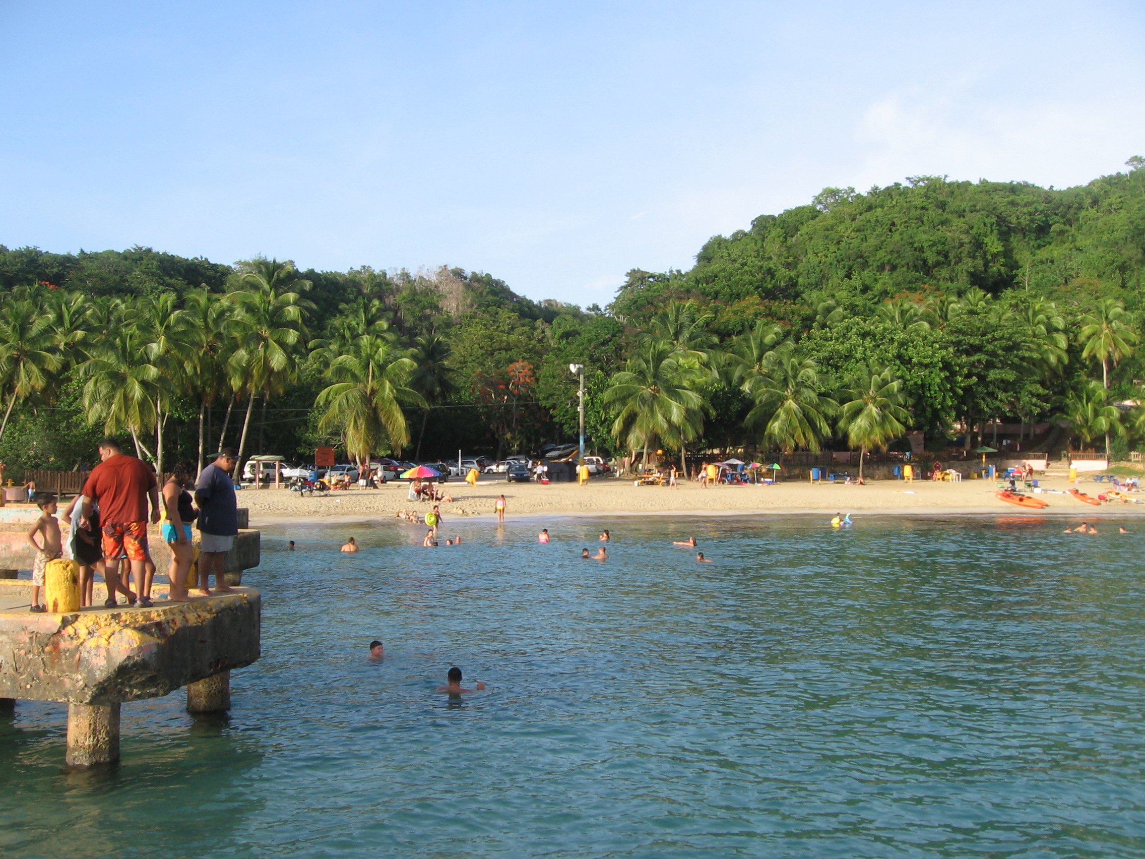
Crash Boat Beach is named for military hardware that's mostly gone, and for a pier whose fortunes have swung from working rescue infrastructure to beloved civilian landmark to storm casualty. That arc — not a single tidy failure — is the actual story here.
What a crash boat was. In U.S. military usage, "crash boats" were fast rescue launches assigned to air bases to recover aircrew who went down in the water near the field — a standing hazard at any base that ran overwater training or patrol routes. Aguadilla's namesake pier was built to launch and service the crash boats attached to the air base above the cove, so that a downed airman near the Puerto Rico coast had a fast boat and a working dock close by. The infrastructure was functional, not ceremonial: a working military pier, not a monument.
The base it served was not a minor outpost. The Army bought 3,796 acres of sugarcane land at Punta Borinquen in September 1939 for $1.215 million and built Borinquen Field, which flew B-18 Bolo bombers and transport aircraft through World War II. In 1948, under the newly independent Air Force, it became Ramey Air Force Base and graduated into a Strategic Air Command installation — first hosting RB-36 Peacemaker reconnaissance bombers, then B-52 Stratofortresses backed by KC-135 tankers. The B-36 alone forced the runway to be poured to 11,702 feet by 200 feet, dimensions built for Cold War strategic bombers, not island hopping. A base flying nuclear-capable bombers over open ocean is exactly the kind of installation that keeps rescue boats on permanent standby, and Crash Boat's pier was that standby infrastructure.
Then decades of storms and shifting sand did what infrastructure like this eventually suffers. English Wikipedia's sourced claim about the pier's decline is narrower than the legend built on top of it: local sea currents deposited sand into the pier area, forming a beach and making the original mooring unusable for docking boats — a single sourced sentence, not a documented channel-and-dredging saga. Spanish Wikipedia doesn't repeat the silting claim at all; it simply notes the site still retains some remnants of the pier infrastructure. What local reporting attributes to the pier's more recent damage is storms, not sand: crashboatbeach.com describes decades of storms, swells, and occasional seismic rumbling that broke, bent, and reworked the structure. The pier nonetheless remained a fixture for generations — a long, brightly painted concrete pier that visitors walked out on, fished from, and jumped off using a ladder bolted to the end. That changed on August 17, 2025, when part of the pier collapsed under swells thrown up by Hurricane Erin passing near Puerto Rico. Aguadilla's mayor, Julio Roldán, ordered the pier closed to the public for safety, and the Puerto Rico Ports Authority — which owns the structure — opened talks with the municipality about transferring it, pending a structural inspection and a decision on repair versus rebuild. As of this writing, the pier's reopening status hasn't been confirmed and should be re-checked before planning a visit.
The base outlived its bombers by two years and its beach-facing pier not at all. SAC drew down Ramey's bomber wings as the Cold War's basing needs shifted, and the Air Force deactivated the installation between 1971 and 1973, handing the airfield to the Puerto Rico government. It's now Rafael Hernández International Airport (BQN), 5.5 kilometers from the beach in a straight line — close enough that the same acreage the Army bought for bombers in 1939 is what commercial and cargo flights land on today. The rescue-boat pier, unlike the runway, never got a second civilian career. It just stopped working and stayed where it was.
What's there now is a landmark under repair, not a ruin. Before the 2025 collapse, the long concrete pier — painted in bright colors and covered in murals — was Crash Boat's signature landmark: a place to fish, jump from a ladder into deep water, and snorkel the reef flat it shelters. Reference sources describe scuba diving and snorkeling as the beach's defining activities. Wave data for the cove shows real conditions behind that calm reputation — an annual mean height of 1.2 meters, a February average of 1.55 meters, and gusts to 2.3 meters on the roughest recorded day, on a coast that has logged 17 tropical cyclones within its regional tracking radius over 50 years, one at Category 5 strength. The surf break here is rated a modest 4 out of 10 for difficulty and needs a specific combination — west swell, northeast offshore wind — to work at all, which is most of why the reef stays swimmable rather than surfable most of the year. None of that comes with a lifeguard, and with the pier itself closed since August 2025, the platform jumping and pier fishing visitors associate with Crash Boat are on hold pending repairs.
The sand itself is an unusually mixed batch, on paper. A global coastal-sediment model estimates the beach at 66.2% quartz, 13.1% feldspar, and 20.7% lithic (rock-fragment) grains — a modeled figure, not a measured one, but consistent with a beach fed by more than one sediment source rather than a single carbonate reef or a single river mouth. It's the same current-driven sand supply that, per Wikipedia's account, once made the boat channel unusable for docking — and the same supply that keeps today's cove shallow enough to wade and swim in.
The honest version of the story is more storm-battered than legend, and currently unresolved. Crash Boat's pier isn't a preserved monument with interpretive signage, and as of this writing it isn't even open: a section collapsed in Hurricane Erin's swells in August 2025, the Ports Authority and the municipality are discussing its future, and no confirmed reopening date exists in available sourcing. The name survives from a WWII-era rescue mission that no longer happens here; the concrete the mission built has spent decades absorbing storms, and its most recent one closed it.