British Columbia, CA

Kitsilano Beach

Kits-Beach.jpg

British Columbia, CA

Kitsilano Beach

Vancouver's busiest swimming beach sits on a Squamish reserve emptied by a coerced 1913 eviction; the nation now rebuilds beside it at Sen̓áḵw.

Kits-Beach.jpg · <a href="//commons.wikimedia.org/wiki/User:Xicotencatl" title="User:Xicotencatl">Xicotencatl</a> · CC BY-SA 4.0
Substrate
sand
Nearest airport
YVR · 9 km
I’m here for
Story

Kitsilano Beach faces English Bay from the north edge of the Kitsilano neighbourhood, across the water from downtown Vancouver and the North Shore mountains. Its Squamish name is X̱epx̱páy̓em, "having red cedar." The flats just east of the sand, where the Burrard Street Bridge now lands at the mouth of False Creek, were Sen̓áḵw, a Squamish village and the core of Kitsilano Indian Reserve No. 6, about 80 acres set aside in 1877. The district's English name is an anglicization of X̱ats'alanexw, the name of Squamish chief August Jack Khatsahlano (1877–1971); the Canadian Pacific Railway took the spelling "Kitsilano" around 1905 to market the land it was subdividing.

Before the Squamish were removed, a settler was too. In 1882 Sam Greer pre-empted 160 acres of the waterfront and farmed it, and the sand became known as Greer's Beach. When the province granted the land to the CPR, Greer refused to leave. In September 1891 he fired on a deputy sheriff who came to evict him; he was convicted of assault causing bodily harm that November and sentenced to 27 months of hard labour, and his house was pulled down. The beach kept his name into the early 1900s.

The Squamish clearance was larger and more lasting. In 1913 the provincial government, acting through its attorney general, arranged a surrender of the reserve that federal law did not permit, paying roughly twenty Squamish men about $11,250 each. Residents were given a few days to pack, loaded onto a barge, and taken to reserves on the North Shore and Howe Sound; the emptied houses were burned. By 1916 the Vancouver Harbour Commission had expropriated more of the flats, and by 1946 the Kitsilano reserve had been erased entirely.

The Squamish never accepted the loss. The nation sued Canada in 1977 over the mishandling of the reserve, voted in 2000 to accept a $92.5-million federal settlement, and had 11.7 acres (4.7 hectares) of the original reserve restored, confirmed through the courts in 2002 and marked by a homecoming of 28 canoes to the shore. In 2019 Squamish members voted to develop that land as Sen̓áḵw: eleven towers and roughly 6,000 rental homes at the south foot of the Burrard Bridge, described by the nation as the largest Indigenous-led housing project in Canadian history. Construction began in September 2022, backed by a $1.4-billion federal loan.

The beach in front of all this is Vancouver's most-used swimming shore. At its east end, Kitsilano Pool is a 137-metre saltwater outdoor pool, opened in 1931 and heated since a 1979 rebuild, the longest outdoor pool in North America, filled each season with English Bay seawater. Volleyball courts line the sand, the free Kitsilano Showboat stage has run summer performances since 1935, and the water averages under half a metre of wave height. The bay is not always clean: Vancouver Coastal Health posts recurring summer advisories when stormwater runoff pushes E. coli past safe limits.

The spike

Vancouver's busiest swimming beach sits on a Squamish reserve emptied by a coerced 1913 eviction; the nation now rebuilds beside it at Sen̓áḵw.

Most Vancouver beaches are named for a landform or a settler. Kitsilano is named for a person the city pushed aside. The word is an anglicization of X̱ats'alanexw, the name of the Squamish chief August Jack Khatsahlano, and the beach and the flats behind it were Sen̓áḵw, a Squamish village and the heart of a reserve. The singular fact of this shoreline is not the mountain view or the heated pool. It is that the beach is the recreation face of Kitsilano Indian Reserve No. 6, a reserve that was not abandoned but taken, and that the people who were removed are, a century later, rebuilding on the land in plain sight of the sand.

The reserve. In 1877 the Joint Indian Reserve Commission set aside about 80 acres at the mouth of False Creek as Kitsilano Indian Reserve No. 6, formalising a Squamish village the Squamish call Sen̓áḵw. It was home to roughly twenty families. The site sat on some of the most valuable undeveloped waterfront in a city that was about to explode in size, directly across the water from the downtown peninsula and beside the rail and bridge lines the Canadian Pacific Railway wanted to run.

Greer's Beach. The Squamish were not the only people cleared from this shore. In 1882 the settler Sam Greer pre-empted 160 acres of the beachfront and farmed it, and for two decades the sand was Greer's Beach. When the province handed the land to the CPR, Greer fought back; in September 1891 he shot a deputy sheriff sent to evict him, was convicted of assault causing bodily harm, and served 27 months of hard labour while his house was demolished. His stand is remembered almost fondly in local lore. The far larger removal that followed is remembered much less.

1913: the clearing. In 1913 the provincial government, through its attorney general, arranged a surrender of the reserve that federal law explicitly did not allow, because the Indian Act barred the private sale of reserve land without proper federal authorisation. Eighteen Squamish men were paid about $11,250 each, some $202,500 in total for land now worth billions. The residents were given a few days, loaded onto a barge, and taken to reserves on the North Shore and in Howe Sound. The houses they left were burned. Newspapers of the day called it "Indians' Moving Day." The Vancouver Harbour Commission expropriated more of the site in 1916, and by 1946 the reserve had been wiped from the map.

The name stayed; the people did not. The bitter detail is in the branding. Around 1905 the CPR, subdividing the uplands it had been granted, adopted "Kitsilano" as the name of its new district, an anglicised version of Chief Khatsahlano's own name. The railway kept the chief's name to sell the lots and helped remove the people who bore it. For decades the beach was simply a popular swimming spot, its origin unmarked, while August Jack Khatsahlano lived on as one of the last direct witnesses to the pre-city Squamish world, his recollections recorded by Vancouver's first archivist and published as Conversations with Khahtsahlano.

The return. The Squamish never let the claim die. The nation sued Canada in 1977 over the mishandling of the reserve, and in 2000 its members voted to accept a $92.5-million federal settlement that, confirmed through the courts in 2002, restored 11.7 acres of the original reserve. The nation marked the homecoming by paddling 28 canoes back to the shore. What had been an erased reserve was legally a reserve again, a small wedge of land at the foot of the Burrard Bridge, and it was now some of the most valuable real estate in Canada.

Sen̓áḵw now. In 2019 Squamish members voted to build on it. The result, under construction since September 2022, is Sen̓áḵw: eleven towers and roughly 6,000 rental homes on 11.7 acres, financed in part by a $1.4-billion federal loan and described by the nation as the largest Indigenous-led housing and retail development in Canadian history. Because the land is a federal reserve, it sits outside City of Vancouver zoning, which is precisely why it can be built so much denser than the low-rise neighbourhood around it. The founding developer, Westbank, sold its stake to the pension manager OPTrust in 2025. The towers rise at the east end of the beach, visible from the sand.

What the beach is. The recreation lives on top of all this. Kitsilano Pool, opened in 1931 and heated since 1979, runs 137 metres along the east end and is the longest outdoor pool in North America, filled each season with English Bay seawater. Volleyball courts fill the sand in summer, the free Showboat stage has performed beside the pool since 1935, and the water is calm enough to swim most of the year, when Vancouver Coastal Health has not closed it for E. coli. But the reason this beach earns a page is not its amenities. It is that you can stand on Vancouver's busiest swimming shore and watch a nation rebuild the village the city burned, on the same ground, at the same time.

Big Giant Staple March 2011.jpg
Culture

Where it shows up

History
  • August Jack Khatsahlano

    The Squamish chief (1877–1971) whose name, X̱ats'alanexw, the CPR anglicised into "Kitsilano." He was one of the last direct witnesses to the pre-city Squamish world.

  • Sen̓áḵw

    The Squamish village name for the flats at the mouth of False Creek, now the name of the nation's development on the restored reserve beside the beach.

Literature
  • Conversations with Khahtsahlano · 1955
    J.S. Matthews

    Vancouver's first city archivist, Major J.S. Matthews, recorded years of conversations with Khatsahlano and published them, preserving Squamish accounts of the land before the city.

Music
  • Khatsahlano Street Party · 2011
    Kitsilano West 4th Avenue Business Association

    A ten-block free music and arts festival on West 4th Avenue, run since 2011 and named to acknowledge the chief whose name the neighbourhood carries.

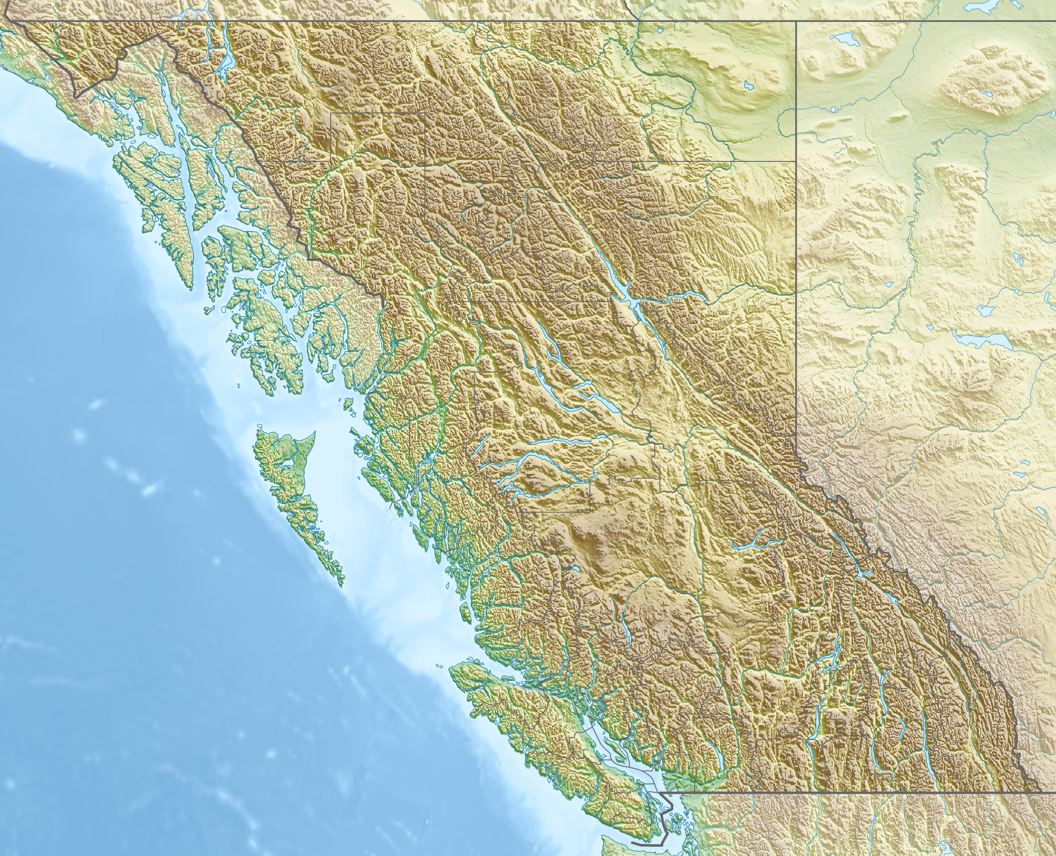
Canada British Columbia relief location map.jpg
History

What happened here

  1. 1877policy

    Kitsilano Indian Reserve No. 6 set aside

    The Joint Indian Reserve Commission formalises about 80 acres at the mouth of False Creek as Kitsilano Indian Reserve No. 6, covering the Squamish village of Sen̓áḵw, then home to roughly twenty families.

    Wikipedia →
  2. 1882founding

    Sam Greer pre-empts the waterfront

    The settler Sam Greer pre-empts 160 acres of the beachfront and farms it, and the sand becomes widely known as Greer's Beach, a name it keeps into the early 1900s.

    Wikipedia →
  3. 1891other

    Greer shoots a deputy sheriff during his eviction

    With the province granting his land to the CPR, Sam Greer fires on a deputy sheriff sent to evict him. He is convicted of assault causing bodily harm on 16 November 1891 and sentenced to 27 months of hard labour; his house is demolished.

  4. 1913policy

    The Squamish are evicted and Sen̓áḵw burned

    The provincial government arranges an unlawful surrender of the reserve, paying eighteen Squamish men roughly $11,250 each. Residents are given a few days, barged to reserves on the North Shore and Howe Sound, and their emptied homes are burned.

    Wikipedia →
  5. 1931founding

    Kitsilano Pool opens

    The 137-metre saltwater outdoor pool opens on 15 August 1931, built as a Depression-era job-creation project alongside other Vancouver saltwater pools, of which it is now the only one left.

    Wikipedia →
  6. 1935cultural

    Kitsilano Showboat begins

    A free open-air performance stage opens beside the pool at the beach's east end. The Showboat has run summer programs of music and dance since 1935 and remains free to the public.

  7. 2000policy

    Squamish accept a $92.5-million settlement

    Following a 1977 lawsuit over the reserve's mishandling, Squamish members vote to accept a $92.5-million federal settlement that, confirmed through the courts in 2002, restores 11.7 acres of the original reserve. The nation paddles 28 canoes back to the shore.

    Wikipedia →
  8. 2022founding

    Construction begins on Sen̓áḵw

    Building starts on Sen̓áḵw, eleven towers and roughly 6,000 rental homes on the restored reserve at the foot of the Burrard Bridge, backed by a $1.4-billion federal loan and billed by the nation as the largest Indigenous-led development in Canadian history.

    Wikipedia →
  9. 2024other

    Kitsilano Pool reopens after storm damage

    After a January 2022 storm and king tide damaged the seaside pool, some $3.5 million in repairs allow it to reopen on 7 August 2024. It reopens late again in June 2025, and the city begins planning a full replacement.

The honest part
“The reserve did not fade away; it was taken, and the towers at the beach's east end are the Squamish taking part of it back.”

The comfortable version of Kitsilano Beach is a swimming beach with a heated pool and a mountain view. The fuller version is that all of it sits on Kitsilano Indian Reserve No. 6, the Squamish village of Sen̓áḵw, and that the reserve did not fade away, it was taken. In 1913 the provincial government engineered a surrender that federal law forbade, paid eighteen men roughly $11,250 each, barged the residents to other reserves, and burned the houses they left. The name Vancouver kept for the district is an anglicization of a Squamish chief's name, applied by the railway that profited from clearing the land.

What makes Kitsilano unusual is that the reckoning is not only historical. The Squamish won part of the land back through the courts, and the Sen̓áḵw towers now rising at the east end of the beach are among the most visible corrections of a dispossession on the Vancouver waterfront, roughly 6,000 homes on 11.7 acres the nation had to sue for decades to recover. The beach is genuinely public and genuinely well used. It is also a place where the history is not settled background but a construction site you can watch from the sand.

Kitsilano Beach Playground 2026.JPG
Anatomy

The shape of the place

The main crescent

45%

The central sweep of sand where most swimmers and sunbathers gather, facing north across English Bay to downtown and the North Shore mountains. The substrate is feldspar-rich quartz sand and the water is calm most of the year.

Best for Swimming, sunbathing, and the west-coast sunset

Bay water stays cool (mid-teens Celsius) even in summer; watch for posted E. coli advisories after heavy rain.

Beach volleyball courts

55%

The banks of beach volleyball courts on the sand and grass behind the central beach, one of the busiest organised volleyball scenes in the city through the summer.

Best for Beach volleyball and pickup games

Courts fill on summer weekends; competitive play dominates peak hours.

Kitsilano Pool and Showboat

80%

The east end, anchored by the 137-metre heated saltwater Kitsilano Pool, the longest outdoor pool in North America, with the free Showboat performance stage beside it.

Best for Lap swimming, families, and free summer performances

The outdoor pool runs roughly late May to September; recent storm damage delayed its 2024 and 2025 openings.

The east end and Sen̓áḵw

95%

The quieter eastern edge toward Vanier Park and the Burrard Bridge, where the restored reserve and the rising Sen̓áḵw towers meet the beach. This is the ground of Kitsilano Indian Reserve No. 6.

Best for Reading the beach's history from the sand; walking to Vanier Park

The Sen̓áḵw construction site is active and fenced; the towers are visible along the shore.

Landmarks

Kitsilano Pool · 1931

pool

The 137-metre saltwater outdoor pool at the beach's east end, opened in 1931, heated since a 1979 rebuild, and the longest outdoor pool in North America. It is filled each season with seawater drawn from English Bay.

Wikipedia →

Sen̓áḵw

development · Revery Architecture; Kasian

The Squamish Nation's development on the restored 11.7-acre reserve at the foot of the Burrard Bridge: eleven towers and roughly 6,000 rental homes, under construction since 2022 and billed as the largest Indigenous-led development in Canadian history.

Wikipedia →

Burrard Street Bridge · 1932

bridge

The 1932 art-deco bridge that lands at the beach's east end, crossing False Creek directly over the old reserve flats where the Sen̓áḵw towers now rise.

Wikipedia →
A day here

From first light to dark

Dawn

First light comes over the mountains behind the city rather than off the water, since the beach faces roughly north across English Bay. The sand is quiet except for early swimmers doing lengths at the pool and walkers on the seawall path; the tide decides how much beach there is to have.

Midday

By late morning in summer the volleyball courts are full and the pool is at capacity, the downtown skyline and freighters at anchor forming the backdrop. Shade is scarce on the open sand, and the bay water stays cool, generally in the mid-teens Celsius even at the height of summer.

Golden hour

The long west-coast evenings are the beach's set piece: the sun drops toward the North Shore and the Salish Sea, the towers of Sen̓áḵw catch the last light at the east end, and the Showboat stage runs its free program beside the pool.

Night

After dark the sand empties while the seawall keeps its walkers and cyclists. The pool closes, the bay goes black beyond the lit path, and the cranes over the Sen̓áḵw site stand floodlit at the foot of the Burrard Bridge.

Blue Bird Day.jpg
Sea & surf

What the water does

JFMAMJJASONDmetres (significant wave height)

Solid = typical monthly wave height; pale = the bigger days (90th pct). Offshore/regional swell from Open-Meteo Marine (ERA5 Ocean reanalysis, 2023–2024); a sheltered cove may sit calmer than this.

Calm — gentle swimming water most of the year
Typical wave height
0.38 m
Biggest swell
Feb · 0.44 m
Calmest
Jul · 0.32 m
Typical period
3.2 s (wind chop)
Before you go

Things to know

The water is cold, and sometimes closed

English Bay stays in the mid-teens Celsius even at the height of summer, and Vancouver Coastal Health posts E. coli swimming advisories after heavy rain. Check current beach water-quality notices before swimming.

The pool's season is short and uncertain

Kitsilano Pool is outdoor and runs roughly late May to September, but storm damage delayed both its 2024 and 2025 openings. Confirm with the Vancouver Park Board before relying on it.

You are standing on a reserve

The beach and the flats east to the Burrard Bridge were Kitsilano Indian Reserve No. 6, the Squamish village of Sen̓áḵw. The towers at the east end are the nation's return to the land, not scenery.

Arrive early on summer weekends

Free street parking around Cornwall Avenue and Arbutus Street fills by late morning on sunny summer days; TransLink buses from downtown are the easier approach.

Swimming

Usually calm water — among the gentler beaches for a swim.

Sharks

No incidents on record in the global shark-attack file.

Plan

If you go

Getting there
Nearest airport
Vancouver International Airport (YVR) · 9 km
Nearest town
West End · 2 km

Kitsilano Beach is about 9.3 km by road from Vancouver International Airport (YVR) and roughly 3 km from downtown across the Burrard or Granville bridges. TransLink buses reach the neighbourhood from downtown and the Canada Line; free street parking around Cornwall Avenue and Arbutus Street fills early on summer weekends.

When to go
  • Kitsilano Showboat · Evenings, mid-June to late August

    Free open-air music and dance performances on the Showboat stage beside Kitsilano Pool, run by volunteers since 1935.

  • Khatsahlano Street Party · One Saturday in July

    Ten blocks of West 4th Avenue, between Burrard and Macdonald streets, close for around fifty free concerts, food, and art, run since 2011 by the neighbourhood business association.

What to eat & drink
The beachfront concession

The two-storey pavilion on the sand housed the Watermark restaurant (2005–2010) and then The Boathouse, which closed on 21 September 2025; the Hawksworth Restaurant Group won the lease but has not yet opened a new concept there. The licensed poolside concession by Kitsilano Pool runs seasonally as Batch Kitsilano, serving DownLow Chicken fried chicken, beer, and canned cocktails from a patio on the beach.

Kitsilano Beach Park, 2305 Cornwall Avenue, by the pool

BC spot prawns

A short wild fishery off the British Columbia coast, in season for roughly six weeks from May, and marked in Vancouver by an annual spot-prawn festival. They are a restaurant and market item, not sold on the beach.

Vancouver restaurants and the Granville Island market, in late spring

Wild Pacific salmon

Sockeye, chinook, and coho from the coastal fishery are the regional signature, grilled or cured; the salmon runs are central to Squamish and wider Coast Salish food culture.

Restaurants and markets across Vancouver

Nanaimo bar

A no-bake three-layer dessert of a crumb base, custard middle, and chocolate top, named for the Vancouver Island city of Nanaimo and a British Columbia staple in bakeries and cafes.

Kitsilano cafes and bakeries along West 4th Avenue

Sources & references
  1. Wikipedia: Sen̓áḵw; The Tyee · cited 2×
  2. Globe and Mail; Ammsa.com · cited 2×
  3. CBC News; Squamish Nation · cited 2×
  4. Wikipedia: Sen̓áḵw; Squamish Nation
  5. Wikipedia: Kitsilano Beach; Maclean's (1958)
  6. Maclean's (1958); Kitsilano.ca
  7. Wikipedia: Kitsilano Pool; MONTECRISTO
  8. Kitsilano Showboat; Vancouver Is Awesome
  9. Daily Hive; CBC News
  10. Squamish Nation; Wikipedia: Kitsilano Beach
  11. Wikipedia: Sen̓áḵw
  12. Wikipedia: Kitsilano Pool
  13. Wikipedia: Kitsilano
  14. Open-Meteo Marine (ERA5 reanalysis)
Colophon · Provenance

Where this page comes from

Geography, facilities
OpenStreetMap (ODbL) for geometry and facility tags within 500 m of the beach centroid. GeoNames for city/airport distances.
Climate & ocean
Open-Meteo ERA5 + Marine archive, 2014–2023 monthly normals.
Photography
Archival, original tone (Tier B — Wikimedia Commons). Each image licensed per its own terms; attribution visible inline.
History & culture
Every factual claim is linked to its source in the prose above. Wikipedia citations inline. Non-wiki sources named where relevant.
Editorial voice
Register: reverent. Written to pass a local's nod test; corrections welcome.
Written by Erin Rose
Last reviewed 2026-04-19
v0.9 — in editorial development toward v1.0