Thessaly, EL

KOKKINO NERO

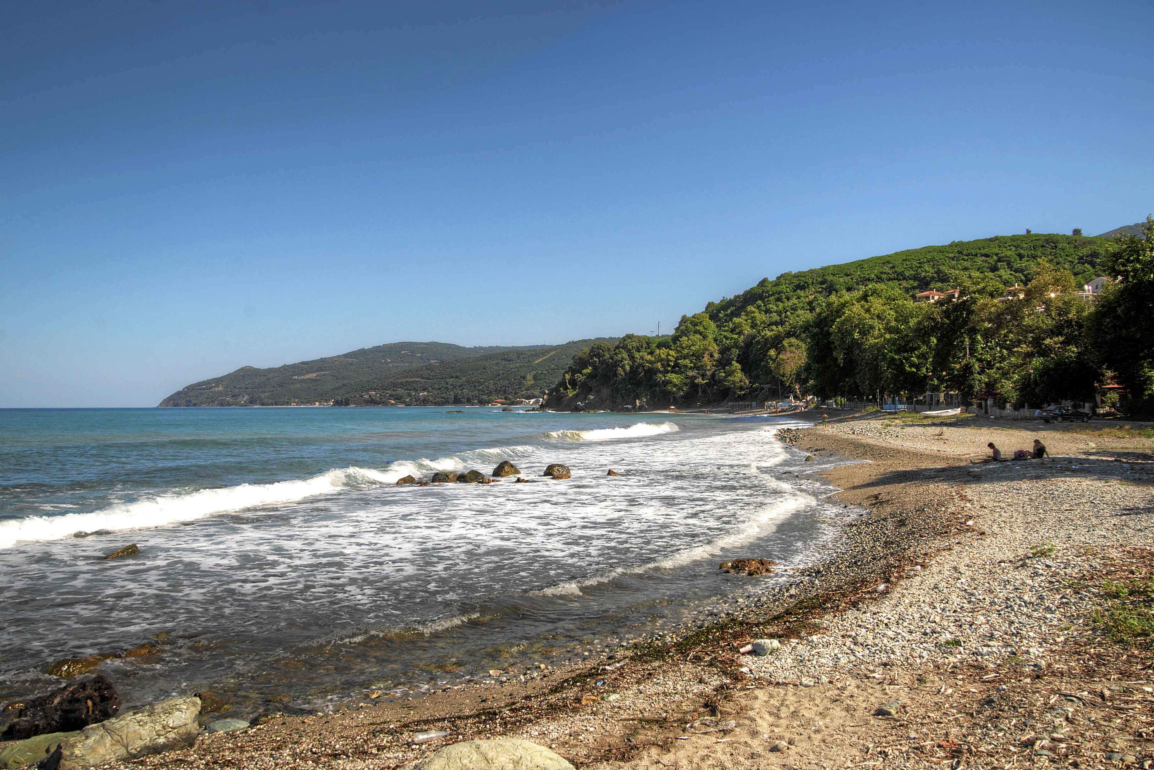
Kokkino-nero-strand.jpg

Thessaly, EL

Kokkino Nero

Three ventures — 1900, the 1930s, and the 1950s — tried to bottle Kokkino Nero's red mineral spring, and every one failed because of its iron.

Kokkino-nero-strand.jpg · <a href="//commons.wikimedia.org/wiki/User:Mboesch" title="User:Mboesch">Mboesch</a> · CC BY-SA 4.0
Nearest airport
VOL · 68 km
I’m here for
Story

Kokkino Nero is a village and beach in the community of Karitsa, municipal unit of Evrymenes, municipality of Agia, in Larissa, Thessaly, at the foot of Mount Ossa — known locally as Kissavos — on the eastern shore of the Thermaikos gulf. The name means “red water,” for the iron-tinted mineral spring that colours its shallows and has drawn visitors since at least the middle of the nineteenth century. That spring has a stranger commercial history than its size suggests, covered in full in the history lens linked from this page.

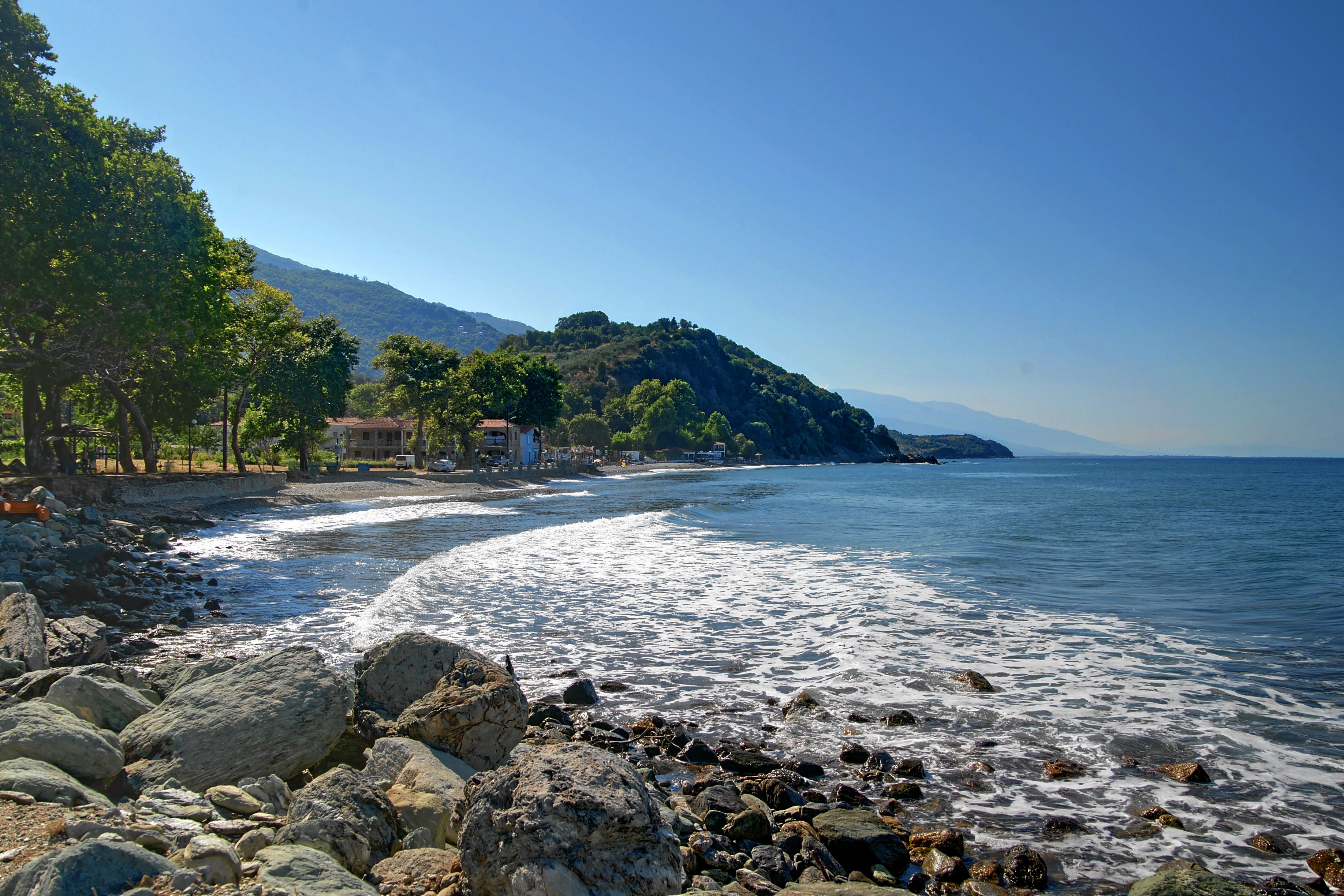
The shore itself is unglamorous by Aegean standards — modest coastal scrub, a scatter of taverns, and two different beach textures running into one another rather than a single uniform strand. What sets Kokkino Nero apart is underfoot and in the water, not on a postcard horizon: the mineral spring that gives the place its name and its colour.

Present-day tourism-board copy frames Kokkino Nero as a modest, family-style stop rather than a resort destination, a place whose main draw remains the spring itself rather than any polished visitor infrastructure.

Kokkino Nero is also a small place, thinly documented outside a handful of Wikipedia entries and regional tourism copy — sources that don't always agree with each other on details as basic as the village's own elevation or its population a generation ago, as the honest-reckoning section on this page goes into directly.

What follows separates the two threads: the spring's real, dated history sits in the lens linked below; the practical basics for actually visiting — access, conditions, safety — sit in the travel lens after it.

The spike

Three ventures — 1900, the 1930s, and the 1950s — tried to bottle Kokkino Nero's red mineral spring, and every one failed because of its iron.

Kokkino Nero is a small Greek village named for water nobody has ever managed to sell.

A “miraculous water,” first written down in 1842. The earliest written testimony describing Kokkino Nero's spring dates to 1842, when accounts began circulating of its “miraculous water.” The spring's iron content gives it a distinctive rust-red tint where it meets the sea, at the foot of Mount Ossa — known locally as Kissavos — on Thessaly's Thermaikos coast. By the turn of the twentieth century, that reputation had attracted outside commercial interest.

The first attempt: 1900. An English company arrived in 1900 intending to bottle the mineral water for sale. It built a hydro-catchment platform on the beach, made of two concrete bases that reportedly still stand today in front of the village's hot sea baths. The platform stayed in use until 1935 — by which point, according to local accounts, the English venture's bottling business had already failed, and the company had left the area.

The second attempt: the 1930s. In 1935, a new platform went up, built by the hotel of Georgios Dimitrakopoulos, publisher of the Larissa newspaper “Eleftheria.” Dimitrakopoulos had built the village's first hotel in the early 1930s specifically to capitalize on the spring, the clean air, and the sea. He then made his own attempt at bottling the water that same decade, renting the springs from the Greek state and importing thousands of glass bottles specifically for the purpose. This attempt, like the first, did not last.

The third attempt: the 1950s. Dimitrakopoulos tried a third time in the 1950s, this time with modern pressed caps and thousands of bottles put into circulation. It failed for the same reason as the two attempts before it.

Why it kept failing. The explanation given for all three failures is the same. Kokkino Nero's spring water carries an unusually high iron content, and that iron settles to the bottom of a sealed bottle, deactivating the properties the water is valued for. The water's broader natural composition is also said to break down once it has been standing bottled for a while. None of that matters if you drink the water standing at the source, which is how it has always been consumed. It matters enormously if your business is selling it somewhere else — which is exactly what three separate ventures, across more than fifty years, tried and failed to do. An English company with capital behind it, a local publisher with two separate tries and a state lease on the springs, and a mid-century operation with modern equipment all ran into the identical chemical wall. That consistency is itself informative: this was never a failure of ambition, financing, or timing. It was a property of the water.

A resource built to be visited, not shipped. Kokkino Nero sits at the foot of Mount Ossa, on the Thermaikos coast of Thessaly — a small, out-of-the-way village whose one real distinction has never traveled further than its own shoreline. Every generation that has tried to change that has run into the same limit. The spring has made the village locally known for close to two centuries; it has never made anyone rich from bottling it.

Official medicine, unofficial commerce. The story does not end with the 1950s failure. In November 2019, a Greek government gazette (FEK) formally classified Kokkino Nero's spring as a therapeutic natural resource, recognized for balneotherapy and drink-therapy. The classification lists specific medical indications — gastrointestinal and urinary conditions, rheumatic disease, sciatica, lumbar pain, and nervous-system conditions — and, with equal precision, a list of contraindications: heart disease, lower-limb edema, coronary disease, cerebral hemorrhage or thrombosis, malignant tumors, fever, nervous or psychiatric conditions, active tuberculosis, and pregnancy after the sixth month.

That is an unusually formal, clinical document to exist for a spring that, a full century after the first attempt to commercialize it, still cannot be exported in a bottle. Kokkino Nero's water has a government file number. It does not have a product line.

The advice hasn't changed. A 2026 visitor feature gives Kokkino Nero's guests almost exactly the guidance a would-be bottler in 1900 would have needed: because of the iron content, the water degrades if it sits bottled for several hours, so the advice is to drink it immediately, standing at the source. A century of engineering attempts — concrete catchment platforms, imported glass bottles, modern pressed caps — never got around that basic chemistry.

Kokkino Nero remains, in the end, a place you have to actually visit to experience its one genuinely distinctive feature. No amount of investment, packaging, or official recognition has changed that since the first account of it in 1842.
Kokkino-nero-heilquellen-b.JPG
Culture

Where it shows up

Literature
  • The Ancient Thessaly (Friedrich Stählin)
    Friedrich Stählin

    Stählin's history of ancient Thessaly describes two springs of metallic red water at Kokkino Nero as pleasantly cool, about 12°C, with a good taste.

Other
  • Theodor von Heldreich's comparison to Vichy's Hauterive water
    Theodor von Heldreich

    The botanist Heldreich compared Kokkino Nero's spring to France's well-known Hauterive water of Vichy, noting the two local springs carried a large volume of water but a different taste from one another.

History
  • Ancient Eurymenae

    Wikipedia states the site of the ancient town of Eurymenae is said to lie within Kokkino Nero's bounds; no excavation report among the sources consulted here confirms an exact location.

Kokkino-nero-strand-b.jpg
History

What happened here

  1. 1928governance

    Officially registered as a separate settlement

    Kokkino Nero is registered for the first time as its own settlement, under the then-community of Karytsis.

    Wikipedia →
  2. 1961demographics

    Population low of 10

    Census records show the village's population at a low point of 10 residents.

    Wikipedia →
  3. 1981demographics

    Population peak of 160

    Census records show the village's population reaching its recorded peak of 160 residents.

    Wikipedia →
  4. 2020governance

    Moves into the municipality of Agia

    Until 2020 the village belonged to the separate former municipality of Evrymenon; it now sits within the municipality of Agia.

    Wikipedia →
  5. 2021demographics

    Population recorded at 116

    The most recent Greek census records a permanent population of 116 for Kokkino Nero.

    Wikipedia →
  6. 2022governance

    Deputy mayor touts the springs, plans a visitor facility

    Agia's deputy mayor Nikos Ntagas says the thermal springs draw many tourists yearly and that the municipality is working toward an EOT-standard visitor facility.

The honest part
“Even the village's own reference sources can't agree on its elevation, or on how many people lived there in 1991.”

The uncomfortable truth about Kokkino Nero is how much of what gets repeated about it rests on promotional language rather than confirmed data. A regional tourism-board page calls it “one of the oldest settlements in the region,” citing unspecified archaeological findings, without naming an excavation report or a date. The same source's Blue Flag references actually belong to three separate, nearby beaches — Agiokampos, Sotiritsa and Velika — not to Kokkino Nero itself; nothing available here confirms that certification for this beach.

Even the basics don't fully agree with each other. Greek Wikipedia's own article text puts the village at 20 metres of elevation; Wikidata lists 7. The 1991 population appears as 80 in one table and 76 in the other. And there is a second village with the exact same name about two kilometres away, in the neighbouring municipal unit of Meliboea, with its own separate Wikipedia and Wikidata entries — close enough, and identically named enough, that it is easy to credit the wrong village's history to this one.

Kokkino-nero-heilquelle.JPG
Anatomy

The shape of the place

North pebble shore

20%

A stretch of pebble beach forming the northern half of Kokkino Nero's shore.

Best for A quieter stretch than the sandy side.

Rocky sea caves

50%

Rock complexes with caves in the sea create a distinctive stretch of coastline here, per regional tourism-board description.

Best for Exploring rock formations along the shore.

South sand shore

75%

A sandier stretch forming the southern half of the beach, on the opposite side from the pebble shore.

Best for A more conventional sand-beach experience than the pebble side offers.

Landmarks

Calypso Gorge

gorge

The area's natural landmark, home to organized hiking and climbing. Greek Wikipedia describes its biggest waterfall at 70 metres, the tallest on Mount Kissavos; a separate tourism-board source instead describes the gorge as having three waterfalls, without giving a height — two different framings of the same gorge, not a confirmed single figure.

The mineral springs

spring

The red-tinted mineral springs at the foot of Mount Kissavos that give the village its name, on the Thermaikos coast.

A day here

From first light to dark

Dawn

At first light the shallows near the spring show their rust tint most clearly, before the day's heat and any boat traffic disturb the water; the pebble stretch to the north is usually empty this early.

Midday

By midday the tavernas along the streambed, shaded by plane trees, are a more comfortable place to be than the open pebble beach, which offers little natural shade of its own.

Golden hour

Evening light picks out the two different textures of the shore — pale pebble to the north, sand to the south — and the rock formations further along the coast, where sea caves break up the shoreline.

Night

After dark the village is quiet — a small, thinly populated place, not a nightlife destination — and the mineral pools sit unlit and untended once the day's visitors leave.

Kokkino-nero-platia-ammos.JPG
Sea & surf

What the water does

JFMAMJJASONDmetres (significant wave height)

Solid = typical monthly wave height; pale = the bigger days (90th pct). Offshore/regional swell from Open-Meteo Marine (ERA5 Ocean reanalysis, 2023–2024); a sheltered cove may sit calmer than this.

Calm — gentle swimming water most of the year
Typical wave height
0.5 m
Biggest swell
Jan · 0.79 m
Calmest
Jun · 0.28 m
Typical period
4.4 s (wind chop)
Before you go

Things to know

Underfoot

The beach is pebbly, with fairly large stones in places; aquashoes are recommended for getting into the water.

Free mineral pools

Cold mineral-water pools (“kolympithres”) near the spring are freely accessible, holding a fairly constant temperature around 17°C.

Water quality

The beach's EU bathing-water rating is “excellent,” in the Coastal category (site ID ELBW089097001101).

Sea conditions

Modeled wave-climate data (Open-Meteo Marine, ERA5 ocean reanalysis, 2023–2024) describes a calm annual wave climate here — a mean height around 0.5 m, roughest in January (about 0.79 m), calmest in June (about 0.28 m).

Swimming

Usually calm water — among the gentler beaches for a swim.

Sharks

No incidents on record in the global shark-attack file.

Plan

If you go

Getting there
Nearest airport
Nea Anchialos National Airport (VOL) · 68 km
Nearest town
Agia · 13 km

Kokkino Nero sits about 70 km from Larissa and 19 km from Agiokampos, on Greece's Thermaikos coast at the foot of Mount Ossa. The closest airport, Nea Anchialos (VOL), is roughly 68.4 km away in a straight line — no source consulted here confirms road distance or drive time. No source consulted here documents a ferry service to the village.

When to go
  • Filoktiteia · Each summer

    A festival organized each summer by the municipality of Agia, with musical and theatrical events, across the municipality including this stretch of coast.

  • Festival of the Sea (Stomio) · Summer, in Stomio

    A sea-themed festival held in the nearby port town of Stomio as part of the municipality of Agia's summer cultural calendar.

What to eat & drink
Beachfront fish taverns

Tourism-board copy describes the beachfront as dominated by taverns serving fresh fish, alongside a beach bar and rooms and hotels for rent; no source consulted here names a specific business by name.

Along the Kokkino Nero beachfront

Streambed tavernas under the plane trees

Taverns and cafes line the coast and the scenic streambed, tucked under the shade of plane trees, serving local dishes.

Along the village streambed, Kokkino Nero

The spring water itself

Traditionally considered good for stomach disorders; people also visited the spring preventively against tuberculosis — a folk belief distinct from the water's later, formal medical classification.

At the spring, Kokkino Nero

Sources & references
  1. Greek Wikipedia · cited 2×
  2. Greek Wikipedia census table · cited 2×
  3. Larissa Beach (tourism board) · cited 2×
  4. German Wikipedia
  5. Wikipedia
  6. Topontiki (July 2022)
  7. Greek Wikipedia: Κόκκινο Νερό Ευρυμενών Λάρισας
  8. Greek Wikipedia; Larissa Beach
  9. Olympus Eastside
Colophon · Provenance

Where this page comes from

Geography, facilities
OpenStreetMap (ODbL) for geometry and facility tags within 500 m of the beach centroid. GeoNames for city/airport distances.
Climate & ocean
Open-Meteo ERA5 + Marine archive, 2014–2023 monthly normals.
Photography
Archival, original tone (Tier B — Wikimedia Commons). Each image licensed per its own terms; attribution visible inline.
History & culture
Every factual claim is linked to its source in the prose above. Wikipedia citations inline. Non-wiki sources named where relevant.
Editorial voice
Register: wry. Written to pass a local's nod test; corrections welcome.
Written by Erin Rose
Last reviewed 2026-04-19
v0.9 — in editorial development toward v1.0