Canary Islands, ES

Maspalomas Dunes

Playa del ingles dunes.jpg

Canary Islands, ES

Maspalomas Dunes

The sand is crushed shell and coral off the sea floor, not Sahara dust, and the whole field migrates downwind.

Playa del ingles dunes.jpg · <a href="//commons.wikimedia.org/wiki/User:Wouterhagens" title="User:Wouterhagens">Wouter Hagens</a> · Public domain
Spring tide
1.90 m
Nearest airport
LPA · 29 km
Tier
Featured
I’m here for
Story

The Maspalomas dunes occupy 404 hectares at the southern tip of Gran Canaria, in the municipality of San Bartolomé de Tirajana. The Spanish state protected them as a nature reserve in 1987 and reclassified the area a Special Nature Reserve (Reserva Natural Especial) in 1994. The reserve bundles three connected systems: a field of mobile dunes, the brackish La Charca lagoon, and a palm grove of Canary Island date palm, Phoenix canariensis.

The sand is not Saharan. The grains are crushed shell and coral skeletons that built up on the marine shelf and were exposed when sea level dropped during the last glaciation; wind then drove them onto the coast. The field is alive: prevailing easterlies push the dunes west across the headland at roughly 2 to 5 metres a year, and the largest crests reach 15 to 20 metres before they slump and reform.

The lagoon sits where the Fataga ravine meets the sea. La Charca is brackish, fringed with tamarisk and reed, and it is the reason birders come. It is a refueling stop on the Europe-to-Africa flyway. Little egret, grey heron, whimbrel, common greenshank, Eurasian spoonbill, black-winged stilt and common moorhen all show up in the records; sources cite roughly two dozen migratory and resident species using the wetland.

The Faro de Maspalomas marks the western corner. The engineer Juan León y Castillo designed it; it was first lit on 1 February 1890. The blue-grey masonry tower stands 54.70 metres, 60 metres to the top of the lantern, and its light carries 19 nautical miles. For decades it was a lonely beacon over empty sand. Then the resorts arrived.

Maspalomas and neighbouring Playa del Inglés form one of the most heavily visited coastlines in Europe; San Bartolomé de Tirajana sits inside the southern Gran Canaria zone that drew about 26 percent of the Canary Islands' 16.1 million tourists in 2025. The dunes have been a nudist beach and an open-air gay cruising ground since the 1970s. Both facts now collide with conservation: the field is shrinking, and since May 2020 you can be fined for stepping off the marked trails.

The spike

The sand is crushed shell and coral off the sea floor, not Sahara dust, and the whole field migrates downwind.

Most people who climb the Maspalomas dunes assume they are standing on a stray finger of the Sahara, 100-odd kilometres of Atlantic away. They are not. The grains underfoot are biogenic carbonate: the ground-up skeletons of shellfish, coral and calcareous algae that accumulated on the continental shelf off southern Gran Canaria. During the last glacial period, sea level fell far enough to expose that shelf, and the dominant winds dragged the loose carbonate sand landward onto the headland at the mouth of the Fataga ravine. Strip the romance of a desert crossing and what you get is more interesting: this is a marine deposit, blown ashore, and it is one of the reasons the sand is pale gold rather than the iron-dark volcanic grit of most Canary beaches.

The second thing that makes the field singular is that it moves. These are transverse and barchan-type dunes in a true mobile system, not a static pile that tourists happen to walk on. The trade winds out of the east push the crests west across the 404-hectare reserve at roughly 2 to 5 metres a year. A given dune builds to 15 or 20 metres, oversteepens on its lee face, avalanches forward, and reforms downwind. Walk the same line a year apart and the topography has rearranged itself. That mobility is the whole engine of the place, and it is exactly what human activity has broken.

The machine needs a feed of new sand. Historically, sand eroded off Playa del Inglés beach to the east, blew up and over the dune field, and was eventually returned to the sea off the Maspalomas point, where currents carried some of it back around to start the cycle again. Two things severed that loop. First, the hotels: once a wall of tall buildings went up along the back edge of the dunes in the 1960s and after, they disrupted the wind field that delivered sand to the system. Second, hard structures along the shore interrupted the longshore supply. A study published in the Journal of Coastal Research in 2007, working from aerial photographs, foraminiferal content and sediment-transport trends, documented a genuine shortage of sediment in the field and estimated that on the order of 45,000 cubic metres of sand leave the system for the sea bed each year without being replaced. The dunes are, slowly, running out of sand.

The response has been to manage the field like a patient. The Cabildo de Gran Canaria's MASDUNAS project, a roughly two-year pilot with a budget of 1,155,000 euros, set out to stop the bleeding: it installed 78 experimental sand-capture devices to trap sand before it blew off the field, planted 350 balancón shrubs (Traganum moquinii, the native dune-building plant) as fixing elements, and ran an experimental transfer of sand back into the system in October 2018, aiming to move up to 60,000 cubic metres. A follow-on phase, MASDUNAS II, reported protecting some 14,000 cubic metres of sand and restoring about 85 percent of the degraded dune front. There is something almost absurd about it: authorities now physically truck sand from the seashore back to the rear of the dunes rather than let the wind carry it into the ocean, doing by lorry what the wind used to do for free.

The third singular fact is human, and it is the one the brochures skip. The dunes have been a nudist beach and an open-air gay cruising area since the 1970s, predating the resorts that now surround them; the Yumbo Centre, built in the 1980s, anchored Playa del Inglés as one of Europe's major queer destinations. For decades the beach kiosks, numbers 5, 6 and 7, oriented the social geography of the sand. This is real social history and worth stating plainly. It is also, the science says, doing measurable damage. A study led by coastal-dune geomorphologist Patrick Hesp, with researchers from the University of Las Palmas de Gran Canaria and Flinders University, published in the Journal of Environmental Management in January 2022, mapped 298 "sex spots" across 5,763 square metres of the dune field. The activity, the paper found, damaged 10 plant species, three of them endemic, by people stepping on the vegetation, pulling it up to build hollows and "nests," and leaving 18 categories of waste behind, from cigarette butts and toilet paper to condoms and faeces. Co-author Hesp noted that endemic Gran Canaria giant lizards, Gallotia stehlini, have died after eating discarded condoms.

That is the real Maspalomas: a marine deposit blown ashore, a field that walks downwind and is now starved of the sand that feeds it, propped up by lorries and shrubs, and crossed by a human culture old enough to predate the hotels and large enough to leave its own bootprint in the science. Since 22 May 2020, visitors must stay on roughly 8 kilometres of marked trails or face fines starting at 150 euros, with a team of caretakers and police patrols enforcing it. The dunes are not a desert that wandered over from Africa. They are a fragile machine, and the argument over how to keep it running is the most honest thing about the place.

PlayaDelInglesHotelView.jpg
Culture

Where it shows up

History
  • Yumbo Centre

    Shopping and nightlife centre in Playa del Inglés built in the 1980s that became the anchor of one of Europe's major LGBT tourist scenes, tied to the dunes' long-standing gay cruising culture.

  • Hesp et al. dune-impact study · 2022
    Patrick Hesp and colleagues (ULPGC, Flinders University)

    Journal of Environmental Management study that mapped 298 sites of sexual activity across the dune field and linked them to damage to ten plant species and the deaths of endemic giant lizards.

Other
  • Maspalomas nudist and gay cruising tradition

    Open-air nudist and gay cruising use of the dunes that dates to the 1970s and predates the surrounding resorts; documented in tourism guides and, since 2022, in peer-reviewed conservation research.

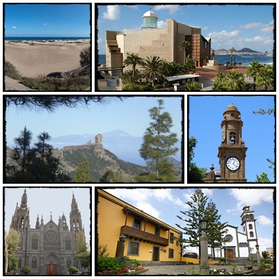
Collage Gran Canaria.jpg
History

What happened here

  1. 1861decision

    Lighthouse approved

    The decision to build a lighthouse at the Maspalomas point is taken on 19 June 1861, decades before construction is finished.

    Wikipedia →
  2. 1890construction

    Faro de Maspalomas first lit

    The lighthouse designed by engineer Juan León y Castillo emits its first light on 1 February 1890; the blue-grey masonry tower stands 54.70 m.

    Wikipedia →
  3. 1987designation

    Protected as a nature reserve

    The 404-hectare dune field, lagoon and palm grove in San Bartolomé de Tirajana are declared a protected area.

    Wikipedia →
  4. 1994designation

    Reclassified Special Nature Reserve

    The site is reclassified as a Reserva Natural Especial under Canary Islands protected-areas law.

  5. 2007research

    Sediment-shortage study published

    A Journal of Coastal Research study using aerial photos, foraminiferal content and transport trends documents a sediment deficit, with sand leaving the field for the sea bed.

  6. 2018restoration

    MASDUNAS sand transfer

    The Cabildo de Gran Canaria's MASDUNAS pilot (budget €1,155,000) runs an experimental sand transfer and deploys 78 sand-capture devices plus 350 balancón plantings to refeed the starved field.

  7. 2020regulation

    Access restricted to marked trails

    From 22 May 2020 visitors must keep to roughly 8 km of marked trails; off-trail fines start at €150, enforced by caretakers and police.

  8. 2022research

    Sex-tourism impact study

    A Journal of Environmental Management study led by Patrick Hesp maps 298 sex spots over 5,763 m², linking them to damage to 10 plant species and 18 categories of litter.

The honest part
Authorities now truck sand from the shore back to the rear of the dunes, doing by lorry what the wind used to do for free.

Maspalomas is shrinking, and the causes are known and mostly man-made. The hotels that brought the tourists also broke the wind cycle that fed the dunes; hard coastal structures cut the sand supply; and an estimated 45,000 cubic metres of sand leave the system for the sea every year. On top of that, the field carries the load of being both a major nudist and gay cruising destination and a Special Nature Reserve at the same time. A 2022 study in the Journal of Environmental Management mapped 298 sites of sexual activity across 5,763 square metres and tied them to damage to ten plant species, three endemic, plus eighteen kinds of litter and lizards killed by eating discarded condoms. The 2020 trail rules, the fines up to 600,000 euros for large-scale sand removal, and the MASDUNAS sand-trucking are all attempts to keep a starved, trampled machine running under the weight of one of Europe's busiest tourist coasts.

Hegeter grancanariensis Lindberg, 1950 (12047238604).png
Anatomy

The shape of the place

Faro de Maspalomas point

5%

Western corner under the 54.70 m lighthouse, where the dune field meets the open Atlantic point.

Best for landmark and sunset views

Lighthouse first lit 1890; promenade and restaurants cluster here.

La Charca lagoon

15%

Brackish lagoon and reedbed at the mouth of the Fataga ravine, edged by the palm grove.

Best for birdwatching

Flyway stopover; herons, egrets, stilts, spoonbill; viewing from the boardwalk only.

Mobile dune field

55%

The open, walking dune field; pale carbonate sand, crests to 15–20 m, migrating west.

Best for the dune walk on marked trails

Off-trail access banned since 2020; also the nudist and cruising zone toward the kiosks.

Playa del Inglés edge

90%

Eastern, resort-fronted end where the beach meets Playa del Inglés and its hotel wall.

Best for easiest beach access

Main entry point; the hotels here disrupted the wind cycle that once fed the dunes.

Landmarks

Faro de Maspalomas · 1890

lighthouse · Juan León y Castillo

Blue-grey masonry tower 54.70 m tall (60 m to the lantern), first lit 1 February 1890, light range 19 nautical miles; the oldest part of the modern resort and the marker of the dune field's western point.

Wikipedia →

La Charca de Maspalomas

lagoon

Brackish coastal lagoon fringed with tamarisk and reed, fed where the Fataga ravine meets the sea; a migratory-bird stopover within the reserve and one of its three core ecosystems.

El Palmeral

palm grove

Grove of endemic Canary Island date palm (Phoenix canariensis) bordering the lagoon; the third ecosystem of the reserve alongside the dunes and the charca.

A day here

From first light to dark

Dawn

Low light rakes across the crests and the wind is usually slack; this is when the ripple patterns the easterlies cut into the lee faces are sharpest before footprints erase them. Birders are already out at La Charca, where herons work the lagoon edge.

Midday

Full sun and no shade anywhere on the open sand; surface temperatures climb and the walk from the Playa del Inglés edge to the lighthouse feels far longer than the 2-plus kilometres it is. Keep to the marked trail.

Golden hour

The trade wind typically firms up in the afternoon and the dunes glow; this is the photographer's hour, with long shadows defining the barchan arms. The nudist and cruising stretches toward the kiosks fill out as the heat eases.

Night

The Faro de Maspalomas flashes its three-pulse, 13-second signature out to 19 nautical miles. The open dunes are unlit and closed off the trails; the social life moves to the Yumbo Centre and the Playa del Inglés promenade.

Compare

How it ranks

Peak warmth
Warmer than 57% of beaches in its country
Peak-month high ≈ 28°C
Beach season
Longer beach season than 91% of beaches in its country
12 comfortable months a year

Ranked against every beach in our database — 228,000+ worldwide.

Bauarbeiten am Strand von Playa del Inglés - 1978.jpg
Sea & surf

What the water does

JFMAMJJASONDmetres (significant wave height)

Solid = typical monthly wave height; pale = the bigger days (90th pct). Offshore/regional swell from Open-Meteo Marine (ERA5 Ocean reanalysis, 2023–2024); a sheltered cove may sit calmer than this.

Mixed — usually swimmable, with a livelier season
Typical wave height
1.04 m
Biggest swell
Mar · 1.28 m
Calmest
Sep · 0.84 m
Typical period
8.7 s (groundswell)
Before you go

Things to know

Stay on the trails

Since 22 May 2020 the dune field is off-limits except on the marked routes (about 8 km total). Off-trail fines start at €150; large-scale sand removal can reach €600,000. Caretakers and police patrol.

No shade, full sun

There is no shade on the open sand and surface temperatures get high. The walk from the Playa del Inglés edge to the lighthouse is over 2 km of soft sand; carry water and a hat.

Nudist and cruising zones are real

Much of the beach toward kiosks 5–7 is nudist, and the dunes are a long-established gay cruising area. This is normal here; the off-trail conservation rules still apply to everyone.

La Charca is for looking, not entering

The lagoon and palm grove are sensitive bird habitat viewed from boardwalks and edges, not waded into. Sandboarding down the dunes and lying in the vegetation are both banned.

Sharks

No incidents on record in the global shark-attack file.

Plan

If you go

Getting there
Nearest airport
Gran Canaria Airport (LPA) · 29 km
Nearest town
Playa del Ingles · 2 km

Fly into Gran Canaria Airport (LPA), about 29 km north; the resort coast is roughly 25–30 minutes by car or the GC-1 motorway south. The dune field stretches between Playa del Inglés (eastern, resort-fronted entry, the easiest access) and the Faro de Maspalomas (western point). Public buses and taxis serve both ends from across southern Gran Canaria. Park at the resort edges; you walk the dunes on foot, on the marked trails only.

When to go
  • Maspalomas Gay Pride · Spring (typically May), Playa del Inglés and the Yumbo Centre

    Annual pride festival centred on the Yumbo Centre, drawing large crowds to the resort beside the dunes; one of the Canary Islands' major LGBT events.

  • Winter bird passage at La Charca · Autumn and winter migration

    Not an organised event but a reliable seasonal one: the lagoon fills with migratory waders and waterbirds resting on the Europe-to-Africa flyway, drawing birdwatchers to the boardwalk.

What to eat & drink
Papas arrugadas con mojo

Canarian wrinkled potatoes boiled in heavily salted water, served with red (spicy) and green (coriander) mojo sauces. The default Canary side dish, on nearly every menu in Playa del Inglés and Maspalomas.

Restaurants across Playa del Inglés and the San Bartolomé de Tirajana resorts; not sold on the open dune field.

Pescado fresco a la espalda

Locally landed fish, often vieja (parrotfish) or cherne (wreckfish), split and grilled. Vieja is a Canary staple caught around Gran Canaria's waters.

Seafood restaurants in the resort zone and at the nearby fishing village of Arguineguín, west along the coast.

Gofio

Toasted milled grain (often a maize or wheat blend), a pre-Hispanic Canary staple of the indigenous islanders, eaten in escaldón, kneaded into amasado, or stirred into milk and desserts.

Traditional Canarian restaurants in San Bartolomé de Tirajana; sold milled in island supermarkets.

Beach kiosks

The numbered beach kiosks (5, 6, 7) along the sand sell cold drinks, snacks and music rather than full meals; they double as the orientation points for the nudist and gay stretches.

On the beach below the dune field, between Playa del Inglés and the lighthouse.

Sources & references
  1. https://www.hellocanaryislands.com/nature-spaces/gran-canaria/maspalomas-dunes-nature-reserve/ · cited 4×
  2. https://en.wikipedia.org/wiki/Maspalomas_Lighthouse · cited 3×
  3. https://en.wikipedia.org/wiki/Maspalomas_Dunes · cited 2×
  4. https://bioone.org/journals/journal-of-coastal-research/volume-2007/issue-234/04-0286.1/Shortage-of-Sediments-in-the-Maspalomas-Dune-Field-Gran-Canaria/10.2112/04-0286.1.short · cited 2×
  5. https://thecanarynews.com/2020/05/you-can-now-be-fined-for-straying-from-the-paths-through-the-dunes-of-maspalomas/ · cited 2×
  6. https://www.vice.com/en/article/sex-tourists-cruising-maspalomas-dunes/ · cited 2×
  7. http://adaptecca.es/en/casos-practicos/environmental-restoration-maspalomas-dune-system-masdunas-project-0
Colophon · Provenance

Where this page comes from

Geography, facilities
OpenStreetMap (ODbL) for geometry and facility tags within 500 m of the beach centroid. GeoNames for city/airport distances.
Climate & ocean
worldclim_v2.1_2.5m
Tides
eot20
Photography
Archival, original tone (Tier B — Wikimedia Commons). Each image licensed per its own terms; attribution visible inline.
History & culture
Every factual claim is linked to its source in the prose above. Wikipedia citations inline. Non-wiki sources named where relevant.
Editorial voice
Register: technical. Written to pass a local's nod test; corrections welcome.
Written by Erin Rose
Last reviewed 2026-04-19
v0.9in editorial development toward v1.0