Wales, GB

Pendine Sands

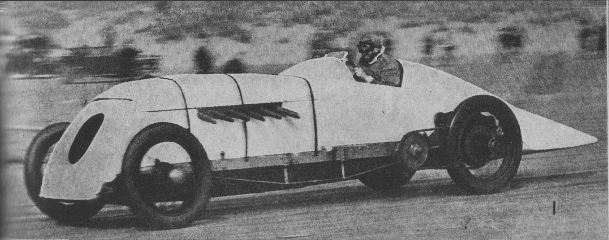
Sunbeam 350HP 'Bluebird'.jpg

Wales, GB

Pendine Sands

Parry-Thomas died chasing the land speed record here in 1927; his car Babs was mutilated after the inquest into his death, buried, then exhumed and restored.

Sunbeam 350HP 'Bluebird'.jpg · <a href="//commons.wikimedia.org/wiki/User:Thruxton" title="User:Thruxton">Thruxton</a> · CC BY-SA 4.0
Substrate
sand
Nearest airport
SWS · 33 km
I’m here for
Story

Pendine Sands is a beach on Carmarthen Bay in Carmarthenshire, south Wales, known in Welsh as Traeth Pentywyn. It runs from Gilman Point in the west toward the beach's eastern end — Wikipedia names that endpoint Laugharne Sands, while Pendine Community Council's own site names it Ginst Point instead, and the two disagree. The village of Pendine sits at the western end; it is a separate place from the beach and should not be confused with it, and its population was 346 at the 2011 census.

Pendine's fame comes from land-speed records set here between 1924 and 1927, and from what happened afterward to the car at the center of the final chapter — Parry-Thomas's Babs, mutilated and buried in the dunes after his fatal crash, later dug up and restored (the full story is in the History deep dive).

Most of the beach does not belong to the village. The Ministry of Defence, through its contractor QinetiQ, owns and fences off the majority of Pendine Sands to the east, land it took over in 1940 to develop weapons and train troops for the Normandy landings; Pendine Community Council owns and manages a smaller section at the village end and to the west. Access to the MOD's side is normally shut on weekdays; driving on the sand at all — once free to any visitor — has required paid, pre-arranged permission from Carmarthenshire's local authorities since cars were allowed back in 2010.

Pendine's more recent public life runs through screens and museums. The beach has stood in for BBC's Top Gear and the BBC Cymru drama Keeping Faith, and in 2011 Aardman Animations built what it called the world's largest stop-motion film set here for the short film Gulp. The original Pendine Museum of Speed operated from 1996 until its demolition in 2021; a new Museum of Land Speed has since taken its place on the promenade.

Pendine's water and tides are not just scenery. RNLI lifeguards patrol only in summer, and outside those months there is no patrol at all; a tidal flood-warning area covers the Beach Hotel, the post office, the Pendine Sands Caravan Park and the A4066 coast road behind the beach. Facilities on the sand itself are thin — the nearest food and shelter are on the promenade, not the beach.

The spike

Parry-Thomas died chasing the land speed record here in 1927; his car Babs was mutilated after the inquest into his death, buried, then exhumed and restored.

Pendine Sands sells itself on speed, but its most famous surviving object was buried in secret and left in the sand for decades. That object is Babs, the car J.G. Parry-Thomas drove to a land speed record here in April 1926 and drove to his death here on 3 March 1927. What officialdom did to Babs afterward, and what happened to it decades later, says as much about how Pendine handles its own history as anything sitting in a museum case today.

The record that killed him. Pendine's run as Britain's speed capital was short and compressed. On 25 September 1924, Malcolm Campbell set the first Pendine land speed record, 146.16 mph, in the Sunbeam 350HP car Blue Bird. In April 1926, Parry-Thomas took it back in Babs at 171.02 mph. Campbell answered in February 1927, reaching 174.22 mph in his second Blue Bird. Parry-Thomas went out almost immediately to reclaim it. On 3 March 1927, running at about 170 mph, his car crashed. He was the first driver ever killed in pursuit of the land speed record. Three record changes in under three years, ending in a fatality — that is the entire arc of Pendine's founding myth, compressed into less time than most beaches take to build a promenade.

What Babs actually was. The car had started life as the Higham Special, built for the racer Louis Zborowski. After Zborowski's death, Parry-Thomas bought it from his estate for £125 and rebuilt it around a 27-litre Liberty V12 aero engine — a war-surplus unit that Wikipedia's infobox rates at 450 hp, though other published accounts of the same engine give a considerably higher figure for the same specification; the two do not agree, and neither can be confirmed further here. Whatever the true output, it was, per Wikipedia, the largest-capacity racing car ever to run at Brooklands. This was not a purpose-built speed machine so much as an aero engine bolted into a chassis and pointed down open sand.

Erasure, not memorial. After the inquest into Parry-Thomas's death, the response was not to preserve Babs as a monument. It was closer to punishment. The car's seats were slashed, the glass in its dials was smashed, and it was buried in the dunes at Pendine following the inquest. This is worth sitting with: the standard tourist narrative treats Pendine's land-speed era as heroic and celebratory, but the immediate, official response to its one fatality was to mutilate the evidence and put it in the ground. Nobody built a plaque. Somebody buried a car.

Decades in the sand, and a discrepancy. Babs stayed in the dunes for a long time. Owen Wyn Owen, an engineering lecturer, eventually excavated and restored it — his most famous project, and one that drew worldwide attention. Wikipedia's own page on Owen states the car had lain buried for 40 years before he began; other sources describing the same excavation put the figure a little higher, and the sheet behind this page cannot resolve which is right. Either way, a tidal beach kept the wreck of a fatal crash intact for roughly four decades before anyone brought it back up — itself a strange kind of preservation, not deliberate, but sand doing the job no county council did.

From punishment to icon. What makes this a genuine reversal, not just a quirky footnote, is the direction the story travels. Pendine's authorities tried to erase Babs completely: destroy its interior, bury the evidence, close the chapter. Decades of tidal sand did what no memorial committee attempted. When Owen brought Babs back up and restored it, the car did not stay a buried secret — it became the beach's single most recognizable artifact, more closely tied to Pendine in the popular imagination than any of the three drivers who set records here. The wreck the inquest wanted gone is now the object people come to Pendine to see.

The uncomfortable part. None of this is a clean redemption story. Parry-Thomas is still the first person killed pursuing the land speed record, and the duel that killed him was three men, three cars, and less than three years — a genuinely fast, genuinely reckless compression of ambition that tourist-facing history tends to soften into "friendly rivalry." It wasn't friendly. It was an escalation that ran out of road, then ran out of a driver, and Pendine's institutional response was to bury the wreckage rather than reckon with what had happened. That the sand later gave it back up is a coincidence of tides and one engineer's curiosity — not evidence that anyone at Pendine planned it that way.

Blue Bird, Pendine, January 1927 (Our Generation, 1938).jpg
Culture

Where it shows up

Film
  • Gulp · 2011
    Aardman Animations

    A short film for which Aardman built what it called the world's largest stop-motion film set, on the beach.

Television
  • Top Gear
    BBC

    The beach has been used as a filming location for the BBC motoring show.

  • Keeping Faith
    BBC Cymru, starring Eve Myles

    The Welsh-language-adjacent BBC Cymru drama filmed at Pendine Sands.

Other
  • Idris Elba's 'Flying Mile' record run · 2015
    Idris Elba

    On 7 May 2015 the actor broke the historic Flying Mile UK land speed record, originally set by Malcolm Campbell, in a Bentley Continental GT Speed, recording 180.361 mph.

Bluebird land speed record car 1927 n041927.jpg
History

What happened here

  1. 1924record

    Campbell sets the first Pendine record

    Malcolm Campbell reaches 146.16 mph in the Sunbeam 350HP Blue Bird, the first Pendine land speed record.

    Wikipedia →
  2. 1926record

    Parry-Thomas breaks it in Babs

    J.G. Parry-Thomas raises the record to 171.02 mph in Babs.

    Wikipedia →
  3. 1927record

    Campbell retakes the record

    Campbell reaches 174.22 mph in his second Blue Bird.

    Wikipedia →
  4. 1927tragedy

    Parry-Thomas dies chasing the record back

    Parry-Thomas crashes at about 170 mph; his car Babs is later buried in the dunes following the inquest.

    Wikipedia →
  5. 1927record attempt

    Foresti's Djelmo is destroyed

    Giulio Foresti crashes his car Djelmo during a test run, ending the planned final Pendine record attempt.

    Wikipedia →
  6. 1933flight

    Amy Johnson takes off for New York

    Amy Johnson and Jim Mollison depart Pendine in the Dragon Rapide Seafarer, attempting a non-stop flight to New York; they crash-land short, at Bridgeport, Connecticut.

    Wikipedia →
  7. 1940governance

    MOD acquires the range

    The Ministry of Defence takes over the land to develop WW2 weaponry and train troops for the Normandy landings.

    Wikipedia →
  8. 2000record

    Don Wales sets the UK electric record

    Campbell's grandson Don Wales sets the UK electric land speed record at Pendine, 137 mph, in Bluebird Electric 2.

    Wikipedia →
  9. 2018record

    Two records in two days

    A home-built 'wooden shed' car hits 101 mph on 12 May; the next day Zef Eisenberg hits 201.5 mph, the first 200+ mph run at Pendine.

    Wikipedia →
The honest part
“The beach that made its name as an open road is, most weekdays, a fenced military range.”

Pendine Sands is sold, in tourist writing, as a place of open space and freedom — the flat, hard sand that let three men chase the land speed record between 1924 and 1927. In practice, most of that space belongs to someone else. The Ministry of Defence, through its contractor QinetiQ, owns the majority of the beach to the east, land it acquired in 1940 to develop Second World War weapons and train troops for the Normandy landings, and it has been used since to trial aircraft ejector seats, for drone testing, and at one stage for Hercules transport aircraft touch-and-go landings. Pendine Community Council owns and manages only the smaller section at the village end and to the west.

The practical result: the range side of the beach is normally closed to the public on weekdays, and even the freedom to drive on the sand — the thing Pendine is famous for — is not free at all. Today, doing so costs £2,000 a day and requires prior permission arranged through Carmarthenshire's local authorities. All vehicles were in fact banned outright between 9 July 2004 and May 2010 on safety grounds before cars were allowed back. The place that made its name as the open road where anyone could try for a record is, for most of the working week, a fenced military range that takes paperwork and money to use.

Parry Thomas and Babs, Pendine, April 1926 (Our Generation, 1938).jpg
Anatomy

The shape of the place

Cliffs and SSSI (west)

2%

Cliffs and rock pools west of the village, part of the Marros-Pendine Coast Site of Special Scientific Interest, used during the Second World War for D-Day landing practice.

Best for rock pools, cliff-top walking

SSSI designated 1988, covers 2.5 km².

Village end (Community Council beach)

8%

The section Pendine Community Council owns and manages, at the village end and to the west; dogs are excluded from the bathing area between the two slipways.

Best for swimming, family use

Managed separately from the MOD side to the east.

MOD range (east)

60%

The majority of the beach, owned by the Ministry of Defence and operated by QinetiQ; normally closed to the public on weekdays 8am-4.30pm.

20.5 km² of range with 9 km of shoreline, an 18 km² sea danger area, and three test tracks.

Eastern end (disputed boundary)

97%

Wikipedia names this endpoint Laugharne Sands; Pendine Community Council's own materials call it Ginst Point instead.

The two named endpoints do not agree.

Landmarks

Museum of Land Speed

museum

Replacement for the original Pendine Museum of Speed (open 1996, 33,522 visitors in 2009, demolished 2021); the new museum cost £7 million, decided on in 2018.

Wikipedia →

Parry Thomas Centre

commercial building

Built by Carmarthenshire County Council on Pendine promenade with five commercial premises, including kayak hire, coffee, ice cream and a first-floor restaurant.

The Caban

accommodation building

A two-storey, 14-bedroom purpose-built development overlooking the beach, maximising views for visitors exploring the Wales Coast Path or attending events such as the annual hot rods.

A day here

From first light to dark

Dawn

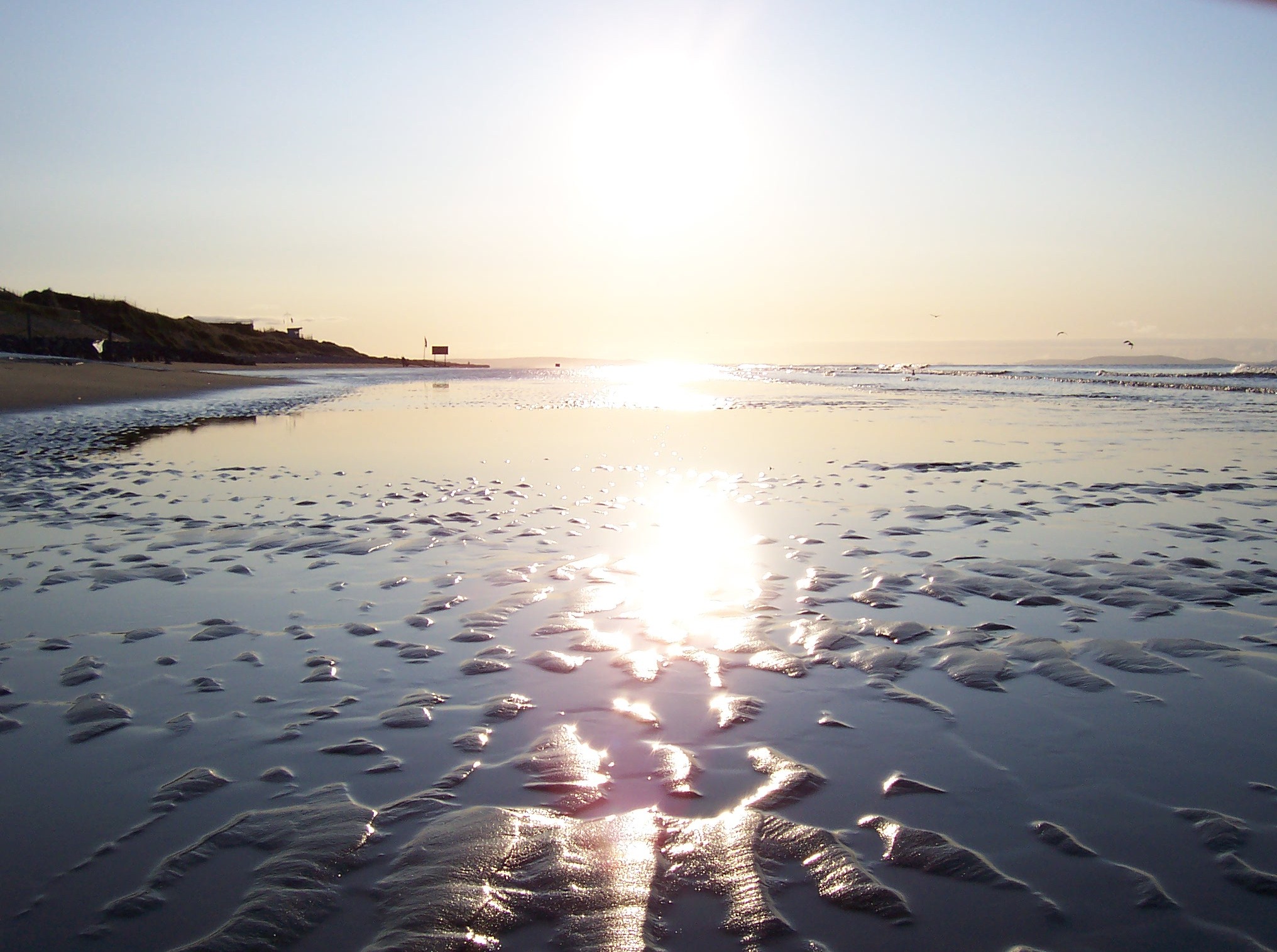
At first light the sand lies hard and flat under a low grey sky typical of this coast; if the tide is out, the beach's full width is exposed and empty long before any lifeguard or MOD notice takes effect.

Midday

Through summer, midday brings the only supervised swimming window — RNLI lifeguards are on the sand from 10am to 6pm between 11 July and 6 September; on a weekday with the MOD range active, the eastern majority of the beach can be closed off entirely.

Golden hour

Late light throws long shadows across the flats, the same flat glare that once let drivers judge a straight line at around 170 mph; today it mostly frames dog-walkers and, on club days, a land-yacht from the Carmarthenshire Land Sailing Club.

Night

After dark the beach reverts to what the tide and the MOD's notices decide it is — unlit, unsupervised, and, on the eastern range, off-limits regardless of the hour.

Babs in Museum of Speed, Pendine (5747).jpg
Sea & surf

What the water does

JFMAMJJASONDmetres (significant wave height)

Solid = typical monthly wave height; pale = the bigger days (90th pct). Offshore/regional swell from Open-Meteo Marine (ERA5 Ocean reanalysis, 2023–2024); a sheltered cove may sit calmer than this.

Exposed — real surf, and rip current to respect
Typical wave height
1.34 m
Biggest swell
Dec · 1.86 m
Calmest
May · 0.73 m
Typical period
8.1 s (groundswell)
Before you go

Things to know

Access hours

The MOD-owned majority of the beach is normally closed to the public on weekdays 8am-4.30pm; Pendine Community Council's section at the village end stays open.

Dogs

Dogs are excluded from the Community Council's bathing area between the two slipways.

Boats and jet skis

Launching a boat or jet ski at Pendine requires membership of a club registered with Pendine Community Council.

Land sailing

Landsailing is restricted to members of the Carmarthenshire Land Sailing Club, who must carry £5m public liability insurance.

Surf & rip

Powerful water — strongest around Dec, gentlest in May. Mind rip currents; this isn't a wade-in-anywhere beach.

Sharks

No incidents on record in the global shark-attack file.

Plan

If you go

Getting there
Nearest airport
Swansea Airport (SWS) · 33 km
Nearest town
Llanddowror · 8 km

Pendine sits on Carmarthen Bay in Carmarthenshire, south Wales. The nearest airport in this dataset is Swansea (SWS), about 32.8 km away in a straight line; the nearest named settlement is Llanddowror, 8 km away. No road-distance or public-transport times to Pendine were confirmed in research, so check current routes before travelling.

When to go
  • Vintage Hot Rod Association races · First held 7 September 2013

    The VHRA's inaugural amateur hot rod races at Pendine timed 80 pre-1949 hot rods on the sand; no later date is confirmed in research.

  • Carmarthenshire Land Sailing Club sailing days · Club dates, members only

    Formed in 2004 to allow controlled landsailing on Pembrey Sands and Pendine Sands; members must carry £5m public liability insurance.

What to eat & drink
Parry Thomas Centre kiosks and restaurant

Kayak hire, coffee, ice cream and a first-floor restaurant, built by Carmarthenshire County Council along a new traffic-free 500-metre promenade.

Pendine promenade

The Caban café

The café attached to the Caban, a two-storey, 14-bedroom purpose-built accommodation block overlooking the beach.

Pendine seafront

No dining on the sand itself

There is nothing to eat or drink on the beach proper; the Parry Thomas Centre and the Caban, both on the promenade behind it, are the nearest options.

Pendine promenade

Sources & references
  1. Wikipedia: Pendine Sands · cited 11×
  2. Classic & Sports Car, Oct 2024 · cited 3×
  3. Wikipedia: Pendine Sands / Babs (car)
  4. Wikipedia: Pendine
  5. Wikipedia: Babs (car)
Colophon · Provenance

Where this page comes from

Geography, facilities
OpenStreetMap (ODbL) for geometry and facility tags within 500 m of the beach centroid. GeoNames for city/airport distances.
Climate & ocean
Open-Meteo ERA5 + Marine archive, 2014–2023 monthly normals.
Photography
Archival, original tone (Tier B — Wikimedia Commons). Each image licensed per its own terms; attribution visible inline.
History & culture
Every factual claim is linked to its source in the prose above. Wikipedia citations inline. Non-wiki sources named where relevant.
Editorial voice
Register: severe. Written to pass a local's nod test; corrections welcome.
Written by Erin Rose
Last reviewed 2026-04-19
v0.9 — in editorial development toward v1.0