KY

Seven Mile Beach

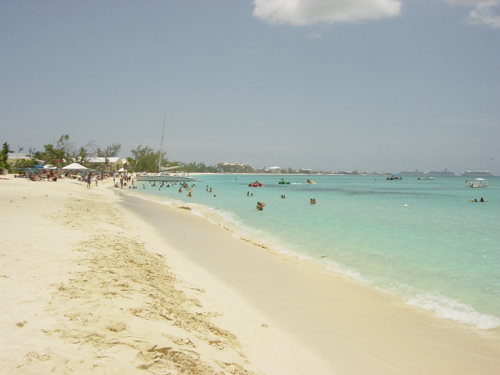
Resorts on Seven Mile Beach, Grand Cayman.jpg

KY

Seven Mile Beach

The name oversells the length and erosion is shrinking it further, yet every grain of this leeward coral coast is legally yours to walk.

Resorts on Seven Mile Beach, Grand Cayman.jpg · <a href="https://en.wikipedia.org/wiki/User:RoadTripWarrior" class="extiw" title="en:User:RoadTripWarrior">RoadTripWarrior</a> · CC BY-SA 3.0
Spring tide
0.24 m
Nearest airport
GCM · 7 km
Tier
Featured
I’m here for
Story

Seven Mile Beach runs along the western, leeward coast of Grand Cayman, between George Town to the south and the West Bay district to the north. It is the most developed shoreline in the Cayman Islands and home to the bulk of the island's resorts, but the name is the first thing to correct: it is not seven miles long, and never was. Local histories call it "a name born of romance rather than cartography." The honest figure is roughly five and a half to six miles of mostly continuous sand, and erosion has trimmed even that at the ends.

The sand is coral, not quartz: pale calcareous grains ground from reef and shell, which is why it stays comparatively cool underfoot and reads almost white against the water. (A global sediment model in this dataset predicts a quartz-dominant mix for the cell, but that is a modeled guess; the field reality on this carbonate island is coral sand.) The water is flat because the beach faces the lee side of the island, away from the trade-wind swell. ERA5 reanalysis puts the annual mean wave height at 1.18 meters, easing to 0.85 in May, and the tide barely moves, with a spring range near 0.24 meters.

By Cayman law, the beach belongs to everyone. The seaward boundary of any landowner's parcel is the mean high-water mark; below it, the foreshore is Crown land, so you can legally place a towel anywhere along the full length regardless of which resort is behind you. What you cannot do is use the loungers, umbrellas, or bars those resorts own. The practical effect is a public beach with a wall of private frontage, and the access points between properties are the thing visitors actually need to find.

The northern end, off Cemetery Beach, holds the snorkeling. A reef sits in about 30 feet of water roughly a six-minute swim offshore; fishing it is illegal, so the marine life is dense, and the current there can run hard. Most cruise passengers reach all of this by tender: George Town has no cruise pier, so ships anchor offshore and ferry people to three terminals, about a ten-minute drive south of the beach.

The uncomfortable part sits under everything. Hurricane Ivan oversept the island in September 2004 and gutted the resort row, and a 2024 government-commissioned study by DHI warned that without major intervention, "chronic erosion along the entire Seven Mile Beach is likely to occur over the coming years and decades."

The spike

The name oversells the length and erosion is shrinking it further, yet every grain of this leeward coral coast is legally yours to walk.

Seven Mile Beach is singular not because it is the longest or the most untouched stretch in the Caribbean, but because it is the place where a beach's marketing, its law, and its physical disappearance are all visibly in tension at once. Start with the name, because the name is the tell. The beach is not seven miles long. The most generous measurement stretches to a bit over six miles, a realistic figure for the uninterrupted sand is closer to five and a half to six, and erosion has shortened it further at both ends. Cayman histories are unusually candid about this, describing the name as "a name born of romance rather than cartography." That is the first thing that makes the beach worth understanding: the gap between what it is sold as and what it measures is baked into its own brand.

The sand is coral, and that is why it behaves the way it does. Grand Cayman is a low carbonate platform, the eroded cap of a submarine mountain, with no rivers to deliver quartz or volcanic grit. So the beach is built from calcareous sediment: reef rubble, coral, and shell broken down over millennia and pushed ashore. Coral sand is paler and reflects more sun than silica sand, which is why the beach stays relatively cool and reads bright white-gold under the flat turquoise water. It also matters for the erosion problem, because a carbonate beach is only as stable as the offshore reef and the longshore drift that resupply it. Interrupt that supply and the sand does not come back on its own.

The water is calm by geography, not luck. Seven Mile Beach faces west, on the leeward side of the island, sheltered from the persistent northeast trade-wind swell that batters Grand Cayman's eastern and northern coasts. The wave record bears this out: an annual mean of 1.18 meters, dropping to 0.85 meters in the calmest month, May, and a tide so small, a spring range around a quarter of a meter, that the waterline barely shifts across a day. That flat, warm, swimmable water is the entire commercial premise of the coast and the reason the resorts, condos, and dive operators clustered here rather than on the windward side.

The access law is the most genuinely unusual thing about the beach. Under Cayman Islands law, the seaward boundary of private land is the mean high-water mark. Everything below that, the foreshore between high and low water, is Crown land and public. The upshot is that all of Seven Mile Beach is public up to the high-water line, and you can walk or sit along its entire length no matter which resort owns the lawn behind you. You simply cannot use a hotel's chairs, palapas, or beach bar without being a guest. This produces the beach's defining everyday friction: a fully public shoreline fronted almost end to end by private development, where the real skill is knowing the public access points wedged between properties, and where the constant background dispute is exactly how far up the sand a beachgoer's right actually extends.

And the beach is physically vanishing. This is the part the rankings leave out. The development that makes Seven Mile Beach famous is also strangling its sand supply. In September 2004, Hurricane Ivan, passing about 21 miles southwest of the island with near-Category-5 winds, oversept Grand Cayman almost entirely and devastated the resort row. Since then, decades of privately built seawalls, jetties, and groynes have interrupted the natural longshore movement of sand. A 2024 study commissioned by the government and carried out by the coastal consultancy DHI concluded that hard structures are a core part of the problem and warned that, if present trends continue, "chronic erosion along the entire Seven Mile Beach is likely to occur over the coming years and decades." Some southern sections have already lost their beach entirely at high water. The study's preferred fix is soft renourishment, feeding sand back into the system from the water via "sand engines" in the southern part of the beach, repeated roughly every five years, rather than more walls. As of the 2024/25 budget, the government had allocated nothing to do it. In August 2025, the Grand Cayman Marriott won a precedent-setting coastal-works permit to rebuild its own frontage, placing sand and installing two 135-foot rock groynes in the active part of the beach, a private, parcel-by-parcel response to a problem the science says has to be solved whole-coast or not at all.

That is the real argument for Seven Mile Beach's importance. It is a postcard that openly contradicts itself: a beach named for a length it has never had, made of sand that cannot replace itself fast enough, legally owned by the public but walled off by the private resorts whose seawalls are helping it disappear. It is one of the clearest places on Earth to watch a celebrated tropical beach negotiate its own survival in real time.
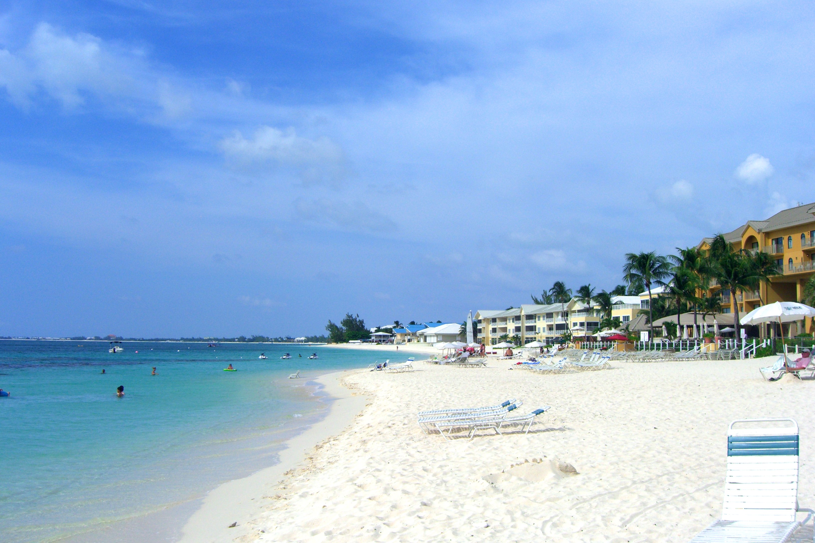
Hypoplectrus indigo 255066682.jpg
Culture

Where it shows up

History
  • Hurricane Ivan (2004) · 2004

    The near-Category-5 hurricane that oversept Grand Cayman in September 2004 and devastated the Seven Mile Beach resort row, a dividing line in the island's modern history.

Brand & advertising
  • "Seven Mile Beach" as a place name

    A name described in local histories as "born of romance rather than cartography"; the beach is and was closer to 5.5–6 miles, making the name itself a piece of marketing folklore.

Other
  • Cayman Turtle Centre

    The licensed turtle farm in West Bay at the northern end of the coast, tied to the Caymanian seafaring and turtling tradition that gives the islands their culinary and cultural identity.

  • Caribbean best-beach rankings

    Seven Mile Beach has been a fixture in beach rankings, named "the Caribbean's Best Beach" by Caribbean Travel and Life in 2015 and appearing on later world best-beach lists.

Seven Mile Beach cayman sun.jpg
History

What happened here

  1. 1952infrastructure

    Owen Roberts International Airport opens

    The airport (IATA: GCM), about 6.9 km from the beach, opened in 1952 and made air tourism to Grand Cayman possible, setting up the resort build-out of Seven Mile Beach.

    Wikipedia →
  2. 1966political

    Companies Law establishes the offshore sector

    The 1966 Companies Law turned Grand Cayman into a major offshore financial center, bringing the wealth and visitor traffic that drove luxury development along Seven Mile Beach.

    Wikipedia →
  3. 1987development

    Hyatt Regency opens

    The Hyatt Regency opened on Seven Mile Beach in 1987, an early anchor of the modern resort strip.

  4. 1989development

    Marriott opens on the beach

    The Marriott resort opened in 1989; the same property would, decades later, lead the first precedent-setting private beach-rebuild effort on the coast.

  5. 2004storm

    Hurricane Ivan oversweeps the island

    On 12 September 2004, Hurricane Ivan passed about 21 miles southwest of Grand Cayman with near-Category-5 winds and a storm surge that oversept nearly the entire island, devastating the Seven Mile Beach resort row.

    Wikipedia →
  6. 2006development

    Ritz-Carlton, Grand Cayman opens

    The Ritz-Carlton opened on Seven Mile Beach in 2006, part of the post-Ivan rebuild that intensified development along the shore.

  7. 2024research

    DHI erosion study released

    A government-commissioned study by the coastal consultancy DHI warned that "chronic erosion along the entire Seven Mile Beach is likely" without intervention, blamed hard structures, and recommended whole-coast soft renourishment via sand engines every five years.

  8. 2025infrastructure

    Marriott wins precedent-setting beach permit

    The Grand Cayman Marriott received a coastal-works permit to rebuild its frontage with placed sand and two 135-foot rock groynes, the first groynes installed in the active part of the beach, plus relocation of over 230 reef balls.

The honest part
A beach named for a length it never had, made of sand it cannot replace, public to the high-water mark and walled off above it.

The brochure version of Seven Mile Beach leaves out three uncomfortable facts that are all true at once. It is not seven miles long, or six, or in places even continuous: the name oversells it and erosion is taking the rest, with some southern sections now stripped to bare ledge at high water. The 2004 oversweep by Hurricane Ivan showed what a low carbonate island a few feet above the sea is exposed to, and the dense wall of resorts rebuilt since then has made the sand problem worse, not better, because the seawalls and groynes that protect individual properties interrupt the longshore drift the whole beach depends on. And the access that sounds so generous, every grain public to the high-water mark, exists in permanent tension with that private frontage, so the lived reality is a public beach you often have to squeeze onto between resorts that own everything but the wet sand. A 2024 study said the fix is whole-coast soft renourishment; the government budgeted nothing, and in 2025 a single hotel started rebuilding its own stretch behind new groynes. That is the future the science warns against: a famous beach saved, if at all, one private parcel at a time.

Sailboats, Seven Mile Beach, Grand Cayman.jpg
Anatomy

The shape of the place

George Town end (south)

10%

The southern start of the beach near George Town and the cruise terminals; some sections here have suffered the worst erosion, stripped to ledge at high water.

Best for cruise-day access

About a ten-minute drive from the George Town tender terminals.

Resort strip (center)

50%

The core resort row, fronted end to end by hotels and condos including the Marriott, Westin, and Ritz-Carlton; flat leeward water and the busiest sand.

Best for resort beach days

Public to the high-water mark, but loungers and bars above it are private.

Cemetery Beach / Reef (north)

85%

The quieter northern end off Cemetery Beach, with a public access point and a reef in about 30 feet of water a short swim out.

Best for snorkeling

Fishing the reef is illegal; the offshore current can be strong.

Landmarks

Cemetery Reef

natural

A coral reef in roughly 30 feet of water about a six-minute swim off the northern (Cemetery Beach) end of Seven Mile Beach; protected from fishing, so marine life is dense, with a current that can run hard.

Grand Cayman Marriott Resort · 1989

hotel

A resort on the central strip, opened 1989, that in 2025 won the first coastal-works permit to rebuild its eroded frontage with placed sand and two 135-foot rock groynes in the active part of the beach.

George Town cruise anchorage

port

George Town has no cruise pier; ships anchor offshore and tender passengers to three terminals (Royal Watler, North, and South), about a ten-minute drive south of Seven Mile Beach.

A day here

From first light to dark

Dawn

The leeward water is at its flattest before the day's breeze, and with a tide range of only about a quarter meter the waterline sits where it sat at midnight. Early walkers get the full public length to themselves before resort loungers are set out.

Midday

Peak-month highs reach about 32°C and the coral sand stays paler and cooler than silica would. Snorkelers head for Cemetery Reef off the northern end; the flat 1.18 m mean swell makes the swim out routine, though the offshore current is not.

Golden hour

West-facing means the beach takes the sunset head-on, the reason this coast, not the windward side, became the resort row. Low light rakes across the seawalls and the new groyne work fronting the Marriott.

Night

The resort frontage lights up while the public wet sand below the high-water mark stays dark and, legally, still open. Tenders have long since stopped running back to the cruise ships anchored off George Town to the south.

Compare

How it ranks

Peak warmth
Cooler than 92% of beaches in its country
Peak-month high ≈ 32°C
Worldwide
Among the warmest 9% of beaches on Earth

Ranked against every beach in our database — 228,000+ worldwide.

Seven mile beach.JPG
Sea & surf

What the water does

JFMAMJJASONDmetres (significant wave height)

Solid = typical monthly wave height; pale = the bigger days (90th pct). Offshore/regional swell from Open-Meteo Marine (ERA5 Ocean reanalysis, 2023–2024); a sheltered cove may sit calmer than this.

Mixed — usually swimmable, with a livelier season
Typical wave height
1.18 m
Biggest swell
Dec · 1.57 m
Calmest
May · 0.85 m
Typical period
6.1 s (wind chop)
Before you go

Things to know

It's all public, but frontage isn't

You can legally walk and sit anywhere up to the high-water mark, but the loungers, umbrellas, and bars above it belong to the resorts. Use the public access points (e.g. at Cemetery Beach and the Seven Mile Public Beach) to get on without crossing private property.

No cruise pier

Ships anchor off George Town and tender passengers to three terminals; budget the tender time plus about a ten-minute drive to reach the beach, and the same back to make your departure.

Cemetery Reef current

The northern reef is a short swim out in about 30 feet of water and the fish are abundant, but the offshore current can be strong; gauge it from shore before swimming out, and never snorkel it alone.

The beach is shrinking

Erosion has stripped some southern sections to bare ledge at high water. Where you find good sand can vary year to year, and renourishment work (e.g. the Marriott's groynes) may mean construction on parts of the strip.

Sharks

No incidents on record in the global shark-attack file.

Plan

If you go

Getting there
Nearest airport
Owen Roberts International Airport (GCM) · 7 km
Nearest town
West Bay · 4 km

Seven Mile Beach lies along West Bay Road on Grand Cayman's western, leeward coast, about 6.9 km from Owen Roberts International Airport (GCM) and a short drive north of George Town. Reach it by taxi, rental car, or the public minibus that runs the West Bay Road corridor. Cruise passengers arrive by tender (George Town has no pier) and then take a taxi or bus roughly ten minutes north. The whole beach is public to the high-water mark; use the marked public access points, including the Seven Mile Public Beach and Cemetery Beach, to get onto the sand without crossing resort property.

When to go
  • Cruise season tendering · Year-round, heaviest in the winter high season

    Because George Town has no cruise pier, ships anchor offshore daily and tender passengers ashore; many head straight for Seven Mile Beach about ten minutes' drive north.

  • Atlantic hurricane season · June through November, peaking September

    Grand Cayman sits in the Atlantic hurricane belt; September is the riskiest month, the same month Hurricane Ivan oversept the island in 2004, and storm surge is the main driver of the beach's erosion.

What to eat & drink
Cayman-style turtle stew

Slow-cooked turtle meat, historically a Caymanian staple, now sourced from the licensed farm at Cayman Turtle Centre in West Bay rather than the wild; a dish tied directly to the island's seafaring history.

Local restaurants in George Town and West Bay, not on the beach itself.

Conch fritters

Battered and fried conch, a standard across the Cayman and wider Caribbean menu, usually served as a starter with a dipping sauce.

Beach-bar and restaurant menus along the Seven Mile Beach resort strip.

Fish rundown (rundung)

Fish simmered in coconut milk with cassava, breadfruit, and plantain, a traditional Caymanian one-pot dish reflecting the island's Jamaican and West African culinary threads.

Local Caymanian restaurants in George Town; rarely on the resort beachfront.

Caybrew

Cayman Islands Brewery's flagship lager, brewed on Grand Cayman; the local alternative to imported beer on the resort strip.

Bars and beach kiosks along Seven Mile Beach.

Sources & references
  1. Cayman Renaissance history · cited 4×
  2. Cayman Renaissance history / Wikipedia
  3. NOAA NHC report; Cayman Islands National Weather Service
  4. Cayman Compass, March 2024
  5. Cayman News Service, August 2025
  6. Cayman Renaissance / Cayman Compass
  7. Wikipedia: Seven Mile Beach, Grand Cayman
  8. Cayman Compass; Cayman property law
  9. Open-Meteo Marine (ERA5 Ocean reanalysis, 2023–2024)
  10. EOT20 tide model
  11. NOAA NHC; Cayman Islands National Weather Service
  12. DHI study, March 2024 / Cayman Compass
  13. World Beach Tour dataset
Colophon · Provenance

Where this page comes from

Geography, facilities
OpenStreetMap (ODbL) for geometry and facility tags within 500 m of the beach centroid. GeoNames for city/airport distances.
Climate & ocean
worldclim_v2.1_2.5m
Tides
eot20
Photography
Archival, original tone (Tier B — Wikimedia Commons). Each image licensed per its own terms; attribution visible inline.
History & culture
Every factual claim is linked to its source in the prose above. Wikipedia citations inline. Non-wiki sources named where relevant.
Editorial voice
Register: romantic. Written to pass a local's nod test; corrections welcome.
Written by Erin Rose
Last reviewed 2026-04-19
v0.9in editorial development toward v1.0