British Columbia, CA

Wreck Beach

Cherry Blossoms UBC.JPG

British Columbia, CA

Wreck Beach

You earn Wreck Beach by climbing back up nearly 500 wooden steps; everything below the cliff runs on that toll.

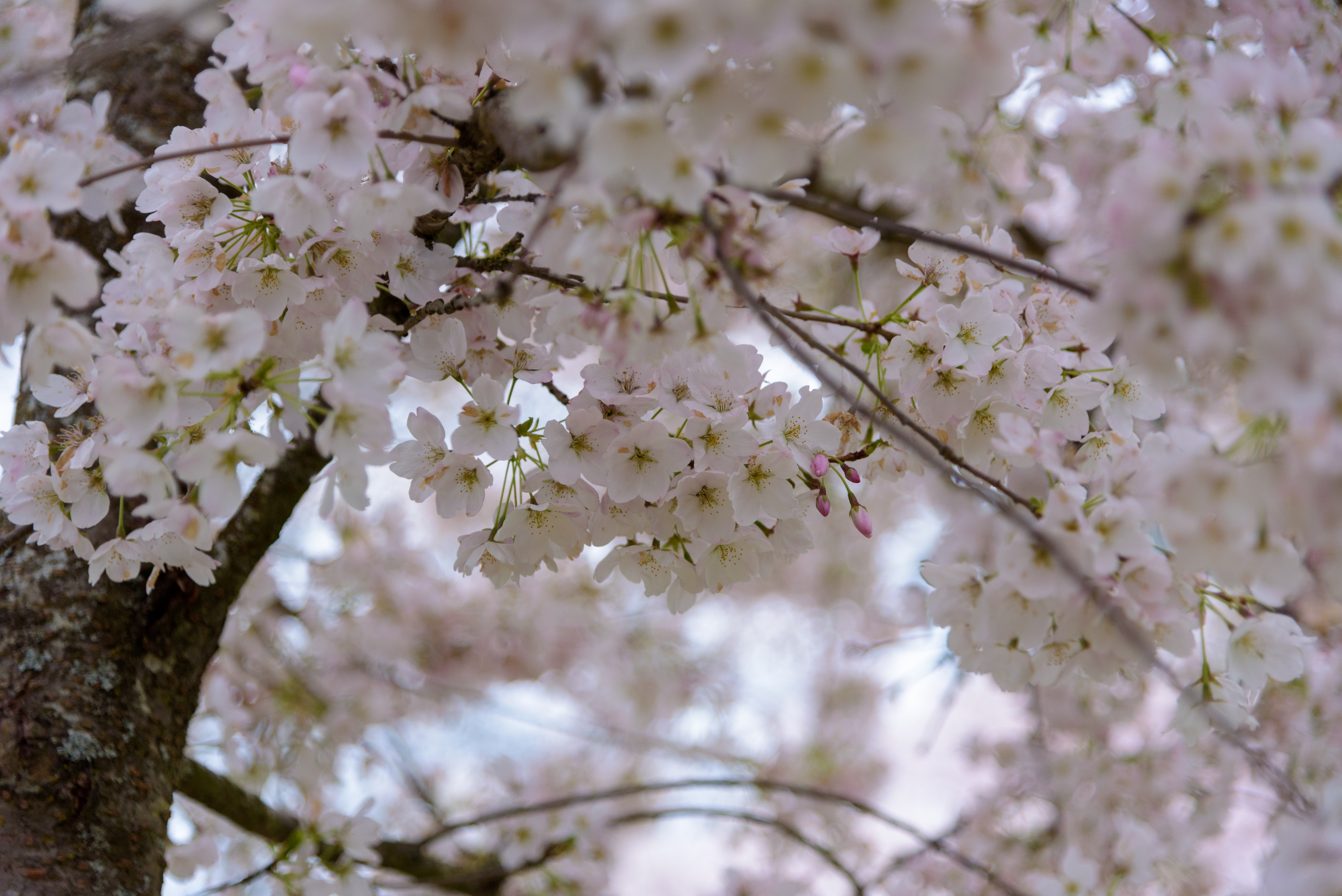
Cherry Blossoms UBC.JPG · <a href="//commons.wikimedia.org/wiki/User:Xicotencatl" title="User:Xicotencatl">Xicotencatl</a> · CC BY-SA 4.0
Substrate
sand
Nearest airport
YVR · 9 km
Tier
Featured
I’m here for
Story

Wreck Beach is the strip of sand and driftwood below the University of British Columbia's Point Grey campus, on the southern edge of Vancouver where the Salish Sea meets the north arm of the Fraser River. It is the largest clothing-optional beach in North America. The clothing-optional section runs roughly 6.7 kilometres, from Acadia Beach in the north down to Booming Grounds Creek, and almost all of it sits at the foot of cliffs that are still slowly falling apart.

There is no road to the sand. You get down by Trail 6, the main wooden staircase that drops off the cliff edge near the campus bus loop. Accounts of the step count vary, with figures clustered just under 500, and the descent is easy in a way the return climb is not. That single fact organizes everything below the cliff. Vendors who sell beer, food, and trinkets along the foreshore have to haul their stock down those stairs and their garbage back up; so does every visitor who wants to leave with what they brought.

The nudity here is legal, not merely tolerated. The Greater Vancouver Regional District formally recognized Wreck Beach as clothing-optional in 1991, two decades after a 1970 police raid and the nude-in protest that answered it. The community that defends that status is older than the recognition: the Wreck Beach Preservation Society traces to a group founded on January 25, 1977, first called Citizens Concerned for Coward's Cove and renamed in 1983.

The land itself is engineered and contested. Parts of the foreshore were reclaimed in cooperation with the Canadian military, and the squat concrete "instrument towers" still standing on the sand are leftovers of that era. From 1939 to 1948 the Point Grey Battery sat on the headland above with three six-inch coastal guns; two 60-inch searchlights were installed down at beach level in 1941. The battery never fired a round in the war.

What keeps Wreck Beach in the news is not the nudity but the skyline. Since the 1970s the Preservation Society has fought UBC's plans to build housing on the clifftop, arguing the towers ruin the one sightline on the city's coast that still looks like forest. When UBC began the Marine Drive Residences in 2004, three landslides followed on the cliff face below. That tension, between a public beach that wants to stay wild and a university that keeps building toward the edge, has not been resolved.
The spike

You earn Wreck Beach by climbing back up nearly 500 wooden steps; everything below the cliff runs on that toll.

The thing that makes Wreck Beach singular is not that people take their clothes off. Plenty of beaches do that. What makes Wreck Beach what it is, is that the beach is defined by its inaccessibility, and the entire culture below the cliff is a consequence of a staircase.

Start with the geography. Wreck Beach sits at the base of the Point Grey cliffs, a wall of glacial sediment dropping from the UBC campus to the Salish Sea. There is no road down and no parking at sea level. To reach the main beach you take Trail 6, a long wooden staircase bolted to the cliff face. Sources disagree on the exact step count, with most figures landing just under 500, and the disagreement itself tells you something: people count those steps because the climb is the price of admission. Going down is nothing. Coming back up, in summer heat, carrying whatever you brought and whatever you bought, is the part everyone remembers.

That single barrier produces almost everything else. Because nobody can drive in, the beach economy runs on human muscle. Vendors carry coolers of beer, fruit, baked goods, and pipes down the stairs each morning and haul the empties and trash back up at night. There is no concession stand built into a pier, no chain coffee kiosk, because nothing arrives by truck. The result is an informal, cash-and-barter foreshore market that has its own etiquette and its own characters, a counterculture economy that exists precisely because the logistics keep ordinary commerce out.

The same barrier shapes the social contract. A staircase is a filter. The people who make the effort to come down tend to be the people who actually want to be there, which is part of why the clothing-optional norm holds without much enforcement. The nudity was never imposed by a sign; it was settled by use, then ratified. Police treated the area as a no-harm zone for years before the Greater Vancouver Regional District formally recognized it as clothing-optional in 1991. The 1970 police raid and the nude-in protest that followed are the origin story locals tell, but the deeper point is that the beach governs itself, and it can do that partly because the cliff does the gatekeeping.

Now layer on the history, because the cliff has been fought over for a century. The flat sand you stand on is partly reclaimed land, built up in cooperation with the Canadian military, and the blunt concrete "instrument towers" on the beach are relics of that work. Above them, from 1939 to 1948, the Point Grey Battery guarded the entrance to Burrard Inlet with three six-inch guns manned by the 58th Heavy Battery of the Royal Canadian Artillery. In 1941 the army added two 60-inch coastal searchlights, numbers 9 and 10, down at beach level, with concrete shelters that still survive. The whole installation never fired a shot in anger. So the beach carries a layer of dead military infrastructure that no longer means anything except as ruins to climb on.

Then comes the part that genuinely threatens the place. The cliff is eroding, and erosion is the lever in the long political war over Wreck Beach. The Wreck Beach Preservation Society, founded in 1977, has spent its existence resisting UBC's appetite to build on the clifftop. The argument is about sightlines: the society holds that the view from the sand, forested cliff meeting sea with no buildings showing, is the last stretch of Vancouver coast that still looks the way it did before the city. When UBC pushed ahead with the Marine Drive Residences, breaking ground in 2004, three landslides occurred on the cliff below during and after construction. The society gathered tens of thousands of signatures; the regional district passed a resolution in 2004 opposing development that compromises the beach's viewscapes. The fight recurs every time a new tower is proposed, most recently over a high-rise that opponents say would loom over the beach.

So Wreck Beach is not really a nude beach with a nice view. It is a piece of contested ground where four pressures meet at the bottom of a staircase: the physical toll of access, the self-governing community that toll selects for, the abandoned war machinery embedded in the sand, and the slow structural failure of the cliff that the community fights to keep undeveloped. Take away the staircase and the difficulty and you would have an ordinary city beach with a sign. The difficulty is the point. Everything worth saying about Wreck Beach starts at the top of those steps and the knowledge that you will have to climb back up.

Wreck beach 1970.jpg
Culture

Where it shows up

History
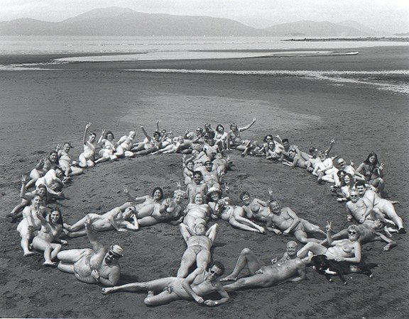
  • 1970 nude-in protest · 1970

    The protest answering a police raid, remembered locally as the founding act of Wreck Beach's clothing-optional identity, two decades before the 1991 legal recognition.

  • Wreck Beach Preservation Society · 1977

    The advocacy group, founded as Citizens Concerned for Coward's Cove and renamed in 1983, whose decades-long fight against clifftop towers is a defining part of the beach's public story.

  • Point Grey Battery · 1939

    The WWII coastal battery whose ruined searchlight shelters and instrument towers remain on the beach, a layer of dead military history embedded in the sand.

Other
  • Wreck Beach vendor economy

    The informal, carry-it-down market of beer, food, and trinket sellers, a counterculture commerce that exists because no vehicle can reach the sand.

Carex macrocephala 3793834.jpg
History

What happened here

  1. 1939military

    Point Grey Battery established

    The Canadian Army stood up the Point Grey Battery on the headland above the beach to guard the entrance to Burrard Inlet, eventually mounting three six-inch coastal guns manned by the 58th Heavy Battery, Royal Canadian Artillery.

  2. 1941military

    Beach searchlights installed

    Two 60-inch coastal-defence searchlights, numbered 9 and 10, were installed at beach level with concrete shelters that still stand on the sand.

  3. 1948military

    Battery deactivated

    The Point Grey Battery was stood down after the war, having never fired a round in combat; its concrete remnants survive near the present beach and campus.

  4. 1970social

    Police raid and nude-in protest

    A police raid on the beach was answered by a nude-in protest, the confrontation locals cite as the moment Wreck Beach asserted itself as clothing-optional.

  5. 1977civic

    Preservation group founded

    Citizens Concerned for Coward's Cove formed on January 25, 1977 to defend the beach from development; it would later become the Wreck Beach Preservation Society.

  6. 1983civic

    Renamed Wreck Beach Preservation Society

    The group adopted the name it still carries, formalizing decades of advocacy against clifftop development and for the beach's viewscape.

  7. 1991legal

    Recognized as clothing-optional

    The Greater Vancouver Regional District formally recognized Wreck Beach as a clothing-optional beach, giving legal standing to a use established by decades of practice.

  8. 2004development

    Marine Drive Residences construction; landslides

    UBC began building the Marine Drive Residences on the clifftop; three landslides were recorded on the cliff face below during and after construction, and the regional district passed a resolution that year opposing development that harms the beach's viewscapes.

  9. 2012infrastructure

    Permanent toilets installed

    Permanent outhouse toilets were installed on the beach, a rare piece of fixed infrastructure on a foreshore that otherwise has almost none.

The honest part
The staircase that protects Wreck Beach is also the thing most likely to hurt you on it.

Wreck Beach is genuinely hard and genuinely risky to reach, and that is not a quirky detail. Trail 6 is a long, steep wooden staircase down an eroding cliff; the climb back up has sent unfit and overheated visitors into real distress, and the cliff face itself sheds material, with three landslides recorded below the UBC residences after construction began in 2004. At the water's edge the hazards are different and just as real: the Salish Sea here pushes heavy drift logs onto the sand, and a loose log shifted by an incoming tide can pin or crush. The tide moves fast over a low-slope beach, the water stays cold, and there are no lifeguards down on the clothing-optional sand.

The slower danger is political. The beach has spent fifty years defending its own existence against the campus above it, fighting tower after tower on the grounds that the buildings ruin the one undeveloped sightline left on the city's coast and accelerate the erosion eating the cliff. That fight is not settled, and the community's autonomy, its right to govern its own foreshore, is contested every time UBC draws a new building near the edge.

Marine Drive Cherry Blossoms 02.JPG
Anatomy

The shape of the place

Booming Grounds Creek (south end)

5%

The far southern limit toward the north arm of the Fraser River, remote and lightly used.

Best for solitude and long walks at low tide

Named for the log-booming grounds at the river mouth; the southern boundary of the clothing-optional section.

Trail 6 / Main Beach

50%

The busiest stretch, at the foot of the main wooden staircase, where the vendor foreshore and the densest summer crowd gather.

Best for first-time visitors and the main scene

The staircase here is the steep, near-500-step descent and the hard climb back up.

Acadia Beach (north end)

90%

The northern boundary of the clothing-optional run, closer to easier access and quieter than the main beach.

Best for a calmer, less crowded stretch

Marks the north end of the roughly 6.7 km clothing-optional section.

Landmarks

Trail 6 staircase

infrastructure

The main wooden stairway down the Point Grey cliff to the beach, with a step count cited just under 500. It is the only practical access for most visitors and the defining feature of getting to the sand.

Point Grey Battery · 1939

military fortification

A WWII coastal-defence battery on the headland above the beach, with three six-inch guns active from 1939 to 1948 and two 60-inch searchlights installed at beach level in 1941. Concrete searchlight shelters and instrument towers survive on and near the sand.

Point Grey cliffs

natural feature

The eroding glacial-sediment bluffs that wall the beach off from the UBC campus, the physical reason there is no road access and the focus of the long fight over clifftop development and erosion.

A day here

From first light to dark

Dawn

First light comes over the campus at the cliff top, leaving the sand in cool cedar shadow until the sun clears the trees. The tide is often well out at dawn, exposing a wide flat of firm sand and stranded drift logs, and the beach is nearly empty except for crows working the wrack line.

Midday

By midday in summer the foreshore fills and the vendors are set up; this is when the climb down rewards you and the climb back up looms. The water is cold even in August, and the sun, when it clears the cliff, hits hard on a beach with no shade except what the driftwood throws.

Golden hour

Late afternoon is the beach's signature hour, the west-facing sand catching the full low sun across the Salish Sea toward Vancouver Island. The crowd thins as people start the long stair climb before dark, since there is no lighting on Trail 6.

Night

After dark the beach empties fast because the staircase is unlit and the cliff is unforgiving. What light there is comes from the city and, historically, from the swept beams of the searchlights whose concrete shelters still sit on the sand.

Compare

How it ranks

Peak warmth
Warmer than 87% of beaches in its country
Peak-month high ≈ 21°C
Beach season
Longer beach season than 89% of beaches in its country
4 comfortable months a year

Ranked against every beach in our database — 228,000+ worldwide.

WreckBeach.jpg
Sea & surf

What the water does

JFMAMJJASONDmetres (significant wave height)

Solid = typical monthly wave height; pale = the bigger days (90th pct). Offshore/regional swell from Open-Meteo Marine (ERA5 Ocean reanalysis, 2023–2024); a sheltered cove may sit calmer than this.

Calm — gentle swimming water most of the year
Typical wave height
0.42 m
Biggest swell
Apr · 0.48 m
Calmest
Jul · 0.35 m
Typical period
3.1 s (wind chop)
Before you go

Things to know

The climb is the catch

Access is by Trail 6, a steep wooden staircase of nearly 500 steps with no vehicle alternative. Going down is easy; the climb back up in heat, carrying everything, is what catches people out. Bring water and pace it.

No lifeguards, real tides

There are no lifeguards on the clothing-optional sand. The tide moves fast over a low-slope beach and the water stays cold year-round; the calm wave summary does not mean a safe wade-out for weak swimmers.

Drift logs and unstable cliffs

Heavy drift logs on the sand can shift and pin you as the tide returns, and the glacial-sediment cliffs shed material; stay clear of the cliff base and of large logs at the waterline.

Pack it in, pack it out

There is little fixed infrastructure beyond the toilets added in 2012. Whatever you carry down, you carry back up; the beach's character depends on visitors not leaving it behind.

Swimming

Usually calm water — among the gentler beaches for a swim.

Sharks

No incidents on record in the global shark-attack file.

Plan

If you go

Getting there
Nearest airport
Vancouver International Airport (YVR) · 9 km
Nearest town
West End · 10 km

From central Vancouver, reach the UBC Point Grey campus by transit to the bus loop, then walk about fifteen minutes to the top of Trail 6 near Gate 6 / NW Marine Drive. The beach is only reachable on foot down the wooden staircase, which descends just under 500 steps to the sand; there is no road, no parking at sea level, and the return is a demanding climb. Nearest airport is Vancouver International (YVR), about 9.4 km away.

When to go
  • Bare Buns Run · annually since 1997, a Sunday morning at low tide

    A 5-kilometre clothing-optional run held along the beach as a fundraiser for the Wreck Beach Preservation Society, run since 1997. Participants may go fully nude, partly clothed, or fully dressed ('shy'); it starts at low tide so there is sand to run on.

What to eat & drink
Informal beach vendors

There is no built concession on Wreck Beach. Food and drink come from itinerant vendors who carry coolers of beer, fruit, baked goods, and snacks down Trail 6 by hand; supply, prices, and presence are entirely informal and cash-based.

Along the foreshore near the bottom of Trail 6

Japadog

Vancouver's Japanese-influenced hot dog stands, started as a downtown street cart, are a genuine city staple worth eating before or after the beach rather than on it.

Multiple Vancouver locations, including near downtown

Pacific spot prawns

British Columbia's spring spot prawn season is a regional event; the sweet, large prawns are landed locally and served around Vancouver in May and June.

Vancouver seafood restaurants and the seasonal dockside prawn sales

Nanaimo bar

The no-bake chocolate, custard, and coconut-crumb bar named for the Vancouver Island city of Nanaimo is the defining British Columbia sweet, sold in bakeries across the region.

Bakeries and cafes throughout Metro Vancouver

Sources & references
  1. Wikipedia: Wreck Beach · cited 5×
  2. Wikipedia / WBPS · cited 3×
  3. Point Grey Battery history · cited 2×
  4. Point Grey Battery / FortWiki · cited 2×
  5. Point Grey Battery history / FortWiki
  6. Watershed Sentinel / WBPS / Tyee
  7. Swim Guide / trail guides
  8. Watershed Sentinel / WBPS
  9. World Beach Tour data
Colophon · Provenance

Where this page comes from

Geography, facilities
OpenStreetMap (ODbL) for geometry and facility tags within 500 m of the beach centroid. GeoNames for city/airport distances.
Climate & ocean
worldclim_v2.1_2.5m
Photography
Archival, original tone (Tier B — Wikimedia Commons). Each image licensed per its own terms; attribution visible inline.
History & culture
Every factual claim is linked to its source in the prose above. Wikipedia citations inline. Non-wiki sources named where relevant.
Editorial voice
Register: melancholic. Written to pass a local's nod test; corrections welcome.
Written by Erin Rose
Last reviewed 2026-04-19
v0.9in editorial development toward v1.0