Lower Normandy, FR

Omaha Beach

American assault troops at Omaha Beach 02.jpg

Lower Normandy, FR

Omaha Beach

The bloodiest D-Day landing beach is now a lifeguarded summer swimming beach above a cemetery of 9,389 American graves.

American assault troops at Omaha Beach 02.jpg · <p>Taylor </p> <ul><li>Post-Work: <a href="//commons.wikimedia.org/wiki/User:W.wolny" title="User:W.wolny">User:W.wolny</a></li></ul> · Public domain
Length
8.6 km
Spring tide
6.13 m
Nearest airport
CFR · 37 km
Tier
Featured
I’m here for
Story

Omaha Beach is an 8-kilometer arc of sand on the Calvados coast of Normandy, fronting the English Channel below a line of bluffs 30 to 50 meters high. It runs in front of three communes: Vierville-sur-Mer at the west end, Saint-Laurent-sur-Mer in the center, Colleville-sur-Mer at the east. The name is not French. It is the codename Allied planners assigned this stretch for the invasion of 6 June 1944, and it stuck so completely that the French now use it too.

The tide here is enormous: the spring range is over 6 meters, which on the morning of the landing meant several hundred meters of open, obstacle-strewn flat that men had to cross on foot under fire. The bluffs that make the beach scenic are the reason it was a killing ground. The Germans had fortified the high ground with concrete strongpoints, and the only ways off the sand were a handful of draws cutting up through the cliffs, each covered by guns.

Two American infantry divisions landed here that morning, the 1st (the "Big Red One") and the 29th (the "Blue and Gray"), with Army Rangers. It went worse than any other Allied beach on D-Day: the naval bombardment had largely missed the bunkers, the amphibious tanks meant to give cover mostly sank, and the first waves walked into interlocking machine-gun fire. American casualties at Omaha on 6 June are most often cited at around 2,400, though estimates vary and a precise count was never possible; roughly 34,000 troops were ashore by nightfall, holding a shallow toehold around the three villages, far short of their objectives.

The dead are above the beach. The Normandy American Cemetery sits on the bluff at Colleville-sur-Mer, 172.5 acres given to the United States in perpetuity by France, with 9,389 burials and 1,557 names on its Walls of the Missing. Down on the sand at Saint-Laurent stands "Les Braves," a 15-meter stainless-steel sculpture installed for the 60th anniversary in 2004; offshore at low tide lie the wrecked caissons of the Mulberry harbour the Americans assembled here and lost to a storm thirteen days after the landing.

And in July and August, the beach is supervised by lifeguards from noon to 7 p.m., families swim, and an outfit at the Colleville end runs sand-yachting across the same flat the tide exposes. Omaha Beach is two things at once on the same sand, and it has not resolved the contradiction so much as learned to hold both: a mass grave of a morning, and a working Norman beach a short walk from where the men came ashore.

The spike

The bloodiest D-Day landing beach is now a lifeguarded summer swimming beach above a cemetery of 9,389 American graves.

Most legendary beaches earn the word through nature: a reef, a wave, a color of sand, a cliff. Omaha earned it in a single morning of human catastrophe, and its singular, unresolved fact is that the catastrophe and an ordinary seaside leisure beach now occupy exactly the same ground. This is the bloodiest of the five D-Day landing beaches, and it is also a lifeguarded public swimming beach with a sand-yachting school. Both statements are true of the same sand on the same afternoon in August.

Start with why it was a death trap, because the geography is the whole story. Omaha is a gentle concave arc roughly 8 kilometers long, backed not by dunes but by a steep shingle bank and then bluffs 30 to 50 meters high. There are only a few natural exits off the beach, draws or "draws" cutting up through the bluffs toward the villages of Vierville, Saint-Laurent, and Colleville. Anyone wanting to get off the sand and inland had to funnel through those gaps. The German defenders understood this exactly. They built their fortifications, a chain of concrete and earth strongpoints the Germans called Widerstandsnester, "resistance nests," on the high ground specifically to cover the draws and rake the open flat. Accounts commonly cite around thirteen such strongpoints along the Omaha front. The most formidable, WN-62, overlooked the Easy Red and Fox Green sectors above Colleville and held machine guns, mortars, and anti-tank guns with a clear field of fire down the entire eastern beach.

The tide turned the geography lethal. Omaha has a very large tidal range, with a spring range of more than 6 meters, which meant that at low water the sea withdrew to expose a flat several hundred meters wide, seeded with mined obstacles, stakes, and steel hedgehogs. The Allies timed the landing for a rising tide so the obstacles would be visible, which is logically sound and which also meant the first waves had to cross that entire killing flat on foot, in the open, while the strongpoints on the bluffs fired down on them. The Allied planners had divided the beach, west to east, into sectors with codenames, Charlie, Dog Green, Dog White, Dog Red, Easy Green, Easy Red, Fox Green, Fox Red, and it is in those sector names that the casualty reports are still written.

Then almost everything that was supposed to protect the first wave failed. The pre-landing naval and air bombardment largely overshot the bunkers and left them intact. The DD amphibious tanks, swimming tanks meant to land with the infantry and provide covering fire, mostly foundered and sank in the rough water before reaching shore. The result is the thing the beach is named for in memory: the leading companies walked off the ramps into interlocking machine-gun fire with no cover and almost nothing firing back. Company A of the 116th Infantry Regiment, landing in the Dog Green sector below Vierville, was effectively destroyed in the first minutes, taking casualties commonly cited near 90 percent. This is the morning that earned the name "Bloody Omaha."

The numbers must be given with care, because sloppy precision dishonors them. American casualties at Omaha on 6 June 1944 are most frequently cited at roughly 2,400, with some sources putting the figure as high as 2,500 and breaking it into perhaps 1,000 to 1,200 killed and a comparable number wounded; a precise, verified count was never possible and the figures vary by source. The 1st Infantry Division's losses for the day are estimated near 1,036 and the 29th Division's near 743, with the 116th and 16th Infantry Regiments bearing the worst of it. By nightfall roughly 34,000 men had been landed across the beach, and they held a precarious strip around the three villages, far short of the day's objectives but ashore and unbudgeable. The German machine-gunner Heinrich Severloh, who manned a position at WN-62, later claimed in his memoir to have fired some 13,500 rounds and to have caused enormous American losses; his account is the source of the "Beast of Omaha" nickname, and historians treat his casualty claims as a gross and uncheckable overestimate. Cite Severloh for the texture of the defense, not for a body count.

What sits on the beach now is the second half of the singular fact. On the bluff at Colleville, on ground the French ceded to the United States in perpetuity, the Normandy American Cemetery holds 9,389 graves in 172.5 acres, with 1,557 names on its Walls of the Missing; it was dedicated in 1956. The exact grave count is sometimes reported as 9,387 or 9,388 by secondary sources, but the American Battle Monuments Commission, the official custodian, states 9,389, and that is the number to use. Down on the sand at Saint-Laurent stands "Les Braves," a 15-meter-wide stainless-steel sculpture by the French artist Anilore Banon, installed for the 60th anniversary on 6 June 2004, its three elements titled the Wings of Hope, Rise Freedom, and the Wings of Fraternity. Offshore lie the broken Phoenix caissons of Mulberry "A," the prefabricated harbour the Americans towed across the Channel and assembled off Vierville and Saint-Laurent, wrecked beyond repair by a severe storm on 19 June 1944, only days after it began working; its British twin, Mulberry "B" at Arromanches up the coast, survived and ran for months.

And the culture fixed the memory of this beach more than any monument did. The opening 24 minutes of Steven Spielberg's "Saving Private Ryan" (1998) reconstructed the Omaha landing with a realism that reset how war is shown on film; the sequence was not filmed here, for practical and moral reasons, but on Curracloe Beach in County Wexford, Ireland. The protected status of the real beach is itself part of the answer to why: this is consecrated ground, and a film crew cannot blow it up.

That is the spike, and it does not soften with familiarity. You can stand on Omaha at low tide in August, with families swimming and a land-yacht crossing the flat, look up at the bluff where the cemetery's crosses are, and understand that the calm wide beach in front of you and the worst Allied morning of the invasion are not two places. They are one place, and the only honest way to be there is to hold both at once.

France-000813 - Omaha Beach (14880489210).jpg
Culture

Where it shows up

Film
  • Saving Private Ryan · 1998
    Steven Spielberg

    The film opens with a roughly 24-minute reconstruction of the Omaha landing that redefined combat realism on screen. It was filmed on Curracloe Beach in County Wexford, Ireland, not at Omaha, for practical and moral reasons; the real beach is protected ground.

  • The Longest Day · 1962
    Darryl F. Zanuck (producer)

    The large-scale ensemble film of the D-Day landings, based on Cornelius Ryan's book, includes the Omaha assault among its multiple beach sequences. For decades it was the standard cinematic account of 6 June 1944.

Literature
  • D-Day: The Battle for Normandy · 2009
    Antony Beevor

    A widely cited narrative history of the Normandy campaign, including a detailed account of the Omaha landing and its casualties, used as a general reference for the events of 6 June 1944.

History
  • Mulberry "A" artificial harbour · 1944
    Allied military engineers

    The prefabricated harbour towed across the Channel and assembled off Omaha after the landing, using sunken Phoenix concrete caissons as breakwaters, to land supplies without a captured port. Wrecked by the storm of 19 June 1944; remnants are still visible offshore at low tide.

Television
  • Band of Brothers · 2001
    Steven Spielberg & Tom Hanks (HBO)

    The HBO miniseries on Easy Company of the 506th Parachute Infantry Regiment dramatizes the wider Normandy invasion of which Omaha was the bloodiest beach; it cemented the public memory of the campaign in the years after "Saving Private Ryan."

Into the Jaws of Death 23-0455M edit.jpg
History

What happened here

  1. 1944battle

    The Omaha Beach landing

    On 6 June 1944, the U.S. 1st and 29th Infantry Divisions, with Army Rangers, land on Omaha as part of Operation Overlord. The naval bombardment misses many bunkers and most DD amphibious tanks sink; the first waves cross the open tidal flat into machine-gun fire from the bluff strongpoints. American casualties for the day are most often cited at ~2,400 (some sources up to ~2,500); ~34,000 troops are ashore by nightfall, holding a shallow toehold short of their objectives.

    Wikipedia →
  2. 1944military

    Mulberry "A" assembled off Omaha

    In the days after the landing, the Americans tow and assemble Mulberry "A," a prefabricated artificial harbour, off Vierville and Saint-Laurent to land supplies without a captured port. It uses sunken concrete Phoenix caissons as breakwaters.

    Wikipedia →
  3. 1944disaster

    Storm wrecks Mulberry "A"

    A severe Channel storm on 19–20 June 1944, the worst in decades, devastates the Omaha harbour; most of its Phoenix caissons are destroyed and the harbour is deemed irreparable. Mulberry "B" at Arromanches survives and continues operating as "Port Winston." Wrecked caissons from Mulberry "A" remain visible off the beach at low tide.

    Wikipedia →
  4. 1956memorial

    Normandy American Cemetery dedicated

    The permanent Normandy American Cemetery and Memorial on the bluff at Colleville-sur-Mer is dedicated on 19 July 1956. It holds 9,389 graves on 172.5 acres of ground granted to the United States in perpetuity by France, with 1,557 names on the Walls of the Missing.

    Wikipedia →
  5. 1998cultural

    "Saving Private Ryan" released

    Steven Spielberg's film opens with a roughly 24-minute reconstruction of the Omaha landing that reset the standard for combat realism on film. For practical and moral reasons it was filmed not at Omaha but on Curracloe Beach in County Wexford, Ireland.

    Wikipedia →
  6. 2004memorial

    "Les Braves" installed on the sand

    For the 60th anniversary of the landing, French artist Anilore Banon's stainless-steel sculpture "Les Braves" is installed on the beach at Saint-Laurent-sur-Mer. About 15 meters wide, its three elements are titled the Wings of Hope, Rise Freedom, and the Wings of Fraternity.

  7. 2014commemoration

    70th-anniversary commemorations

    Heads of state gather on the Normandy beaches for the 70th anniversary of D-Day, with ceremonies at the Normandy American Cemetery and along the Omaha front. The commemorations underline the beach's status as protected, consecrated ground.

    Wikipedia →
  8. 2024commemoration

    80th-anniversary commemorations

    The 80th anniversary of the landings is marked at Omaha and the American cemetery, one of the last major commemorations expected to include living veterans of the invasion.

    Wikipedia →
The honest part
It is a mass grave of a morning and a lifeguarded summer swimming beach, on the same sand, and the honest way to stand here is to hold both at once.

The discomfort at Omaha is structural and permanent: this is simultaneously a mass grave of a morning and a regional swimming beach, and there is no way to make those two facts sit easily together. In July and August the sand at Saint-Laurent and Vierville is supervised by lifeguards from noon to 7 p.m., people swim, kites fly, and a school at the Colleville end runs sand-yachting across the same tidal flat that, on 6 June 1944, the first American waves had to cross on foot under fire. The beach belongs to the living communes that line it, and the people of Vierville, Saint-Laurent, and Colleville are entitled to their beach. But the tour buses, the gift shops selling helmets and ration tins, and the visitors who treat the bluffs as a photo backdrop are a real and recurring tension, and the cemetery on the heights, with its 9,389 graves and the rule of silence its staff ask for, exists partly to hold a line against the carnival.

The casualty figures themselves demand humility. The roughly 2,400 American casualties most often cited for Omaha on D-Day is an estimate, not a count; sources differ, the chaos of the morning made precise accounting impossible, and the temptation to round it into a clean, quotable number is its own small dishonesty. The honest version is that a great many men, somewhere near 2,400 and possibly more, were killed, wounded, or lost here in a few hours, that the worst German fire came from a handful of concrete strongpoints on the bluffs, and that the beach you can swim at today is the floor they crossed to take those bluffs.

The Blue Marble, AS17-148-22727.jpg
Anatomy

The shape of the place

Dog sector — Vierville-sur-Mer (west)

15%

The western end below Vierville, divided in 1944 into the Dog Green, Dog White, and Dog Red sectors. Dog Green, below the Vierville draw, is where Company A of the 116th Infantry was effectively destroyed in the first minutes. A more family-oriented stretch of the beach today, with cliffs at the western edge.

Best for the Vierville memorials and draw, low-tide walks, foot-fishing along the western cliffs

Wrecked Mulberry "A" caissons lie offshore here and off Saint-Laurent, visible at low tide.

Easy sector — Saint-Laurent-sur-Mer (center)

50%

The central beach below Saint-Laurent, the Easy Green and Easy Red sectors of 1944. The lively, supervised swimming center of the beach today, and the site of Anilore Banon's "Les Braves" sculpture on the sand.

Best for swimming (lifeguarded July–August), "Les Braves," the central beach access

Lifeguards on duty noon–7 p.m. in July and August only; outside that window there is no coverage.

Fox / Easy Red bluff — Colleville-sur-Mer (east)

85%

The eastern end below Colleville, overlooked by the bluff that held WN-62, the strongest German strongpoint, above the Easy Red and Fox Green sectors. The Normandy American Cemetery sits on the heights directly above. The dune-backed flat here is used for sand-yachting.

Best for the American cemetery on the bluff, the WN-62 site, sand-yachting at low tide

The cemetery is a place of mourning; staff ask for quiet and appropriate dress. It is above the beach, reached by road, not from the sand.

Landmarks

Normandy American Cemetery and Memorial · 1956

cemetery · Harbeson, Hough, Livingston & Larson

On the bluff at Colleville-sur-Mer, on 172.5 acres ceded to the United States in perpetuity by France. Holds 9,389 graves (9,238 Latin crosses, 151 Stars of David) and 1,557 names on the Walls of the Missing; dedicated 19 July 1956. Among those buried are Theodore Roosevelt Jr. and two other Medal of Honor recipients. Run by the American Battle Monuments Commission.

Wikipedia →

"Les Braves" · 2004

sculpture · Anilore Banon

A stainless-steel sculpture about 15 meters wide standing on the sand at Saint-Laurent-sur-Mer, installed for the 60th anniversary on 6 June 2004. Its three elements are titled the Wings of Hope, Rise Freedom, and the Wings of Fraternity.

WN-62 (Widerstandsnest 62) · 1944

fortification

The most powerful German strongpoint on the Omaha front, on the bluff above Colleville overlooking the Easy Red and Fox Green sectors. Its surviving concrete positions and a memorial can still be visited near the American cemetery. The machine-gunner Heinrich Severloh fought here.

Wikipedia →
A day here

From first light to dark

Dawn

At low water on a spring tide the sea is far out, and the flat the first waves crossed lies bare and firm under a flat Channel-grey light; the wrecked Mulberry caissons stand out of the water off Vierville and Saint-Laurent. Early walkers and a few sea-anglers have the beach almost to themselves before the cemetery on the bluff opens to visitors.

Midday

In July and August the lifeguards are on station from noon, and families spread out on the sand at Saint-Laurent and Vierville; this is the ordinary-beach face of Omaha, swimming and beach games below the bluffs. Up at Colleville the cemetery is at its busiest, and tour coaches turn over in the car parks above the beach.

Golden hour

Late afternoon light rakes along the 8-kilometer arc and up the bluffs, throwing the silhouette of "Les Braves" against the wet sand at Saint-Laurent as the tide begins to push back in. The land-yachts come off the flat as the water returns and the day-trippers thin out.

Night

After dark the beach empties and goes quiet under the bluffs; there is no boardwalk and no strip of bars here, only the dark line of the heights where 9,389 graves lie above the sand. The villages behind, Vierville, Saint-Laurent, Colleville, are small and close early.

Compare

How it ranks

Peak warmth
Cooler than 83% of beaches in its country
Peak-month high ≈ 21°C

Ranked against every beach in our database — 228,000+ worldwide.

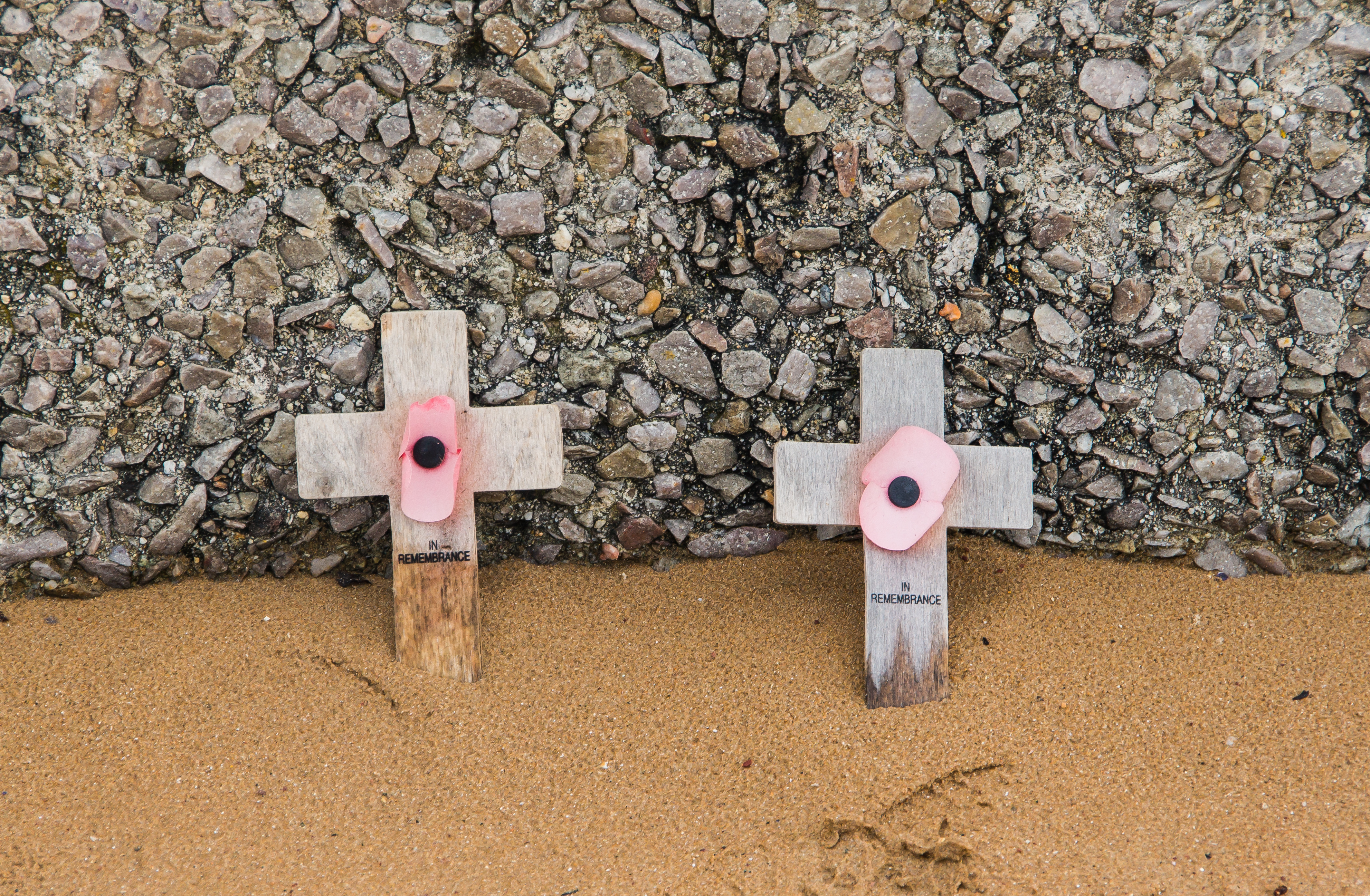
In remembrance poppies Omaha Beach.jpg
Sea & surf

What the water does

JFMAMJJASONDmetres (significant wave height)

Solid = typical monthly wave height; pale = the bigger days (90th pct). Offshore/regional swell from Open-Meteo Marine (ERA5 Ocean reanalysis, 2023–2024); a sheltered cove may sit calmer than this.

Calm — gentle swimming water most of the year
Typical wave height
0.56 m
Biggest swell
Dec · 0.79 m
Calmest
Jul · 0.41 m
Typical period
3.7 s (wind chop)
Before you go

Things to know

The cemetery is a place of mourning, not a sight

The Normandy American Cemetery on the bluff has 9,389 graves. Staff ask for silence, appropriate dress, and no picnicking or play among the graves. There is security screening at the entrance. It is reached by road above the beach, not from the sand.

Lifeguards are summer-only

The beach at Saint-Laurent and Vierville is supervised by lifeguards only in July and August, noon to 7 p.m. Outside that window there is no coverage, the tidal range is large (over 6 m at springs), and the water and weather are cool English Channel conditions.

Mind the tide

The spring range exceeds 6 meters, so the sea retreats a long way and returns quickly across a wide flat. The wrecked Mulberry caissons and the broadest sand appear only at low water; check the tide table before walking far out.

Respect the memorials on the sand

"Les Braves" at Saint-Laurent and the WN-62 and Vierville-draw memorials are war memorials, not photo props. Several distinct sites line the 8 km of beach; a half-day at least is realistic to see the beach, the cemetery, and a museum.

Swimming

Usually calm water — among the gentler beaches for a swim.

Sharks

No incidents on record in the global shark-attack file.

Plan

If you go

Getting there
Nearest airport
Caen Carpiquet airport (CFR) · 37 km
Nearest town
Port-en-Bessin-Huppain · 9 km

Omaha Beach is on the Calvados coast of Normandy, reached most easily by car. From Caen (Caen–Carpiquet airport, CFR, is about 37 km away) it is roughly a 45-minute drive west; the beach is also a common stop on D-Day coach tours from Caen and Bayeux. The nearest town and working fishing port is Port-en-Bessin-Huppain, about 9 km east. Bayeux, about 15 km southeast, is the practical base, with a mainline rail station (Paris–Saint-Lazare to Bayeux is roughly 2.5 hours) and the closest large town; from Bayeux it is a short drive to the Vierville, Saint-Laurent, and Colleville beach accesses and the American cemetery.

When to go
  • D-Day anniversary commemorations · Every 6 June, with major ceremonies on round anniversaries

    Ceremonies at the Normandy American Cemetery and along the Omaha front mark the anniversary of the landing each 6 June; the 70th (2014) and 80th (2024) drew heads of state and, increasingly few, living veterans.

  • Summer swimming season · July and August, lifeguards noon–7 p.m.

    In peak summer the beach at Saint-Laurent and Vierville is supervised and used as an ordinary public swimming beach, the living, present-tense face of Omaha alongside its memorial role.

What to eat & drink
Moules-frites

Mussels steamed in cider or white wine with shallots, served with fries, the standard coastal-Normandy plate. The mussels are local to the Calvados shellfish coast. There is no food on the beach itself; you eat in the villages behind it.

Cafés and restaurants in Saint-Laurent-sur-Mer, Vierville-sur-Mer, and nearby Port-en-Bessin-Huppain

Coquilles Saint-Jacques

Scallops from the Bay of the Seine, landed at Port-en-Bessin, one of Normandy's main scallop ports about 9 km east. In season (autumn to spring) they are a regional specialty, pan-seared or gratinéed with cream.

Restaurants in Port-en-Bessin-Huppain and the Omaha-front villages

Camembert, cider, and Calvados

This is Calvados, the département named for the apple brandy. The classic Norman trio is the local raw-milk cheese (Camembert, Pont-l'Évêque, Livarot are all from the region), dry cider, and Calvados as a digestif. The pays d'Auge to the east is the cider and brandy heartland.

Village shops, fermes, and restaurants across the Calvados coast

Teurgoule

A traditional Norman baked rice pudding, slow-cooked for hours with cinnamon until a dark skin forms. A regional dessert specific to lower Normandy, not a tourist invention.

Bakeries and traditional restaurants in the Bessin region behind the beach

Sources & references
  1. American Battle Monuments Commission; Wikipedia · cited 3×
  2. Wikipedia · cited 2×
  3. Encyclopaedia Britannica; HistoryNet; The George C. Marshall Foundation
  4. Wikipedia; Naval History and Heritage Command
  5. Naval History and Heritage Command; ECMWF; Wikipedia
  6. Collider; RTÉ Archives; movie-locations.com
  7. Anilore Banon (artist's site); Normandy War Guide
  8. Encyclopaedia Britannica; HistoryNet; figures are estimates, never a precise count
  9. Encyclopaedia Britannica; The George C. Marshall Foundation
  10. American Battle Monuments Commission; Wikipedia (some secondary sources cite 9,387–9,388)
  11. World Beach Tour beach data
  12. World Beach Tour beach data (EOT20 tidal model)
  13. Anilore Banon; Normandy War Guide
Colophon · Provenance

Where this page comes from

Geography, facilities
OpenStreetMap (ODbL) for geometry and facility tags within 500 m of the beach centroid. GeoNames for city/airport distances.
Climate & ocean
worldclim_v2.1_2.5m
Tides
eot20
Photography
Archival, original tone (Tier B — Wikimedia Commons). Each image licensed per its own terms; attribution visible inline.
History & culture
Every factual claim is linked to its source in the prose above. Wikipedia citations inline. Non-wiki sources named where relevant.
Editorial voice
Register: reverent. Written to pass a local's nod test; corrections welcome.
Written by Erin Rose
Last reviewed 2026-04-19
v0.9in editorial development toward v1.0